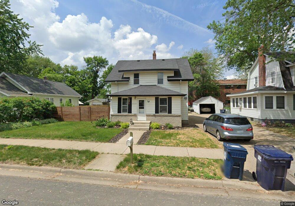
20735 Hollins Ave W Lakeville, MN 55044
Estimated Value: $329,000 - $358,668
4
Beds
3
Baths
1,372
Sq Ft
$253/Sq Ft
Est. Value
About This Home
This home is located at 20735 Hollins Ave W, Lakeville, MN 55044 and is currently estimated at $347,417, approximately $253 per square foot. 20735 Hollins Ave W is a home located in Dakota County with nearby schools including Lake Marion Elementary School, Mcguire Middle School, and Lakeville South High School.
Ownership History
Date
Name
Owned For
Owner Type
Purchase Details
Closed on
Oct 10, 2017
Sold by
Larson Mary J
Bought by
Borup John and Borup Melissa
Current Estimated Value
Home Financials for this Owner
Home Financials are based on the most recent Mortgage that was taken out on this home.
Original Mortgage
$207,767
Outstanding Balance
$174,921
Interest Rate
4.12%
Mortgage Type
FHA
Estimated Equity
$172,496
Purchase Details
Closed on
Oct 10, 2016
Sold by
Larson Mary Jean and Larson Ray
Bought by
Bedeaux Brenda and Wistraill Laura
Create a Home Valuation Report for This Property
The Home Valuation Report is an in-depth analysis detailing your home's value as well as a comparison with similar homes in the area
Home Values in the Area
Average Home Value in this Area
Purchase History
| Date | Buyer | Sale Price | Title Company |
|---|---|---|---|
| Borup John | $211,600 | Bankers Title | |
| Bedeaux Brenda | -- | Attorney |
Source: Public Records
Mortgage History
| Date | Status | Borrower | Loan Amount |
|---|---|---|---|
| Open | Borup John | $207,767 |
Source: Public Records
Tax History Compared to Growth
Tax History
| Year | Tax Paid | Tax Assessment Tax Assessment Total Assessment is a certain percentage of the fair market value that is determined by local assessors to be the total taxable value of land and additions on the property. | Land | Improvement |
|---|---|---|---|---|
| 2024 | $3,544 | $303,100 | $66,100 | $237,000 |
| 2023 | $3,544 | $330,300 | $63,900 | $266,400 |
| 2022 | $2,726 | $297,900 | $63,700 | $234,200 |
| 2021 | $2,510 | $243,500 | $55,400 | $188,100 |
| 2020 | $2,700 | $219,200 | $52,800 | $166,400 |
| 2019 | $2,220 | $222,500 | $50,300 | $172,200 |
| 2018 | $2,108 | $193,500 | $47,900 | $145,600 |
| 2017 | $2,028 | $182,200 | $45,600 | $136,600 |
| 2016 | $1,984 | $165,600 | $43,400 | $122,200 |
| 2015 | $1,877 | $131,710 | $35,774 | $95,936 |
| 2014 | -- | $128,985 | $34,678 | $94,307 |
| 2013 | -- | $130,729 | $31,813 | $98,916 |
Source: Public Records
Map
Nearby Homes
- 20685 Howland Ave W
- 19820 Henning Ave
- 20420 Hughes Ave W
- 20304 Hunter Ct
- 8210 208th St W
- 20724 Hurley Ave
- 20144 Holister Ln
- 20055 Heritage Dr
- 21221 Hummingbird Ln
- 20060 Heritage Dr
- 20041 Heritage Dr
- 20450 Dodd Blvd
- 20508 Hartford Way
- 20061 Highview Ave
- 20055 Holt Ave W
- 20576 Gunnison Dr
- 20023 Homestead Ct Unit 25
- 20771 Independence Ave
- 8266 200th St W
- 19966 Hiawatha Ct
- 20745 Hollins Ave W
- 20725 Hollins Ave W
- 20755 Hollins Ave W
- 20715 Hollins Ave W
- 20765 Hollins Ave W
- 20760 Holt Ave
- 20740 Hollins Ave W
- 20730 Hollins Ave W
- 20750 Hollins Ave W
- 20720 Hollins Ave W
- 20764 Holt Ave
- 20775 Hollins Ave W
- 20760 Hollins Ave W
- 20710 Hollins Ave W
- 20770 Hollins Ave W
- 8655 208th St W
- 8645 207th St W
- 8671 208th St W
- 20795 Hollins Ave W
- 8675 207th St W