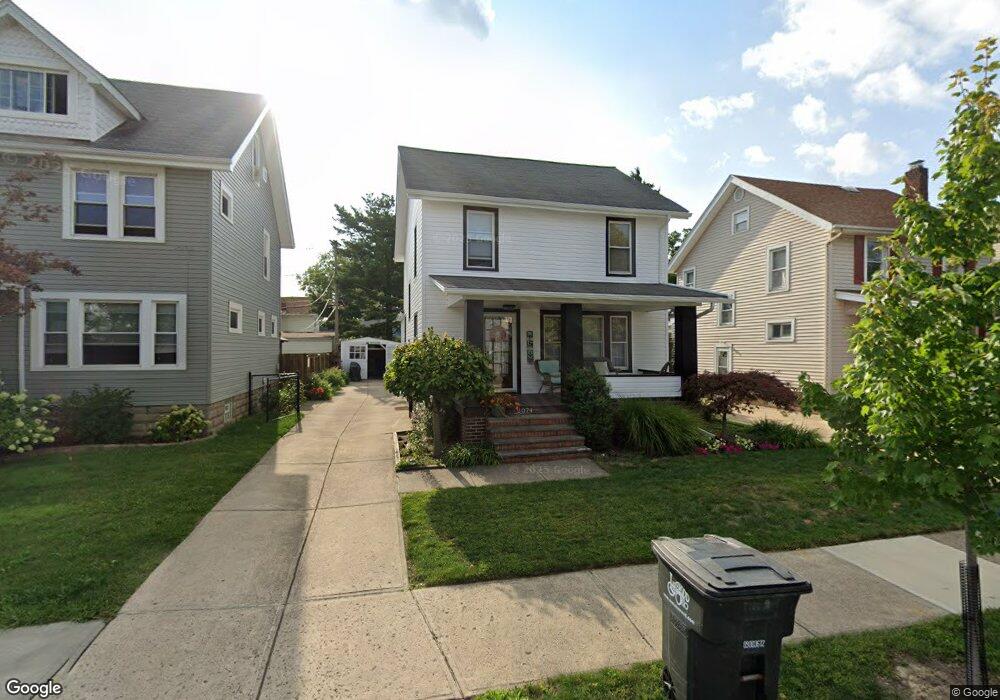
2074 Brown Rd Lakewood, OH 44107
Estimated Value: $290,863 - $314,000
3
Beds
1
Bath
1,231
Sq Ft
$249/Sq Ft
Est. Value
About This Home
This home is located at 2074 Brown Rd, Lakewood, OH 44107 and is currently estimated at $306,466, approximately $248 per square foot. 2074 Brown Rd is a home located in Cuyahoga County with nearby schools including Roosevelt Elementary School, Garfield Middle School, and Lakewood High School.
Ownership History
Date
Name
Owned For
Owner Type
Purchase Details
Closed on
Dec 20, 2000
Sold by
Marjorie L Sandstrom Verner W
Bought by
Cummins Carl N and Cummins Lidia
Current Estimated Value
Home Financials for this Owner
Home Financials are based on the most recent Mortgage that was taken out on this home.
Original Mortgage
$107,100
Outstanding Balance
$39,837
Interest Rate
7.83%
Estimated Equity
$266,629
Purchase Details
Closed on
Jan 1, 1975
Bought by
Marjorie L
Create a Home Valuation Report for This Property
The Home Valuation Report is an in-depth analysis detailing your home's value as well as a comparison with similar homes in the area
Home Values in the Area
Average Home Value in this Area
Purchase History
| Date | Buyer | Sale Price | Title Company |
|---|---|---|---|
| Cummins Carl N | $119,000 | -- | |
| Marjorie L | -- | -- |
Source: Public Records
Mortgage History
| Date | Status | Borrower | Loan Amount |
|---|---|---|---|
| Open | Cummins Carl N | $107,100 |
Source: Public Records
Tax History Compared to Growth
Tax History
| Year | Tax Paid | Tax Assessment Tax Assessment Total Assessment is a certain percentage of the fair market value that is determined by local assessors to be the total taxable value of land and additions on the property. | Land | Improvement |
|---|---|---|---|---|
| 2024 | $5,685 | $88,515 | $17,010 | $71,505 |
| 2023 | $4,816 | $64,160 | $13,090 | $51,070 |
| 2022 | $4,846 | $64,160 | $13,090 | $51,070 |
| 2021 | $4,797 | $64,160 | $13,090 | $51,070 |
| 2020 | $4,254 | $49,740 | $10,150 | $39,590 |
| 2019 | $4,170 | $142,100 | $29,000 | $113,100 |
| 2018 | $4,164 | $49,740 | $10,150 | $39,590 |
| 2017 | $3,819 | $41,450 | $8,230 | $33,220 |
| 2016 | $3,793 | $41,450 | $8,230 | $33,220 |
| 2015 | $3,793 | $41,450 | $8,230 | $33,220 |
| 2014 | $3,793 | $39,830 | $7,910 | $31,920 |
Source: Public Records
Map
Nearby Homes
- 2078 Baxterly Ave
- 2100 Wascana Ave
- 1675 Roosevelt Ave
- 14404 Bayes Ave
- 1669 Robinwood Ave
- 2203 Bunts Rd
- 14428 Delaware Ave
- 2233 Bunts Rd
- 2180 Elbur Ave
- 14031 Lakewood Heights Blvd
- 1593 Marlowe Ave
- 2263 Warren Rd
- 2180 Lewis Dr
- 2204 Lewis Dr
- 2045 Chesterland Ave
- 2035 Chesterland Ave
- 1576 Wyandotte Ave
- 1545 Marlowe Ave
- 14909 Arden Ave
- 2209 Alger Rd
- 2078 Brown Rd
- 2070 Brown Rd
- 2084 Brown Rd
- 2066 Brown Rd
- 2075 Ferndale Ave
- 2062 Brown Rd
- 2079 Ferndale Ave
- 2071 Ferndale Ave
- 2083 Ferndale Ave
- 2067 Ferndale Ave
- 2090 Brown Rd
- 2060 Brown Rd
- 2087 Ferndale Ave
- 2063 Ferndale Ave
- 2077 Brown Rd
- 2075 Brown Rd
- 2081 Brown Rd
- 2071 Brown Rd
- 2085 Brown Rd
- 2091 Ferndale Ave