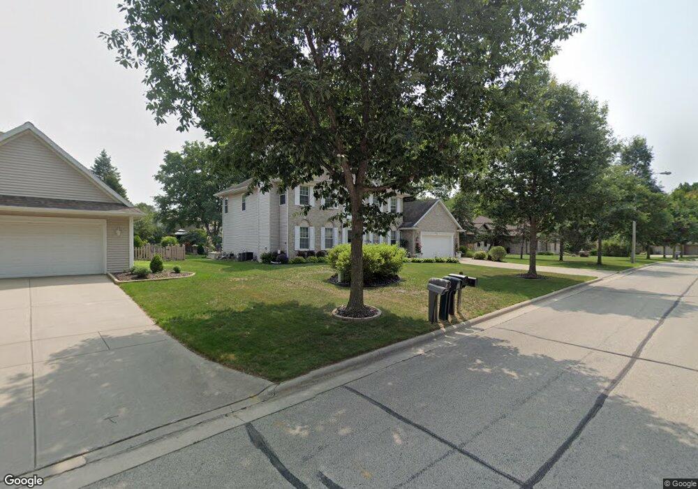
2075 Meadowsweet Dr Green Bay, WI 54313
Westside NeighborhoodEstimated Value: $451,862 - $535,000
--
Bed
--
Bath
--
Sq Ft
0.31
Acres
About This Home
This home is located at 2075 Meadowsweet Dr, Green Bay, WI 54313 and is currently estimated at $497,716. 2075 Meadowsweet Dr is a home located in Brown County with nearby schools including King Elementary School, Lombardi Middle School, and Southwest High School.
Ownership History
Date
Name
Owned For
Owner Type
Purchase Details
Closed on
Jan 28, 2005
Sold by
Jensky Terry P and Jensky Deborah J
Bought by
Wedige Kim M
Current Estimated Value
Home Financials for this Owner
Home Financials are based on the most recent Mortgage that was taken out on this home.
Original Mortgage
$196,000
Interest Rate
6.36%
Mortgage Type
Purchase Money Mortgage
Create a Home Valuation Report for This Property
The Home Valuation Report is an in-depth analysis detailing your home's value as well as a comparison with similar homes in the area
Home Values in the Area
Average Home Value in this Area
Purchase History
| Date | Buyer | Sale Price | Title Company |
|---|---|---|---|
| Wedige Kim M | $245,000 | Bay Title & Abstract Inc |
Source: Public Records
Mortgage History
| Date | Status | Borrower | Loan Amount |
|---|---|---|---|
| Previous Owner | Wedige Kim M | $196,000 |
Source: Public Records
Tax History Compared to Growth
Tax History
| Year | Tax Paid | Tax Assessment Tax Assessment Total Assessment is a certain percentage of the fair market value that is determined by local assessors to be the total taxable value of land and additions on the property. | Land | Improvement |
|---|---|---|---|---|
| 2024 | $6,619 | $347,000 | $51,800 | $295,200 |
| 2023 | $6,726 | $347,000 | $51,800 | $295,200 |
| 2022 | $6,415 | $347,000 | $51,800 | $295,200 |
| 2021 | $6,770 | $275,700 | $53,000 | $222,700 |
| 2020 | $6,719 | $275,700 | $53,000 | $222,700 |
| 2019 | $6,567 | $275,700 | $53,000 | $222,700 |
| 2018 | $6,377 | $275,700 | $53,000 | $222,700 |
| 2017 | $6,271 | $275,700 | $53,000 | $222,700 |
| 2016 | $6,436 | $275,700 | $53,000 | $222,700 |
| 2015 | $6,078 | $275,700 | $53,000 | $222,700 |
| 2014 | $6,421 | $275,700 | $53,000 | $222,700 |
| 2013 | $6,421 | $275,700 | $53,000 | $222,700 |
Source: Public Records
Map
Nearby Homes
- 2768 Independence Dr
- 1680 Cormier Rd
- 2060 Wintergreen Ct
- 3023 Crusade Ln
- 1433 Baumgart Rd Unit 1435
- 1940 Renaissance Ct
- 2044 Ann Ln
- 3097 S Sandstone Ct
- 2466 Parkwood Dr
- 2550 He Nis Ra Ln
- 1570 Mesa Dr
- 1602 W Crusade Ln
- 3096 S Sandstone Ct
- 2993 Fleetwood Dr
- 1310 Sandstone Place
- 2441 Matchwood Ln
- 1514 Ashley Ct
- 2439 W Point Rd
- 1973 Knotty Pine Dr
- 1445 Cormier Rd
- 2085 Meadowsweet Dr
- 2065 Meadowsweet Dr
- 2076 Wintercress Dr
- 2084 Wintercress Dr
- 2066 Wintercress Dr
- 2059 Meadowsweet Dr
- 2076 Meadowsweet Dr
- 2842 Parkwood Dr
- 2084 Meadowsweet Dr
- 2070 Meadowsweet Dr
- 2060 Wintercress Dr
- 2830 Parkwood Dr
- 2094 Meadowsweet Dr
- 2060 Meadowsweet Dr
- 2055 Meadowsweet Dr
- 2050 Wintercress Dr
- 2067 Wintercress Dr
- 2075 Wintercress Dr
- 2085 Wintercress Dr
- 2875 Branberry Ct