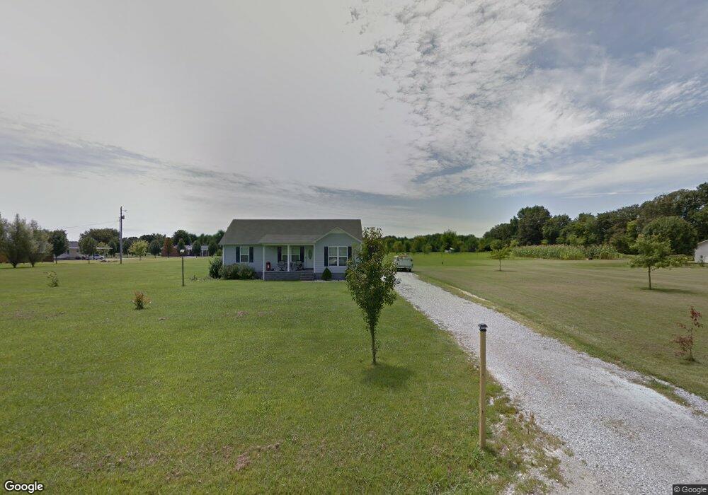
2078 Sagely Anderson Rd Manchester, TN 37355
Estimated Value: $301,000 - $373,000
--
Bed
2
Baths
1,458
Sq Ft
$225/Sq Ft
Est. Value
About This Home
This home is located at 2078 Sagely Anderson Rd, Manchester, TN 37355 and is currently estimated at $327,977, approximately $224 per square foot. 2078 Sagely Anderson Rd is a home located in Coffee County with nearby schools including New Union Elementary School, Coffee County Middle School, and Coffee County Central High School.
Ownership History
Date
Name
Owned For
Owner Type
Purchase Details
Closed on
Oct 27, 2009
Sold by
West Eric
Bought by
West Richard Eric
Current Estimated Value
Purchase Details
Closed on
Oct 17, 2005
Bought by
West Eric
Purchase Details
Closed on
Jun 5, 1998
Sold by
Sissom Richard A and Sissom Betty
Bought by
West Richard A and West Betty A
Purchase Details
Closed on
Sep 29, 1997
Bought by
Pope Doug and Pope Rita Sissom
Create a Home Valuation Report for This Property
The Home Valuation Report is an in-depth analysis detailing your home's value as well as a comparison with similar homes in the area
Home Values in the Area
Average Home Value in this Area
Purchase History
| Date | Buyer | Sale Price | Title Company |
|---|---|---|---|
| West Richard Eric | -- | -- | |
| West Eric | -- | -- | |
| West Richard A | $8,300 | -- | |
| Pope Doug | $7,400 | -- |
Source: Public Records
Tax History Compared to Growth
Tax History
| Year | Tax Paid | Tax Assessment Tax Assessment Total Assessment is a certain percentage of the fair market value that is determined by local assessors to be the total taxable value of land and additions on the property. | Land | Improvement |
|---|---|---|---|---|
| 2024 | $1,460 | $62,625 | $6,850 | $55,775 |
| 2023 | $1,460 | $62,625 | $0 | $0 |
| 2022 | $1,460 | $62,625 | $6,850 | $55,775 |
| 2021 | $1,464 | $49,925 | $4,100 | $45,825 |
| 2020 | $1,464 | $49,925 | $4,100 | $45,825 |
| 2019 | $1,464 | $49,925 | $4,100 | $45,825 |
| 2018 | $884 | $49,925 | $4,100 | $45,825 |
| 2017 | $905 | $27,725 | $4,250 | $23,475 |
| 2016 | $905 | $27,725 | $4,250 | $23,475 |
| 2015 | $905 | $27,725 | $4,250 | $23,475 |
| 2014 | $904 | $27,713 | $0 | $0 |
Source: Public Records
Map
Nearby Homes
- 2635 Pete Sain Rd
- 0 Pete Sain Rd
- 837 Circle Dr
- 781 Circle Dr
- 363 Willow Brook Dr
- 300 Willow Brook Dr
- 667 Pete Sain Rd
- 670 Old McMinnville Hwy
- 2498 Sp Anderson Rd
- 4282 McMinnville Hwy Unit 4270
- 7807 McMinnville Hwy Unit 7807
- 621 Brandon Rd
- 3313 McMinnville Hwy
- 493 Maple Springs Rd
- 0 Ramsey Rd
- 1270 Taylor Rd
- 499 Ridgewood Dr
- 89 Saddle St
- 166 Keele Rd
- 389 Houston Bell Rd
- 2132 Sagely Anderson Rd
- 2052 Pete Sain Rd
- 2090 Pete Sain Rd
- 2120 Pete Sain Rd
- 2160 Pete Sain Rd
- 2210 Pete Sain Rd
- 1756 Pete Sain Rd
- 1708 Sagely Anderson Rd
- 1646 Pete Sain Rd
- 502 Wright Rd
- 426 Wright Rd
- 505 Wright Rd
- 338 Wright Rd
- 1459 Pete Sain Rd
- 2620 Pete Sain Rd
- 270 Wright Rd
- 0 Wright Rd
- 243 Wright Rd
- 2698 Pete Sain Rd
- 46 Country Air Ln