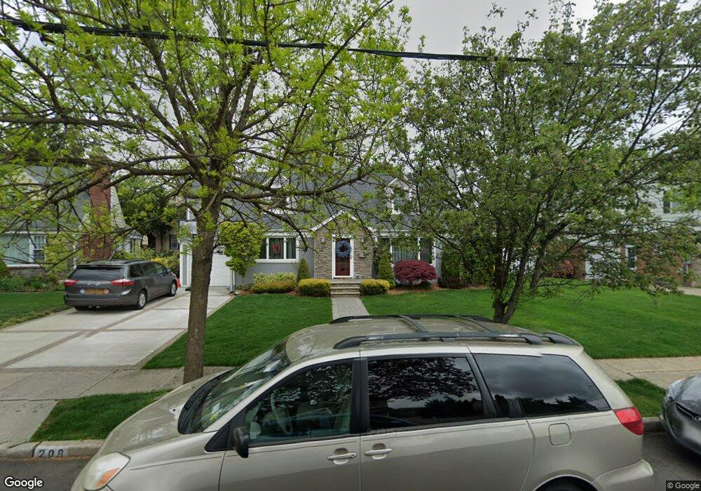
208 Groton Place West Hempstead, NY 11552
Estimated Value: $774,012 - $853,000
--
Bed
2
Baths
2,000
Sq Ft
$407/Sq Ft
Est. Value
About This Home
This home is located at 208 Groton Place, West Hempstead, NY 11552 and is currently estimated at $813,506, approximately $406 per square foot. 208 Groton Place is a home located in Nassau County with nearby schools including Chestnut Street School, West Hempstead Secondary School, and Crescent School.
Ownership History
Date
Name
Owned For
Owner Type
Purchase Details
Closed on
Nov 16, 2001
Sold by
Machado Gerard
Bought by
Oldenborg Richard G
Current Estimated Value
Purchase Details
Closed on
Dec 20, 1995
Sold by
Machado Gerardo and Machado Violet
Bought by
Machado Gerard and Machado Violet
Home Financials for this Owner
Home Financials are based on the most recent Mortgage that was taken out on this home.
Original Mortgage
$164,000
Interest Rate
7.34%
Create a Home Valuation Report for This Property
The Home Valuation Report is an in-depth analysis detailing your home's value as well as a comparison with similar homes in the area
Home Values in the Area
Average Home Value in this Area
Purchase History
| Date | Buyer | Sale Price | Title Company |
|---|---|---|---|
| Oldenborg Richard G | $350,000 | David Goodsell | |
| Machado Gerard | -- | -- |
Source: Public Records
Mortgage History
| Date | Status | Borrower | Loan Amount |
|---|---|---|---|
| Previous Owner | Machado Gerard | $164,000 |
Source: Public Records
Tax History Compared to Growth
Tax History
| Year | Tax Paid | Tax Assessment Tax Assessment Total Assessment is a certain percentage of the fair market value that is determined by local assessors to be the total taxable value of land and additions on the property. | Land | Improvement |
|---|---|---|---|---|
| 2025 | $15,080 | $548 | $264 | $284 |
| 2024 | $4,944 | $552 | $266 | $286 |
| 2023 | $16,775 | $592 | $298 | $294 |
| 2022 | $16,775 | $559 | $280 | $279 |
| 2021 | $16,399 | $554 | $278 | $276 |
| 2020 | $9,019 | $1,034 | $594 | $440 |
| 2019 | $19,005 | $1,034 | $594 | $440 |
| 2018 | $17,881 | $1,034 | $0 | $0 |
| 2017 | $9,620 | $1,034 | $594 | $440 |
| 2016 | $14,784 | $1,034 | $594 | $440 |
| 2015 | $4,816 | $1,034 | $594 | $440 |
| 2014 | $4,816 | $1,034 | $594 | $440 |
| 2013 | $4,509 | $1,034 | $594 | $440 |
Source: Public Records
Map
Nearby Homes
- 252 Lexington Ave
- 50 Mayfair Ave
- 253 William St
- 301 Concord Ave
- 47 Stratford Rd
- 2 Sunset Ln
- 170 Ivy St
- 197 Ivy St
- 181 Oak St
- 89 Osborne Rd
- 39 Hilbert St
- 26 Sycamore St
- 179 Fairlawn Ave
- 67 3rd St
- 306 Cambridge Ave
- 87 Elton St
- 72 Spruce St
- 30 Cathedral Ave Unit 4A
- 200 Hilton Ave Unit 55
- 22 Mulford Place Unit 2D
- 200 Groton Place
- 214 Groton Place
- 160 Andover Place
- 154 Andover Place
- 159 Andover Place
- 194 Groton Place
- 215 Groton Place
- 218 Groton Place
- 155 Andover Place
- 161 Saint Pauls Place
- 199 Groton Place
- 157 Saint Pauls Place
- 222 Groton Place
- 227 Groton Place
- 193 Groton Place
- 146 Andover Place
- 170 Groton Place
- 160 Groton Place
- 173 Westminster Rd
- 145 Andover Place