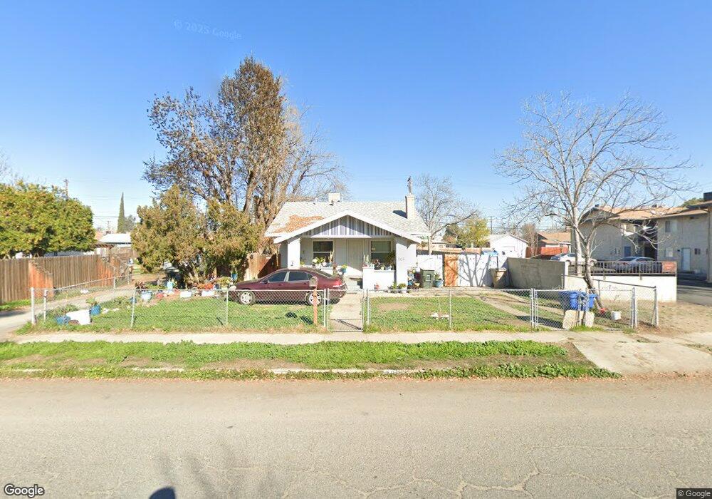
208 Lincoln Ave Bakersfield, CA 93308
Estimated Value: $187,000 - $274,000
2
Beds
1
Bath
875
Sq Ft
$263/Sq Ft
Est. Value
About This Home
This home is located at 208 Lincoln Ave, Bakersfield, CA 93308 and is currently estimated at $230,175, approximately $263 per square foot. 208 Lincoln Ave is a home located in Kern County with nearby schools including Standard Elementary School, Standard Middle School, and North High School.
Ownership History
Date
Name
Owned For
Owner Type
Purchase Details
Closed on
Mar 22, 2013
Sold by
Wirth Ronald P and Ronald P Wirth Trust
Bought by
Janikian Shahe
Current Estimated Value
Purchase Details
Closed on
Mar 17, 2008
Sold by
Wirth Ronald Paul and Wirth Ronald P
Bought by
Wirth Ronald P and Ronald P Wirth Trust
Purchase Details
Closed on
Jun 29, 2006
Sold by
Wirth Ronald Paul and Wirth Stacy Jane
Bought by
Wirth Ronald Paul
Create a Home Valuation Report for This Property
The Home Valuation Report is an in-depth analysis detailing your home's value as well as a comparison with similar homes in the area
Home Values in the Area
Average Home Value in this Area
Purchase History
| Date | Buyer | Sale Price | Title Company |
|---|---|---|---|
| Janikian Shahe | $59,500 | Placer Title Company | |
| Wirth Ronald P | -- | None Available | |
| Wirth Ronald Paul | -- | None Available |
Source: Public Records
Tax History Compared to Growth
Tax History
| Year | Tax Paid | Tax Assessment Tax Assessment Total Assessment is a certain percentage of the fair market value that is determined by local assessors to be the total taxable value of land and additions on the property. | Land | Improvement |
|---|---|---|---|---|
| 2025 | $1,858 | $73,256 | $24,622 | $48,634 |
| 2024 | $1,790 | $71,821 | $24,140 | $47,681 |
| 2023 | $1,790 | $70,414 | $23,667 | $46,747 |
| 2022 | $1,710 | $69,034 | $23,203 | $45,831 |
| 2021 | $1,619 | $67,682 | $22,749 | $44,933 |
| 2020 | $1,546 | $66,989 | $22,516 | $44,473 |
| 2019 | $1,526 | $66,989 | $22,516 | $44,473 |
| 2018 | $1,470 | $64,390 | $21,643 | $42,747 |
| 2017 | $1,453 | $63,128 | $21,219 | $41,909 |
| 2016 | $1,355 | $61,891 | $20,803 | $41,088 |
| 2015 | $1,337 | $60,962 | $20,491 | $40,471 |
| 2014 | $1,311 | $59,769 | $20,090 | $39,679 |
Source: Public Records
Map
Nearby Homes
- 229 Washington Ave
- 302 Washington Ave
- 304 Washington Ave
- 306 Washington Ave
- 308 Washington Ave
- 217 Decatur St
- 304 Woodrow Ave
- 112 Woodrow Ave
- 324 Lincoln Ave
- 115 Decatur St
- 311 Wilson Ave
- 407 Washington Ave
- 309 El Tejon Ave
- 110 Cooper Ave
- 109 Hughes Ave
- 115 Ferguson Ave
- 710 N Chester Ave
- 301 Harding Ave
- 404 Wilson Ave
- 118 Hughes Ave
- 212 Lincoln Ave
- 214 Lincoln Ave
- 209 Washington Ave Unit ABCD
- 209 Washington Ave
- 211 Washington Ave
- 216 Lincoln Ave
- 213 Washington Ave
- 215 Washington Ave
- 203 Lincoln Ave
- 218 Lincoln Ave
- 209 Lincoln Ave
- 211 Lincoln Ave
- 201 Washington Ave
- 207 Lincoln Ave
- 217 Washington Ave
- 213 Lincoln Ave
- 205 Lincoln Ave Unit A-B
- 205 Lincoln Ave
- 215 Lincoln Ave
- 232 Washington Ave