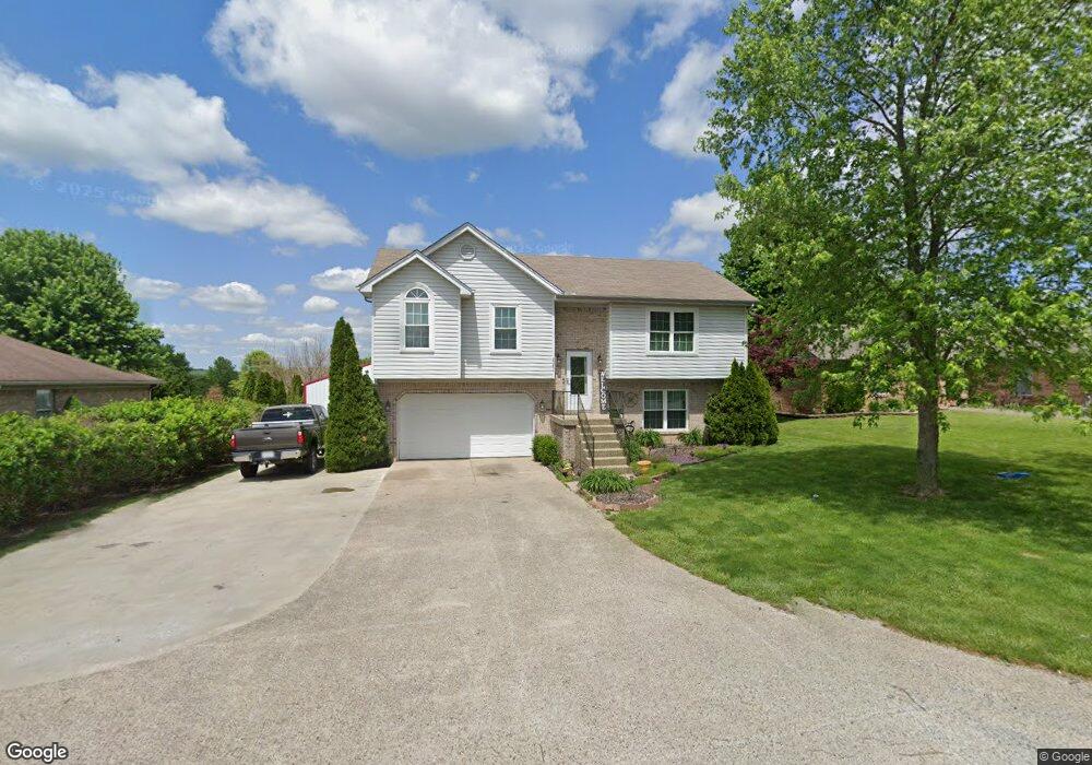
2086 Highway 337 NW Corydon, IN 47112
Estimated Value: $293,092 - $378,000
4
Beds
2
Baths
1,815
Sq Ft
$175/Sq Ft
Est. Value
About This Home
This home is located at 2086 Highway 337 NW, Corydon, IN 47112 and is currently estimated at $317,273, approximately $174 per square foot. 2086 Highway 337 NW is a home located in Harrison County with nearby schools including Corydon Elementary School, Corydon Intermediate School, and Corydon Central Junior High School.
Ownership History
Date
Name
Owned For
Owner Type
Purchase Details
Closed on
Aug 28, 2023
Sold by
Forbess Michael M
Bought by
Pavey Rhiley
Current Estimated Value
Create a Home Valuation Report for This Property
The Home Valuation Report is an in-depth analysis detailing your home's value as well as a comparison with similar homes in the area
Home Values in the Area
Average Home Value in this Area
Purchase History
| Date | Buyer | Sale Price | Title Company |
|---|---|---|---|
| Pavey Rhiley | $277,000 | Momenutm Title Agency Llc |
Source: Public Records
Tax History Compared to Growth
Tax History
| Year | Tax Paid | Tax Assessment Tax Assessment Total Assessment is a certain percentage of the fair market value that is determined by local assessors to be the total taxable value of land and additions on the property. | Land | Improvement |
|---|---|---|---|---|
| 2024 | $1,620 | $276,400 | $35,000 | $241,400 |
| 2023 | $1,200 | $210,700 | $27,500 | $183,200 |
| 2022 | $1,366 | $213,300 | $18,800 | $194,500 |
| 2021 | $1,205 | $187,800 | $18,800 | $169,000 |
| 2020 | $1,087 | $171,600 | $17,500 | $154,100 |
| 2019 | $1,151 | $169,400 | $15,000 | $154,400 |
| 2018 | $1,095 | $164,300 | $15,000 | $149,300 |
| 2017 | $936 | $154,000 | $11,200 | $142,800 |
| 2016 | $691 | $137,500 | $11,200 | $126,300 |
| 2014 | $595 | $129,100 | $10,200 | $118,900 |
| 2013 | $595 | $126,600 | $10,200 | $116,400 |
Source: Public Records
Map
Nearby Homes
- 710 Sky Way Dr NW
- 1944 Andrew Ct NW
- 1230 Karen Ave NW
- The Paislee Plan at Poplar Trace
- The Eleanor Plan at Poplar Trace
- The Bedford Plan at Poplar Trace
- The Ivy Plan at Poplar Trace
- The Harrison Plan at Poplar Trace
- 1052 Poplar Trace Way
- 1371 Poplar Trace Way NW
- DUPONT Plan at Poplar Trace
- 1361 Poplar Trace Way NW
- 1052 Poplar Trace Way NW
- 1487 Poplar Trace Way NW
- 1557 Cypress Cove NW
- 1555 Cypress Cove NW
- 1477 Poplar Trace Way NW
- 1235 Highway 62 NW
- 1121 Poplar Trace Way NW
- 813 Woodland Ave
- 2086 Indiana 337
- 2080 Highway 337 NW
- 2088 Highway 337 NW
- 2135 Liberty Way NW
- 2092 Highway 337 NW
- 2078 Highway 337 NW
- 2155 Liberty Way NW
- 2150 Liberty Way NW
- 2098 Highway 337 NW
- 2161 Liberty Way NW
- 2160 Liberty Way NW
- 2106 Highway 337 NW
- 2155 Colonial Dr NW
- 2179 Liberty Way NW
- 2143 Colonial Dr NW
- 2070 Highway 337 NW
- 2071 Highway 337 NW
- 2176 Liberty Way NW
- 2110 Highway 337 NW
- 2165 Colonial Dr NW