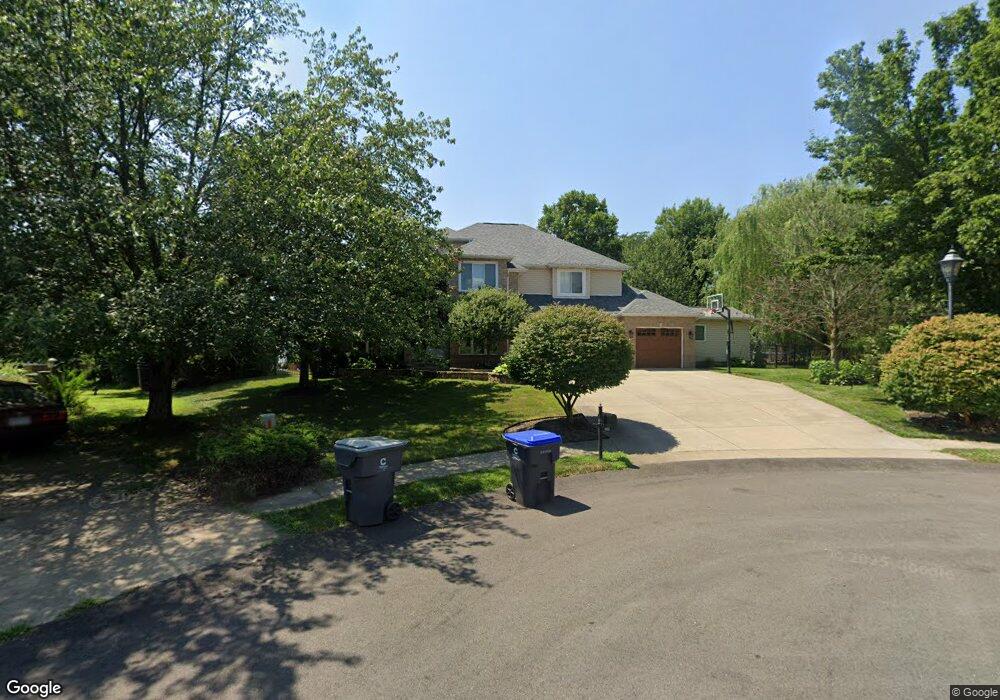
209 Jacobs Ct Cranberry Township, PA 16066
Estimated Value: $654,000 - $802,855
4
Beds
3
Baths
2,958
Sq Ft
$239/Sq Ft
Est. Value
About This Home
This home is located at 209 Jacobs Ct, Cranberry Township, PA 16066 and is currently estimated at $706,214, approximately $238 per square foot. 209 Jacobs Ct is a home located in Butler County with nearby schools including Haine Middle School, Haine Elementary School, and Ryan Gloyer Middle School.
Ownership History
Date
Name
Owned For
Owner Type
Purchase Details
Closed on
Nov 15, 2019
Sold by
Paulson Mark R and Paulson Lisa S
Bought by
Palano Michael and Palano Marie
Current Estimated Value
Home Financials for this Owner
Home Financials are based on the most recent Mortgage that was taken out on this home.
Original Mortgage
$417,600
Outstanding Balance
$367,380
Interest Rate
3.6%
Mortgage Type
New Conventional
Estimated Equity
$338,834
Purchase Details
Closed on
Jul 18, 2008
Sold by
Grenci Anthony
Bought by
Paulson Mark R
Home Financials for this Owner
Home Financials are based on the most recent Mortgage that was taken out on this home.
Original Mortgage
$239,000
Interest Rate
6.49%
Mortgage Type
New Conventional
Purchase Details
Closed on
Jul 15, 2007
Sold by
Raabe Richard E
Bought by
Grenci Anthony
Create a Home Valuation Report for This Property
The Home Valuation Report is an in-depth analysis detailing your home's value as well as a comparison with similar homes in the area
Home Values in the Area
Average Home Value in this Area
Purchase History
| Date | Buyer | Sale Price | Title Company |
|---|---|---|---|
| Palano Michael | $522,000 | None Available | |
| Paulson Mark R | $369,000 | -- | |
| Grenci Anthony | $355,000 | -- |
Source: Public Records
Mortgage History
| Date | Status | Borrower | Loan Amount |
|---|---|---|---|
| Open | Palano Michael | $417,600 | |
| Previous Owner | Paulson Mark R | $239,000 |
Source: Public Records
Tax History Compared to Growth
Tax History
| Year | Tax Paid | Tax Assessment Tax Assessment Total Assessment is a certain percentage of the fair market value that is determined by local assessors to be the total taxable value of land and additions on the property. | Land | Improvement |
|---|---|---|---|---|
| 2025 | $7,519 | $41,960 | $3,030 | $38,930 |
| 2024 | $7,296 | $41,960 | $3,030 | $38,930 |
| 2023 | $7,189 | $41,960 | $3,030 | $38,930 |
| 2022 | $7,189 | $41,960 | $3,030 | $38,930 |
| 2021 | $7,081 | $41,960 | $0 | $0 |
| 2020 | $7,081 | $41,960 | $3,030 | $38,930 |
| 2019 | $5,946 | $41,960 | $3,030 | $38,930 |
| 2018 | $7,002 | $41,960 | $3,030 | $38,930 |
| 2017 | $6,876 | $41,960 | $3,030 | $38,930 |
| 2016 | $1,887 | $41,960 | $3,030 | $38,930 |
| 2015 | $851 | $41,960 | $3,030 | $38,930 |
| 2014 | $851 | $41,960 | $3,030 | $38,930 |
Source: Public Records
Map
Nearby Homes
- 405 Mallard Dr
- 414 Nolan Cir
- 481 Nolan Cir
- 107 Callaway Ln
- 230 Chital Ln
- 111 Callaway Ln
- Wexford w/ 4' Extension Plan at Park Place Townhomes
- Wexford Plan at Park Place Townhomes
- 119 Sample Ln
- 109 Founders St
- 227 Eagle Dr
- 315 Caledonia Place
- 103 Village Dr
- 109 Foundry Pike
- 230 Eagle Dr
- 311 Palisade Way
- Elgin Plan at Brookvue - Single Family
- Ellsworth Plan at Brookvue - Single Family
- Montclair Plan at Brookvue - Single Family
- Dundee Plan at Brookvue - Single Family