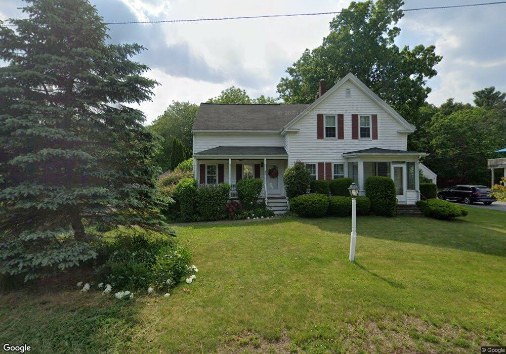
209 Laurel St East Bridgewater, MA 02333
Estimated Value: $522,000 - $668,000
3
Beds
3
Baths
2,139
Sq Ft
$274/Sq Ft
Est. Value
About This Home
This home is located at 209 Laurel St, East Bridgewater, MA 02333 and is currently estimated at $585,149, approximately $273 per square foot. 209 Laurel St is a home located in Plymouth County with nearby schools including Gordon W Mitchell Middle School, East Bridgewater Jr./Sr. High School, and New England Baptist Academy.
Ownership History
Date
Name
Owned For
Owner Type
Purchase Details
Closed on
Mar 3, 2022
Sold by
Donovan John M
Bought by
John M Donovan 2022 Ret
Current Estimated Value
Purchase Details
Closed on
Dec 14, 1978
Bought by
Donovan John and Mcneely Theresa
Create a Home Valuation Report for This Property
The Home Valuation Report is an in-depth analysis detailing your home's value as well as a comparison with similar homes in the area
Home Values in the Area
Average Home Value in this Area
Purchase History
| Date | Buyer | Sale Price | Title Company |
|---|---|---|---|
| John M Donovan 2022 Ret | -- | None Available | |
| Donovan John | -- | -- |
Source: Public Records
Mortgage History
| Date | Status | Borrower | Loan Amount |
|---|---|---|---|
| Previous Owner | Donovan John | $25,000 | |
| Previous Owner | Donovan John | $20,000 | |
| Previous Owner | Donovan John | $162,000 | |
| Previous Owner | Donovan John | $120,000 |
Source: Public Records
Tax History Compared to Growth
Tax History
| Year | Tax Paid | Tax Assessment Tax Assessment Total Assessment is a certain percentage of the fair market value that is determined by local assessors to be the total taxable value of land and additions on the property. | Land | Improvement |
|---|---|---|---|---|
| 2025 | $5,588 | $408,800 | $180,300 | $228,500 |
| 2024 | $5,568 | $402,300 | $173,400 | $228,900 |
| 2023 | $5,485 | $379,600 | $173,400 | $206,200 |
| 2022 | $5,614 | $359,900 | $157,700 | $202,200 |
| 2021 | $5,640 | $330,800 | $151,500 | $179,300 |
| 2020 | $5,609 | $324,400 | $145,700 | $178,700 |
| 2019 | $5,372 | $305,900 | $139,300 | $166,600 |
| 2018 | $7,598 | $294,300 | $139,300 | $155,000 |
| 2017 | $5,177 | $282,900 | $132,800 | $150,100 |
| 2016 | $5,088 | $280,200 | $132,800 | $147,400 |
| 2015 | $4,989 | $280,900 | $131,900 | $149,000 |
| 2014 | $4,876 | $280,700 | $129,100 | $151,600 |
Source: Public Records
Map
Nearby Homes
- 245-r Laurel St
- 6 Andrea Way
- 505 N Central St
- 34 Captain Carlson Way
- 324 W Union St
- 603 East St
- 38 Leland St
- 391 Bedford St
- 590 Bedford St
- 386 Bedford St
- 16 Pearl St
- 386 Matfield St
- 11 Willow Ave
- 192 S Main St
- 41 Bedford St
- 50 Belmont St
- 580 Broad St Unit 1
- 580 Broad St Unit 2
- 261 Plymouth St
- 30 Keenan St