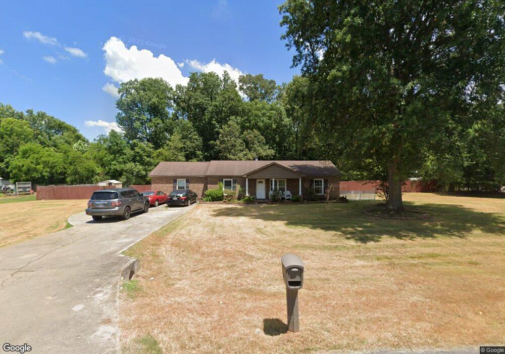
209 Nina Pearl Dr NE Huntsville, AL 35811
Moores Mill NeighborhoodEstimated Value: $205,000 - $294,000
3
Beds
2
Baths
2,070
Sq Ft
$128/Sq Ft
Est. Value
About This Home
This home is located at 209 Nina Pearl Dr NE, Huntsville, AL 35811 and is currently estimated at $265,783, approximately $128 per square foot. 209 Nina Pearl Dr NE is a home located in Madison County with nearby schools including Mt Carmel Elementary School, Riverton Intermediate School, and Buckhorn Middle School.
Ownership History
Date
Name
Owned For
Owner Type
Purchase Details
Closed on
Nov 9, 2012
Sold by
Cole Angelia Mongor and Monger Angelia Densie
Bought by
Flourney Farre and Monger Abgelia Denise
Current Estimated Value
Purchase Details
Closed on
Oct 26, 2007
Sold by
Cole Gerry
Bought by
Cole Angela Monger
Purchase Details
Closed on
Oct 14, 2006
Sold by
Bad Boys Bail Bonding Co Inc
Bought by
Cole Angela M and Cole Gerry
Purchase Details
Closed on
Nov 16, 2005
Sold by
Monger Cole Angela Denise and Cole Gary Devon
Bought by
Bad Boys Bail Bonding Co Inc
Create a Home Valuation Report for This Property
The Home Valuation Report is an in-depth analysis detailing your home's value as well as a comparison with similar homes in the area
Home Values in the Area
Average Home Value in this Area
Purchase History
| Date | Buyer | Sale Price | Title Company |
|---|---|---|---|
| Flourney Farre | -- | None Available | |
| Cole Angela Monger | -- | -- | |
| Cole Angela M | -- | -- | |
| Bad Boys Bail Bonding Co Inc | -- | -- |
Source: Public Records
Tax History Compared to Growth
Tax History
| Year | Tax Paid | Tax Assessment Tax Assessment Total Assessment is a certain percentage of the fair market value that is determined by local assessors to be the total taxable value of land and additions on the property. | Land | Improvement |
|---|---|---|---|---|
| 2024 | $655 | $18,280 | $1,160 | $17,120 |
| 2023 | $616 | $17,840 | $1,160 | $16,680 |
| 2022 | $508 | $15,340 | $1,160 | $14,180 |
| 2021 | $453 | $13,820 | $1,160 | $12,660 |
| 2020 | $409 | $12,370 | $1,150 | $11,220 |
| 2019 | $382 | $11,860 | $1,150 | $10,710 |
| 2018 | $357 | $11,200 | $0 | $0 |
| 2017 | $346 | $10,880 | $0 | $0 |
| 2016 | $333 | $10,540 | $0 | $0 |
| 2015 | $333 | $10,540 | $0 | $0 |
| 2014 | $330 | $10,440 | $0 | $0 |
Source: Public Records
Map
Nearby Homes
- 202 Frances Amelia Dr NE
- 57.4 +/- ACRES Winchester Rd NE
- Lot 2 Winchester Rd NE
- Lot 3 Winchester Rd NE
- 707 Winchester Rd NE
- Winston Pennington Ave
- The Winston Plan at Pennington
- The Bennington Plan at Pennington
- The Cambridge Plan at Pennington
- The Charleston Plan at Pennington
- The Manhattan Plan at Pennington
- The Raleigh Plan at Pennington
- The Savannah Plan at Pennington
- The Lincoln Plan at Pennington
- The Shelburne Plan at Pennington
- Blakley Pennington Ave
- Bennington Pennington Ave
- Shelburne Pennington Ave
- Charleston Pennington Ave
- Cambridge Pennington Ave
- 213 Nina Pearl Dr
- 207 Nina Pearl Dr
- 259 Frances Amelia Dr
- 260 Frances Amelia Dr
- 5135 Rustic Trail
- 120 Molly Bette Dr
- 205 Nina Pearl Dr
- 258 Frances Amelia Dr
- 257 Frances Amelia Dr
- 119 Molly Bette Dr
- 118 Molly Bette Dr
- 203 Nina Pearl Dr
- 256 Frances Amelia Dr
- 215 Nina Pearl Dr
- 5130 Rustic Trail
- 117 Molly Bette Dr
- 116 Molly Bette Dr
- 100 Wheat Ridge Rd NE
- 197 Frances Amelia Dr
- 254 Frances Amelia Dr