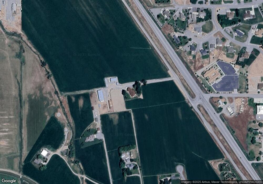
20965 Highway 550 Montrose, CO 81403
Estimated Value: $990,000 - $1,716,000
3
Beds
3
Baths
3,523
Sq Ft
$363/Sq Ft
Est. Value
About This Home
This home is located at 20965 Highway 550, Montrose, CO 81403 and is currently estimated at $1,278,924, approximately $363 per square foot. 20965 Highway 550 is a home located in Montrose County with nearby schools including Cottonwood Elementary School, Columbine Middle School, and Montrose High School.
Ownership History
Date
Name
Owned For
Owner Type
Purchase Details
Closed on
Nov 3, 2016
Sold by
Appelhanz John E and Appelhanz Edward J
Bought by
Flowers Doug
Current Estimated Value
Home Financials for this Owner
Home Financials are based on the most recent Mortgage that was taken out on this home.
Original Mortgage
$1,300,000
Outstanding Balance
$834,655
Interest Rate
3.48%
Mortgage Type
Purchase Money Mortgage
Estimated Equity
$444,269
Purchase Details
Closed on
May 1, 1993
Sold by
Flowers Flowers Steve Allan Steve Allan and Flowers Frasier Cathy Anneette Prs For
Bought by
Flowers Doug
Purchase Details
Closed on
Dec 11, 1953
Sold by
Flowers Abner and Flowers Harold
Bought by
Flowers Harold and Flowers Eleanor
Create a Home Valuation Report for This Property
The Home Valuation Report is an in-depth analysis detailing your home's value as well as a comparison with similar homes in the area
Home Values in the Area
Average Home Value in this Area
Purchase History
| Date | Buyer | Sale Price | Title Company |
|---|---|---|---|
| Flowers Doug | $1,137,500 | Land Title Guarantee | |
| Flowers Doug | $90,000 | -- | |
| Flowers Harold | -- | -- |
Source: Public Records
Mortgage History
| Date | Status | Borrower | Loan Amount |
|---|---|---|---|
| Open | Flowers Doug | $1,300,000 |
Source: Public Records
Tax History Compared to Growth
Tax History
| Year | Tax Paid | Tax Assessment Tax Assessment Total Assessment is a certain percentage of the fair market value that is determined by local assessors to be the total taxable value of land and additions on the property. | Land | Improvement |
|---|---|---|---|---|
| 2024 | $5,629 | $79,060 | $1,700 | $77,360 |
| 2023 | $5,629 | $85,390 | $1,700 | $83,690 |
| 2022 | $4,021 | $58,430 | $1,600 | $56,830 |
| 2021 | $4,187 | $60,730 | $1,750 | $58,980 |
| 2020 | $3,853 | $57,430 | $1,420 | $56,010 |
| 2019 | $3,878 | $57,430 | $1,420 | $56,010 |
| 2018 | $3,946 | $57,000 | $1,880 | $55,120 |
| 2017 | $3,914 | $57,000 | $1,880 | $55,120 |
| 2016 | $3,834 | $56,770 | $1,490 | $55,280 |
| 2015 | $3,765 | $56,770 | $1,490 | $55,280 |
| 2014 | $3,371 | $54,380 | $1,220 | $53,160 |
Source: Public Records
Map
Nearby Homes
- Lot 4 6785 Ct
- Lot 1 6785 Ct
- Lot 3 6785 Ct
- 21179 Highway 550
- 20866 Trophy Rd
- 68053 Tumbleweed Rd
- 68143 Tumbleweed Rd
- 20547 Tulip Cir
- Lot 49 6840 Rd
- Lot 43 6840 Rd
- Lot 50 6840 Rd
- Lot 48 6840 Rd
- 21475 Highway 550
- 68200 Ute Valley Dr
- TBD Ute Valley Dr Unit Lot 1
- TBD Ute Valley Dr Unit Lot 2
- 20124 6720 Ln
- Lot 2 Trout Rd
- Lot 3 Trout Rd
- 21446 Uncompahgre Rd
- 67751 Uintah Ct
- 67859 Tailspin Ct
- 67833 Tailspin Ct
- 67763 Uintah Ct
- 67877 Tailspin Ct
- 67857 Tumbleweed Rd
- 0 Tumbleweed Dr
- 0 Tailspin Ct Unit 599563
- 0 Tailspin Ct Unit 662896
- 0 Tailspin Ct Unit 675326
- 0 Tailspin Ct Unit 714142
- 0 Tailspin Ct Unit 733003
- 21044 Highway 550
- 21044 Highway 550
- 67880 Tailspin Ct
- 67889 Tailspin Ct
- 67831 Tumbleweed Rd
- 21330 6785 Ct
- 67823 Tumbleweed Rd
- 0 Uintah Ct
