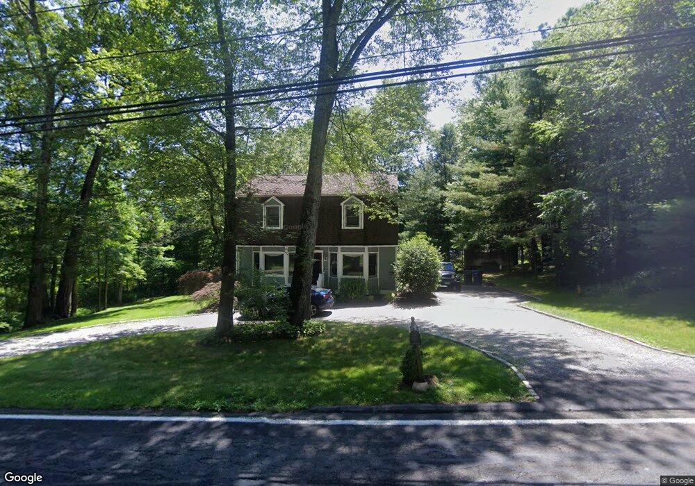
21 Governors Hill Rd Oxford, CT 06478
Estimated Value: $401,000 - $493,000
3
Beds
2
Baths
1,555
Sq Ft
$291/Sq Ft
Est. Value
About This Home
This home is located at 21 Governors Hill Rd, Oxford, CT 06478 and is currently estimated at $452,224, approximately $290 per square foot. 21 Governors Hill Rd is a home located in New Haven County with nearby schools including Quaker Farms School, Oxford Middle School, and Oxford High School.
Ownership History
Date
Name
Owned For
Owner Type
Purchase Details
Closed on
Apr 30, 1992
Sold by
Tift Raymond E and Tift Elizabeth J
Bought by
Gerety Kevin A and Gerety Jennifer R
Current Estimated Value
Home Financials for this Owner
Home Financials are based on the most recent Mortgage that was taken out on this home.
Original Mortgage
$130,000
Interest Rate
8.96%
Mortgage Type
Purchase Money Mortgage
Create a Home Valuation Report for This Property
The Home Valuation Report is an in-depth analysis detailing your home's value as well as a comparison with similar homes in the area
Home Values in the Area
Average Home Value in this Area
Purchase History
| Date | Buyer | Sale Price | Title Company |
|---|---|---|---|
| Gerety Kevin A | $148,000 | -- |
Source: Public Records
Mortgage History
| Date | Status | Borrower | Loan Amount |
|---|---|---|---|
| Closed | Gerety Kevin A | $112,000 | |
| Closed | Gerety Kevin A | $130,000 | |
| Previous Owner | Gerety Kevin A | $57,899 |
Source: Public Records
Tax History Compared to Growth
Tax History
| Year | Tax Paid | Tax Assessment Tax Assessment Total Assessment is a certain percentage of the fair market value that is determined by local assessors to be the total taxable value of land and additions on the property. | Land | Improvement |
|---|---|---|---|---|
| 2025 | $4,541 | $226,940 | $71,050 | $155,890 |
| 2024 | $4,620 | $179,000 | $78,600 | $100,400 |
| 2023 | $4,387 | $179,000 | $78,600 | $100,400 |
| 2022 | $4,360 | $179,000 | $78,600 | $100,400 |
| 2021 | $4,129 | $179,500 | $78,600 | $100,900 |
| 2020 | $4,286 | $179,800 | $79,200 | $100,600 |
| 2019 | $4,286 | $179,800 | $79,200 | $100,600 |
| 2018 | $4,144 | $179,800 | $79,200 | $100,600 |
| 2017 | $3,993 | $179,800 | $79,200 | $100,600 |
| 2016 | $4,353 | $179,800 | $79,200 | $100,600 |
| 2015 | $4,640 | $185,900 | $79,200 | $106,700 |
| 2014 | $4,623 | $185,900 | $79,200 | $106,700 |
Source: Public Records
Map
Nearby Homes
- 7 Butternut Ln
- 000 Dorman Rd
- 93 Hogs Back Rd
- 76 Dorman Rd
- 50 Ancient Hwy
- 6 Autumn Ridge Rd
- 10 Willow St
- 574 Oxford Rd
- 147 Riggs St
- 7 Council Dr
- 0 Christian St Unit 24096996
- 945 Mackenzie Ln Unit 945
- 0 Larkey Rd
- 185 Country Club Dr
- 709 Championship Dr Unit 709
- Parcel B Old Moose Hill Rd
- Parcel A Old Moose Hill Rd
- lot1 Deerwood Rd
- lot1B Deerwood Rd
- 671 Oxford Rd
- 34 Dutton Rd
- 1 Dutton Rd
- 19 Governors Hill Rd
- 38 Dutton Rd
- 27 Governors Hill Rd
- 24 Dutton Rd
- 24 Dutton Rd
- 33 Dutton Rd
- 29 Dutton Rd
- 13 Governors Hill Rd
- 37 Dutton Rd
- 17 Dutton Rd
- 35 Governors Hill Rd
- 423 Oxford Rd
- 11 Dutton Rd
- LOT# 1 Randall Dr
- LOT# 2 Randall Dr
- LOT# 3 Randall Dr
- LOT 1 Randall Dr
- LOT 2 Randall Dr