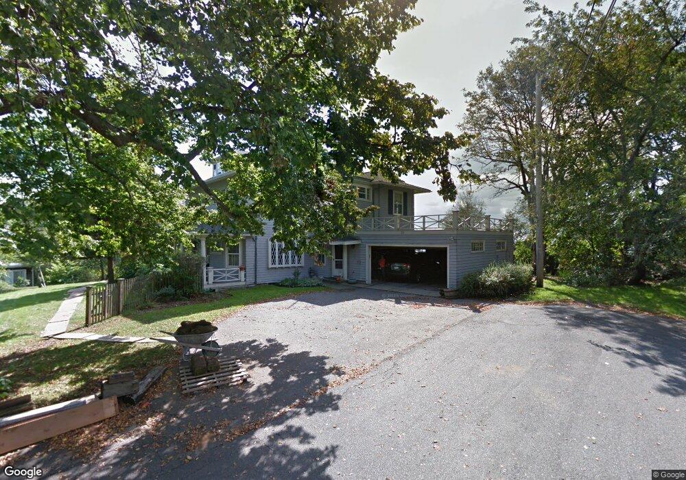
21 High St Nahant, MA 01908
Estimated Value: $1,481,000 - $1,781,000
4
Beds
4
Baths
3,690
Sq Ft
$439/Sq Ft
Est. Value
About This Home
This home is located at 21 High St, Nahant, MA 01908 and is currently estimated at $1,619,068, approximately $438 per square foot. 21 High St is a home located in Essex County with nearby schools including Johnson Elementary School, Swampscott Middle School, and Swampscott High School.
Create a Home Valuation Report for This Property
The Home Valuation Report is an in-depth analysis detailing your home's value as well as a comparison with similar homes in the area
Home Values in the Area
Average Home Value in this Area
Tax History Compared to Growth
Tax History
| Year | Tax Paid | Tax Assessment Tax Assessment Total Assessment is a certain percentage of the fair market value that is determined by local assessors to be the total taxable value of land and additions on the property. | Land | Improvement |
|---|---|---|---|---|
| 2025 | $13,192 | $1,441,700 | $627,300 | $814,400 |
| 2024 | $12,834 | $1,415,000 | $600,600 | $814,400 |
| 2023 | $11,994 | $1,319,500 | $533,900 | $785,600 |
| 2022 | $11,384 | $1,162,800 | $453,800 | $709,000 |
| 2021 | $11,498 | $1,094,000 | $427,100 | $666,900 |
| 2020 | $10,960 | $999,100 | $427,100 | $572,000 |
| 2019 | $9,983 | $915,000 | $400,400 | $514,600 |
| 2018 | $9,261 | $903,500 | $400,400 | $503,100 |
| 2017 | $9,462 | $903,700 | $400,400 | $503,300 |
| 2016 | $8,796 | $836,100 | $347,000 | $489,100 |
| 2015 | $8,585 | $786,200 | $297,100 | $489,100 |
| 2014 | $8,644 | $783,700 | $297,100 | $486,600 |
Source: Public Records
Map
Nearby Homes
- 66 Ocean St
- 303 Nahant Rd
- 23 Phillips Rd
- 17 Pearl Rd
- 183 Bass Point Rd
- 43 Maple Ave
- 9 Little Nahant Rd
- 51 Cliff St
- 36 Lennox Rd
- 3 Cliff St
- 53 Lancaster Ave
- 9 Beach Rd Unit 4
- 45 Tudor St Unit 3-8
- 41 Tudor St
- 12 Chancery Ct Unit 205
- 12 Chancery Ct Unit 207
- 98 Lynnway Unit 102
- 300 Lynn Shore Dr Unit 612
- 1 Carey Cir Unit 409
- 107 Lynnway