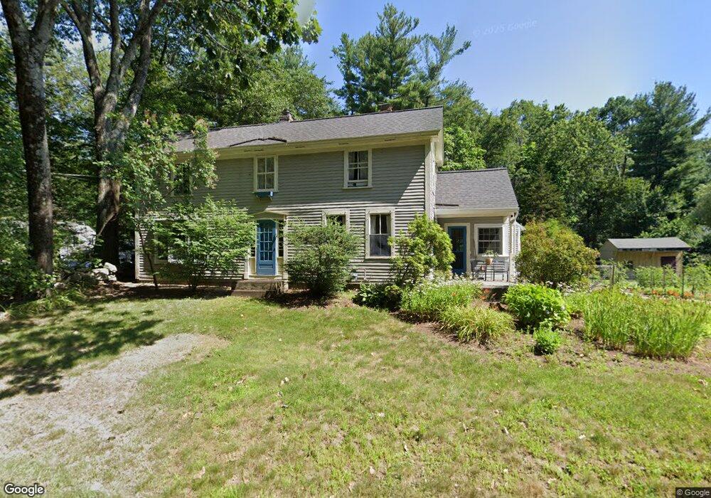
21 New Estate Rd Littleton, MA 01460
Estimated Value: $680,925 - $788,000
3
Beds
2
Baths
1,640
Sq Ft
$440/Sq Ft
Est. Value
About This Home
This home is located at 21 New Estate Rd, Littleton, MA 01460 and is currently estimated at $721,231, approximately $439 per square foot. 21 New Estate Rd is a home located in Middlesex County with nearby schools including Shaker Lane Elementary School, Russell Street Elementary School, and Littleton Middle School.
Ownership History
Date
Name
Owned For
Owner Type
Purchase Details
Closed on
Aug 8, 2014
Sold by
Miller George D and Miller Geralyn A
Bought by
Miller Lt and Miller George D
Current Estimated Value
Purchase Details
Closed on
Dec 1, 1989
Sold by
Weaver William
Bought by
Miller George D
Home Financials for this Owner
Home Financials are based on the most recent Mortgage that was taken out on this home.
Original Mortgage
$149,800
Interest Rate
9.82%
Mortgage Type
Purchase Money Mortgage
Create a Home Valuation Report for This Property
The Home Valuation Report is an in-depth analysis detailing your home's value as well as a comparison with similar homes in the area
Home Values in the Area
Average Home Value in this Area
Purchase History
| Date | Buyer | Sale Price | Title Company |
|---|---|---|---|
| Miller Lt | -- | -- | |
| Miller George D | $187,300 | -- |
Source: Public Records
Mortgage History
| Date | Status | Borrower | Loan Amount |
|---|---|---|---|
| Previous Owner | Miller George D | $144,000 | |
| Previous Owner | Miller George D | $149,800 |
Source: Public Records
Tax History Compared to Growth
Tax History
| Year | Tax Paid | Tax Assessment Tax Assessment Total Assessment is a certain percentage of the fair market value that is determined by local assessors to be the total taxable value of land and additions on the property. | Land | Improvement |
|---|---|---|---|---|
| 2025 | $87 | $588,000 | $253,100 | $334,900 |
| 2024 | $8,643 | $582,400 | $244,500 | $337,900 |
| 2023 | $8,195 | $504,300 | $218,800 | $285,500 |
| 2022 | $7,727 | $436,300 | $210,200 | $226,100 |
| 2021 | $7,285 | $411,600 | $203,800 | $207,800 |
| 2020 | $6,994 | $393,600 | $191,600 | $202,000 |
| 2019 | $6,752 | $370,200 | $166,000 | $204,200 |
| 2018 | $6,570 | $362,200 | $166,000 | $196,200 |
| 2017 | $6,438 | $354,700 | $157,500 | $197,200 |
| 2016 | $6,253 | $353,500 | $157,500 | $196,000 |
| 2015 | $5,741 | $317,200 | $136,200 | $181,000 |
Source: Public Records
Map
Nearby Homes
- 17 Hartwell Ave
- 18 Pleasant St
- 9 (Lt 44) Darrell Dr
- 3 Taylor St
- 336 King St Unit 105
- 0 Ayer Rd
- 36 Whitetail Way
- 8 Edsel Rd
- 221 Foster St
- 10 Baldwin Hill Rd
- 34 Baldwin Hill Rd
- 12 Paula Beth St
- 55 Jennifer St
- 150 Whitcomb Ave
- 115 Goldsmith St
- 4 Mars Place
- Lot 2 Strawberry Farm
- 4 Spectacle Pond Rd
- 17 Chestnut Ln
- 239 Ayer Rd Unit 16