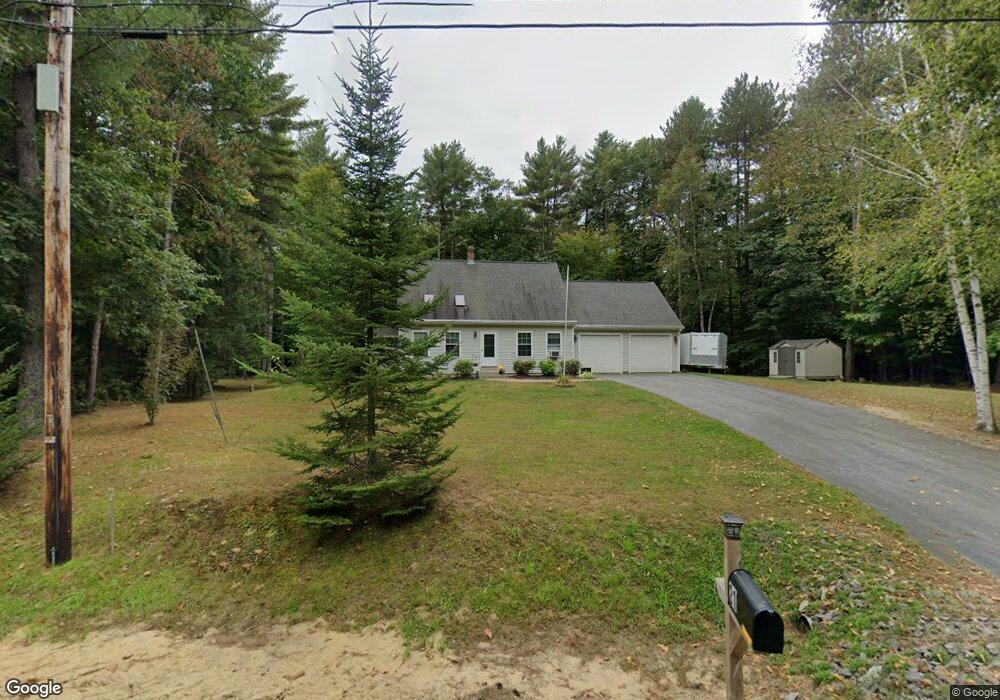
21 Patriot Dr Durham, ME 04222
Estimated Value: $481,000 - $648,000
3
Beds
2
Baths
1,547
Sq Ft
$360/Sq Ft
Est. Value
About This Home
This home is located at 21 Patriot Dr, Durham, ME 04222 and is currently estimated at $557,186, approximately $360 per square foot. 21 Patriot Dr is a home located in Androscoggin County with nearby schools including Durham Community School and Freeport High School.
Ownership History
Date
Name
Owned For
Owner Type
Purchase Details
Closed on
May 5, 2014
Sold by
Lamarre Lorraine H and Segars Roger W
Bought by
Francoeur Steven W
Current Estimated Value
Home Financials for this Owner
Home Financials are based on the most recent Mortgage that was taken out on this home.
Original Mortgage
$194,320
Outstanding Balance
$147,176
Interest Rate
4.32%
Mortgage Type
New Conventional
Estimated Equity
$410,010
Purchase Details
Closed on
Oct 12, 2007
Sold by
George Richrd W and George Danielle R
Bought by
Lamarre Lorraine H and Segars Roger W
Create a Home Valuation Report for This Property
The Home Valuation Report is an in-depth analysis detailing your home's value as well as a comparison with similar homes in the area
Home Values in the Area
Average Home Value in this Area
Purchase History
| Date | Buyer | Sale Price | Title Company |
|---|---|---|---|
| Francoeur Steven W | -- | -- | |
| Francoeur Steven W | -- | -- | |
| Lamarre Lorraine H | -- | -- |
Source: Public Records
Mortgage History
| Date | Status | Borrower | Loan Amount |
|---|---|---|---|
| Open | Francoeur Steven W | $194,320 | |
| Closed | Lamarre Lorraine H | $194,320 |
Source: Public Records
Tax History Compared to Growth
Tax History
| Year | Tax Paid | Tax Assessment Tax Assessment Total Assessment is a certain percentage of the fair market value that is determined by local assessors to be the total taxable value of land and additions on the property. | Land | Improvement |
|---|---|---|---|---|
| 2024 | $4,465 | $205,300 | $67,900 | $137,400 |
| 2023 | $4,383 | $205,300 | $67,900 | $137,400 |
| 2022 | $4,250 | $205,300 | $67,900 | $137,400 |
| 2021 | $4,250 | $205,300 | $67,900 | $137,400 |
| 2020 | $4,157 | $205,300 | $67,900 | $137,400 |
| 2019 | $4,157 | $205,300 | $67,900 | $137,400 |
| 2018 | $4,044 | $205,300 | $67,900 | $137,400 |
| 2016 | $3,860 | $205,300 | $67,900 | $137,400 |
| 2015 | $3,572 | $205,300 | $67,900 | $137,400 |
| 2014 | $3,418 | $205,300 | $67,900 | $137,400 |
| 2013 | $3,069 | $205,300 | $67,900 | $137,400 |
Source: Public Records
Map
Nearby Homes
- 21 Patriot Dr
- 27 Patriot Way
- 27 Patriot Dr
- 38-R Patriot Way
- 38 Patriot Dr
- 39 Patriot Dr
- 752 Hallowell Rd
- 746 Hallowell Rd
- 11 & 19 Ledel
- 41 Patriot Dr
- 762 Hallowell Rd
- 11 Ledel Ln
- 50 Patriot Dr
- 50 Patriot Way
- 79 Pound Rd
- 718 Hallowell Rd
- 65 Deer Creek Crossing Unit Lot 4
- 9 Timber Oak Dr
- 10 Timber Oak Dr
- 711 Hallowell Rd