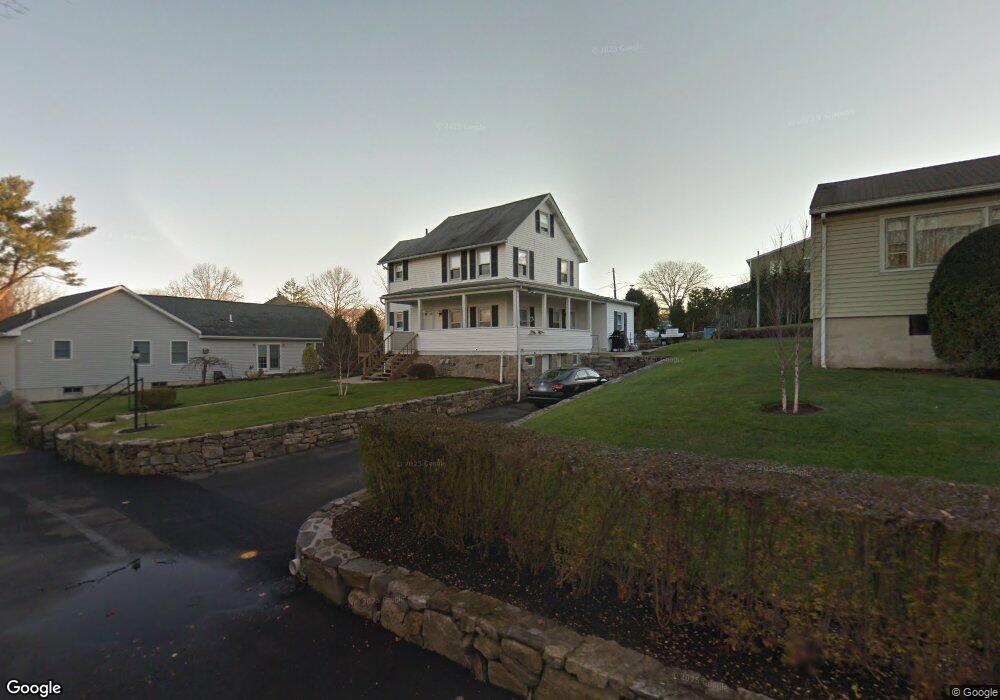
21 Wampus Ln Riverside, CT 06878
Estimated Value: $770,000 - $1,161,401
2
Beds
1
Bath
1,460
Sq Ft
$675/Sq Ft
Est. Value
About This Home
This home is located at 21 Wampus Ln, Riverside, CT 06878 and is currently estimated at $985,600, approximately $675 per square foot. 21 Wampus Ln is a home located in Fairfield County with nearby schools including Cos Cob School, Central Middle School, and Greenwich High School.
Ownership History
Date
Name
Owned For
Owner Type
Purchase Details
Closed on
Oct 30, 1991
Sold by
First Constitution Bk
Bought by
Fiore Angelo and Fiore Janice
Current Estimated Value
Home Financials for this Owner
Home Financials are based on the most recent Mortgage that was taken out on this home.
Original Mortgage
$202,500
Interest Rate
7.38%
Mortgage Type
Unknown
Create a Home Valuation Report for This Property
The Home Valuation Report is an in-depth analysis detailing your home's value as well as a comparison with similar homes in the area
Home Values in the Area
Average Home Value in this Area
Purchase History
| Date | Buyer | Sale Price | Title Company |
|---|---|---|---|
| Fiore Angelo | $270,000 | -- |
Source: Public Records
Mortgage History
| Date | Status | Borrower | Loan Amount |
|---|---|---|---|
| Closed | Fiore Angelo | $202,500 | |
| Previous Owner | Fiore Angelo | $250,000 |
Source: Public Records
Tax History Compared to Growth
Tax History
| Year | Tax Paid | Tax Assessment Tax Assessment Total Assessment is a certain percentage of the fair market value that is determined by local assessors to be the total taxable value of land and additions on the property. | Land | Improvement |
|---|---|---|---|---|
| 2025 | $7,101 | $574,560 | $442,260 | $132,300 |
| 2024 | $6,554 | $549,080 | $442,260 | $106,820 |
| 2023 | $6,389 | $549,080 | $442,260 | $106,820 |
| 2022 | $6,331 | $549,080 | $442,260 | $106,820 |
| 2021 | $5,699 | $473,340 | $378,630 | $94,710 |
| 2020 | $5,690 | $473,340 | $378,630 | $94,710 |
| 2019 | $5,746 | $473,340 | $378,630 | $94,710 |
| 2018 | $5,619 | $473,340 | $378,630 | $94,710 |
| 2017 | $5,689 | $473,340 | $378,630 | $94,710 |
| 2016 | $5,599 | $473,340 | $378,630 | $94,710 |
| 2015 | $5,402 | $452,970 | $416,010 | $36,960 |
| 2014 | $5,266 | $452,970 | $416,010 | $36,960 |
Source: Public Records
Map
Nearby Homes
- 3 Finney Knoll Ln
- 48 Meyer Place
- 32 Meyer Place
- 25 Hoover Rd
- 11 Perna Ln
- 25 Dialstone Ln
- 6 Dorchester Ln
- 24 Harold St Unit E
- 23 Silver Beech Rd
- 45 Sunshine Ave
- 67 Cos Cob Ave
- 18 Sound Beach Ave
- 27 Sound Beach Ave
- 143 Lockwood Rd
- 3 Relay Ct
- 20 Center Dr
- 15 River Rd Unit 210
- 119 Hendrie Ave
- 7 River Rd Unit Boat Slip A-2
- 7 River Rd Unit Boat Slip D-14
- 21 Wampus Ln Unit 2ND F
- 21 Wampus Ln Unit 1ST
- 21 Wampus Ln Unit 2ND
- 8 Spezzano Dr
- 17 Wampus Ln
- 6 Spezzano Dr
- 9 Wampus Ln
- 16 Apache Place
- 19 Riverside Ln
- 17 Riverside Ln
- 10 Spezzano Dr
- 11 Wampus Ln
- 11 Wampus Ln Unit REAR
- 21 Riverside Ln
- 15 Riverside Ln
- 14 Apache Place
- 23 Riverside Ln
- 1 Spezzano Dr
- 7 Wampus Ln Unit 7
- 7 Wampus Ln Unit 1