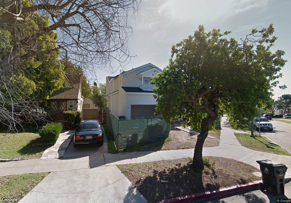
2100 Balsam Ave Los Angeles, CA 90025
West Los Angeles NeighborhoodEstimated Value: $2,994,000 - $3,952,000
4
Beds
4
Baths
3,490
Sq Ft
$945/Sq Ft
Est. Value
About This Home
This home is located at 2100 Balsam Ave, Los Angeles, CA 90025 and is currently estimated at $3,299,475, approximately $945 per square foot. 2100 Balsam Ave is a home located in Los Angeles County with nearby schools including Daniel Webster Middle School, Westwood Charter School, and Ralph Waldo Emerson Community Charter Middle School.
Ownership History
Date
Name
Owned For
Owner Type
Purchase Details
Closed on
Jun 8, 2015
Sold by
Bronte David
Bought by
Hong Jane and Hong Harris Wu
Current Estimated Value
Purchase Details
Closed on
Oct 10, 2003
Sold by
Marks Lauren
Bought by
Marks Lauren
Purchase Details
Closed on
Jun 10, 2003
Sold by
Wright Sharon M Haney and Marks Lauren B
Bought by
Marks Lauren B
Home Financials for this Owner
Home Financials are based on the most recent Mortgage that was taken out on this home.
Original Mortgage
$250,000
Interest Rate
6.4%
Mortgage Type
Stand Alone First
Purchase Details
Closed on
Mar 27, 2001
Sold by
Marks Elizabeth Mae and Marks Elizabeth M
Bought by
Marks Elizabeth M and The Elizabeth M Marks Revocable Trust
Create a Home Valuation Report for This Property
The Home Valuation Report is an in-depth analysis detailing your home's value as well as a comparison with similar homes in the area
Home Values in the Area
Average Home Value in this Area
Purchase History
| Date | Buyer | Sale Price | Title Company |
|---|---|---|---|
| Hong Jane | $2,475,000 | Progressive | |
| Marks Lauren | -- | Commonwealth Land Title Co | |
| Marks Lauren B | -- | Commonwealth Land Title Co | |
| Marks Elizabeth M | -- | Commonwealth |
Source: Public Records
Mortgage History
| Date | Status | Borrower | Loan Amount |
|---|---|---|---|
| Previous Owner | Marks Lauren B | $250,000 |
Source: Public Records
Tax History Compared to Growth
Tax History
| Year | Tax Paid | Tax Assessment Tax Assessment Total Assessment is a certain percentage of the fair market value that is determined by local assessors to be the total taxable value of land and additions on the property. | Land | Improvement |
|---|---|---|---|---|
| 2025 | $21,341 | $1,771,474 | $824,916 | $946,558 |
| 2024 | $21,341 | $1,736,741 | $808,742 | $927,999 |
| 2023 | $20,931 | $1,702,688 | $792,885 | $909,803 |
| 2022 | $19,962 | $1,669,303 | $777,339 | $891,964 |
| 2021 | $19,709 | $1,636,573 | $762,098 | $874,475 |
| 2019 | $19,120 | $1,588,034 | $739,495 | $848,539 |
| 2018 | $18,997 | $1,556,897 | $724,996 | $831,901 |
| 2016 | $29,672 | $2,475,000 | $1,485,000 | $990,000 |
| 2015 | $18,293 | $1,513,080 | $807,824 | $705,256 |
| 2014 | $12,335 | $990,000 | $792,000 | $198,000 |
Source: Public Records
Map
Nearby Homes
- 2175 S Beverly Glen Blvd Unit 403
- 2030 Pelham Ave
- 1951 Manning Ave
- 1831 Prosser Ave Unit 205
- 1830 Westholme Ave Unit 310
- 1823 Westholme Ave
- 1821 1/2 Westholme Ave
- 1920 Pandora Ave Unit 3
- 1944 S Beverly Glen Blvd
- 1940 S Beverly Glen Blvd
- 1817 Prosser Ave Unit 503
- 1920 Pelham Ave Unit 101
- 1925 S Beverly Glen Blvd Unit 37
- 1925 S Beverly Glen Blvd Unit 30
- 2240 S Beverly Glen Blvd Unit 103
- 2203 Pelham Ave
- 1875 S Beverly Glen Blvd Unit 106
- 1839 Pandora Ave Unit C
- 1916 Overland Ave Unit 2
- 1811 Manning Ave Unit 101
- 2044 Thayer Ave
- 2108 Balsam Ave
- 2038 Thayer Ave
- 2114 Balsam Ave
- 2034 Thayer Ave
- 2119 Holmby Ave
- 2115 Holmby Ave
- 2120 Balsam Ave
- 2123 Holmby Ave
- 2111 Holmby Ave
- 2111 Balsam Ave
- 2028 Thayer Ave
- 2129 Holmby Ave
- 2049 Thayer Ave
- 2045 Thayer Ave
- 2053 Thayer Ave
- 2107 Holmby Ave
- 2059 Thayer Ave
- 2041 Thayer Ave
- 2117 Balsam Ave