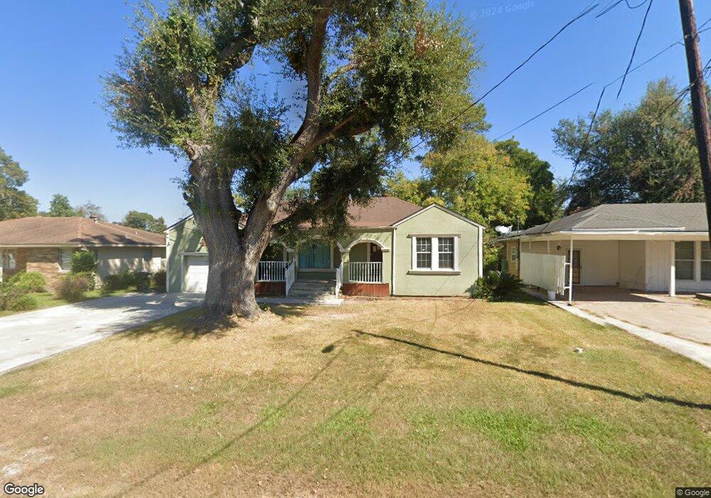
2100 Stanley Blvd Port Arthur, TX 77642
Estimated Value: $93,837 - $146,000
3
Beds
1
Bath
1,461
Sq Ft
$76/Sq Ft
Est. Value
About This Home
This home is located at 2100 Stanley Blvd, Port Arthur, TX 77642 and is currently estimated at $111,709, approximately $76 per square foot. 2100 Stanley Blvd is a home located in Jefferson County with nearby schools including Tyrrell Elementary School, Jefferson Middle School, and Memorial High School.
Ownership History
Date
Name
Owned For
Owner Type
Purchase Details
Closed on
Jul 13, 2018
Sold by
Rogers Dorthy Helen Ayo and Estate Of James Wilmer Rogers
Bought by
Oceguera Juan Pablo and Oceguera Guadalupe Lopez De
Current Estimated Value
Purchase Details
Closed on
Jan 9, 2012
Sold by
Randolph Margaret Hanline
Bought by
Oceguera Juan Pablo and Lopez Guadalupe
Purchase Details
Closed on
Aug 15, 2011
Sold by
Randolph Henry Elvin
Bought by
Randolph Margaret Hanline
Create a Home Valuation Report for This Property
The Home Valuation Report is an in-depth analysis detailing your home's value as well as a comparison with similar homes in the area
Home Values in the Area
Average Home Value in this Area
Purchase History
| Date | Buyer | Sale Price | Title Company |
|---|---|---|---|
| Oceguera Juan Pablo | -- | None Available | |
| Oceguera Juan Pablo | -- | Stewart Title | |
| Randolph Margaret Hanline | -- | None Available |
Source: Public Records
Tax History Compared to Growth
Tax History
| Year | Tax Paid | Tax Assessment Tax Assessment Total Assessment is a certain percentage of the fair market value that is determined by local assessors to be the total taxable value of land and additions on the property. | Land | Improvement |
|---|---|---|---|---|
| 2025 | $2,544 | $91,259 | $9,280 | $81,979 |
| 2024 | $2,544 | $88,817 | $3,802 | $85,015 |
| 2023 | $2,544 | $81,568 | $3,802 | $77,766 |
| 2022 | $2,473 | $77,865 | $3,802 | $74,063 |
| 2021 | $2,335 | $70,459 | $3,802 | $66,657 |
| 2020 | $2,074 | $62,576 | $3,802 | $58,774 |
| 2019 | $2,521 | $56,970 | $3,800 | $53,170 |
| 2018 | $1,250 | $56,970 | $3,800 | $53,170 |
| 2017 | $1,211 | $56,970 | $3,800 | $53,170 |
| 2016 | $1,669 | $56,970 | $3,800 | $53,170 |
| 2015 | $1,234 | $54,050 | $3,800 | $50,250 |
| 2014 | $1,234 | $54,050 | $3,800 | $50,250 |
Source: Public Records
Map
Nearby Homes
- 2129 Neches Ave
- 2515 Glenwood Dr
- 4100 Dryden Rd
- 2515 Date St
- LOT 55 Royal Meadows Estate
- 2621 Evergreen Dr
- 2301 Glenwood Dr
- 2325 Oaklawn Ave
- 4501 Springdale St
- 3945 12th St
- 1349 Jefferson Dr
- 2720 Royal Ave
- 4545 Hollywood Dr
- 3812 30th St
- 4034 32nd St
- 2323 7th Ave
- 2615 3rd Ave
- 3412 Drexel Ave
- 5301 North St
- 3049 Canal Ave
- 2108 Stanley Blvd
- 2048 Stanley Blvd
- 2034 Stanley Blvd
- 2101 Neches Ave
- 2103 Neches Ave
- 2120 Stanley Blvd
- 2049 Neches Ave
- 2105 Stanley Blvd
- 2049 Stanley Blvd
- 2049 Stanley Blvd
- 2024 Stanley Blvd
- 2035 Neches Ave
- 2131 Neches Ave
- 2108 Neches Ave
- 2121 Stanley Blvd
- 2018 Stanley Blvd
- 2146 Stanley Blvd
- 2025 Neches Ave
- 2015 Stanley Blvd
- 2135 Neches Ave