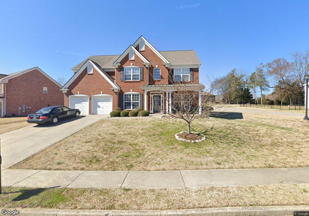
2101 Sister Ct Nolensville, TN 37135
Estimated Value: $753,272 - $809,000
--
Bed
--
Bath
2,911
Sq Ft
$267/Sq Ft
Est. Value
About This Home
This home is located at 2101 Sister Ct, Nolensville, TN 37135 and is currently estimated at $776,318, approximately $266 per square foot. 2101 Sister Ct is a home located in Williamson County with nearby schools including Sunset Elementary School, Sunset Middle School, and Nolensville High School.
Ownership History
Date
Name
Owned For
Owner Type
Purchase Details
Closed on
Feb 27, 2009
Sold by
Pulte Homes Tennessee Limited Partnershi
Bought by
Henson Robert S and Henson Elizabeth
Current Estimated Value
Home Financials for this Owner
Home Financials are based on the most recent Mortgage that was taken out on this home.
Original Mortgage
$240,000
Outstanding Balance
$152,114
Interest Rate
5.15%
Mortgage Type
Purchase Money Mortgage
Estimated Equity
$624,204
Create a Home Valuation Report for This Property
The Home Valuation Report is an in-depth analysis detailing your home's value as well as a comparison with similar homes in the area
Home Values in the Area
Average Home Value in this Area
Purchase History
| Date | Buyer | Sale Price | Title Company |
|---|---|---|---|
| Henson Robert S | $300,000 | None Available |
Source: Public Records
Mortgage History
| Date | Status | Borrower | Loan Amount |
|---|---|---|---|
| Open | Henson Robert S | $240,000 |
Source: Public Records
Tax History Compared to Growth
Tax History
| Year | Tax Paid | Tax Assessment Tax Assessment Total Assessment is a certain percentage of the fair market value that is determined by local assessors to be the total taxable value of land and additions on the property. | Land | Improvement |
|---|---|---|---|---|
| 2025 | $1,175 | $194,625 | $50,000 | $144,625 |
| 2024 | $1,175 | $118,650 | $22,500 | $96,150 |
| 2023 | $0 | $118,650 | $22,500 | $96,150 |
| 2022 | $2,575 | $118,650 | $22,500 | $96,150 |
| 2021 | $2,575 | $118,650 | $22,500 | $96,150 |
| 2020 | $2,475 | $98,600 | $18,750 | $79,850 |
| 2019 | $2,337 | $98,600 | $18,750 | $79,850 |
| 2018 | $2,268 | $98,600 | $18,750 | $79,850 |
| 2017 | $2,248 | $98,600 | $18,750 | $79,850 |
| 2016 | $2,219 | $98,600 | $18,750 | $79,850 |
| 2015 | -- | $72,700 | $16,250 | $56,450 |
| 2014 | -- | $72,700 | $16,250 | $56,450 |
Source: Public Records
Map
Nearby Homes
- 2029 Delaware Dr
- 2025 Delaware Dr
- 2029 Universe Ct
- 2032 Universe Ct
- 2510 Benington Place
- 2203 Carouth Ct
- 1969 Ashburn Ct
- 1818 Eaves Ct
- 2713 Bering Ct
- 2004 Vail Trace
- 9905 Elland Rd
- Devonshire II Plan at Telluride - Manor
- Westchester II Plan at Telluride - Manor
- Southhampton Plan at Telluride - Manor
- St. Andrews III Plan at Telluride - Manor
- Nottingham Plan at Telluride - Manor
- Glen Abbey III Plan at Telluride - Manor
- 2020 Vail Trace
- 2025 Vail Trace
- 2033 Vail Trace
- 2111 Sister Ct
- 2001 Universe Ct
- 1865 Erlinger Dr
- 2104 Sister Ct
- 2100 Sister Ct
- 2115 Sister Ct
- 2108 Sister Ct
- 2112 Sister Ct
- 2005 Universe Ct
- 1859 Erlinger Dr
- 2200 Steel Ct
- 1856 Erlinger Dr
- 2119 Sister Ct
- 2116 Sister Ct
- 2009 Universe Ct
- 2204 Steel Ct
- 1855 Erlinger Dr
- 2004 Universe Ct
- 2120 Sister Ct
- 2123 Sister Ct