Estimated Value: $536,000 - $587,000
5
Beds
2
Baths
2,580
Sq Ft
$220/Sq Ft
Est. Value
About This Home
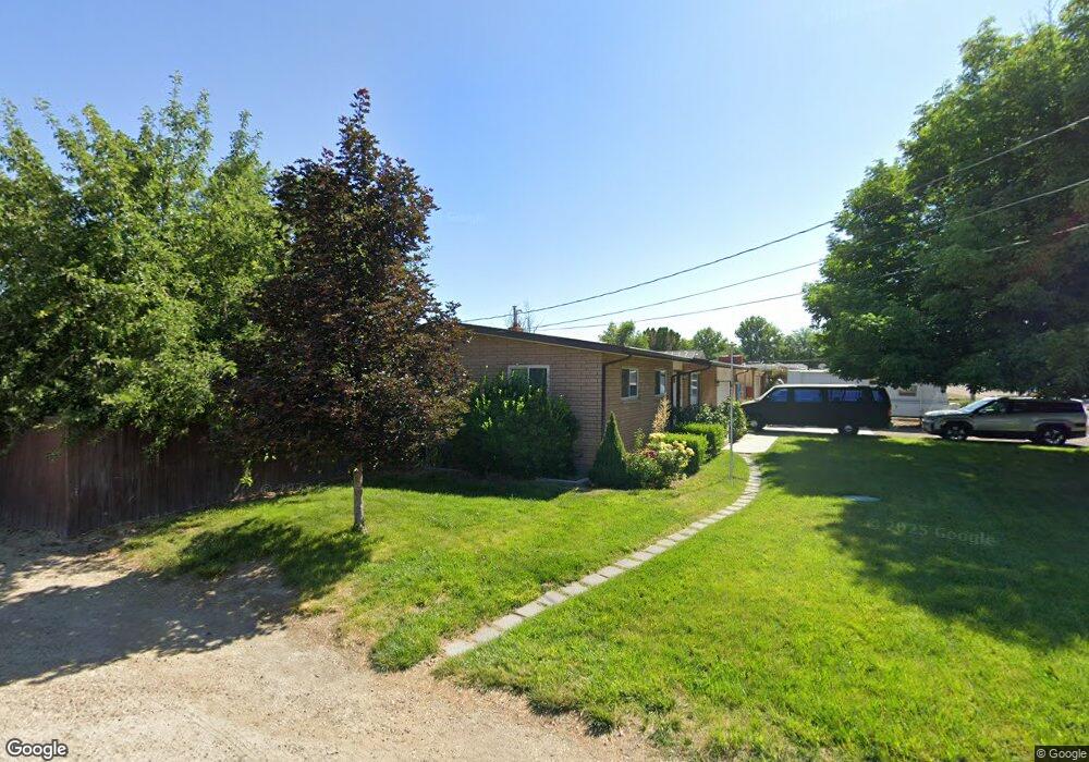
This home is located at 2102 E Greenhurst Rd, Nampa, ID 83686 and is currently estimated at $567,743, approximately $220 per square foot. 2102 E Greenhurst Rd is a home located in Canyon County with nearby schools including Greenhurst Elementary School, South Middle School, and Skyview High School.
Ownership History
Date
Name
Owned For
Owner Type
Purchase Details
Closed on
Jun 14, 2004
Sold by
Howard Elizabeth
Bought by
Johnson Timothy P and Johnson Angela R
Current Estimated Value
Home Financials for this Owner
Home Financials are based on the most recent Mortgage that was taken out on this home.
Original Mortgage
$114,880
Outstanding Balance
$56,496
Interest Rate
6.09%
Mortgage Type
Purchase Money Mortgage
Estimated Equity
$511,247
Create a Home Valuation Report for This Property
The Home Valuation Report is an in-depth analysis detailing your home's value as well as a comparison with similar homes in the area
Home Values in the Area
Average Home Value in this Area
Purchase History
| Date | Buyer | Sale Price | Title Company |
|---|---|---|---|
| Johnson Timothy P | -- | Title One |
Source: Public Records
Mortgage History
| Date | Status | Borrower | Loan Amount |
|---|---|---|---|
| Open | Johnson Timothy P | $114,880 | |
| Closed | Johnson Timothy P | $28,720 |
Source: Public Records
Tax History Compared to Growth
Tax History
| Year | Tax Paid | Tax Assessment Tax Assessment Total Assessment is a certain percentage of the fair market value that is determined by local assessors to be the total taxable value of land and additions on the property. | Land | Improvement |
|---|---|---|---|---|
| 2025 | $1,369 | $499,300 | $182,700 | $316,600 |
| 2024 | $1,369 | $494,300 | $182,700 | $311,600 |
| 2023 | $1,333 | $490,100 | $182,700 | $307,400 |
| 2022 | $1,827 | $541,500 | $201,000 | $340,500 |
| 2021 | $2,254 | $423,400 | $125,000 | $298,400 |
| 2020 | $2,055 | $320,500 | $96,000 | $224,500 |
| 2019 | $2,240 | $306,300 | $77,000 | $229,300 |
| 2018 | $1,832 | $0 | $0 | $0 |
| 2017 | $1,827 | $0 | $0 | $0 |
| 2016 | $1,596 | $0 | $0 | $0 |
| 2015 | $1,225 | $0 | $0 | $0 |
| 2014 | $1,201 | $180,700 | $38,000 | $142,700 |
Source: Public Records
Map
Nearby Homes
- 2019 Kentucky Dr
- 2622 Boulder Ave
- 1835 E Kentucky Ave
- 2714 S Almond Ct
- 1426 Chicago St
- 946 S Almond Ct
- 945 S Almond Ct
- 1801 E Iowa Ave
- 1921 E Explorer Ct
- 3601 S Angel Falls Way
- 2040 W Ibis Dr
- 3630 S Angel Falls Way
- 7232 E Merlin Hawk Ct
- 11623 W Black Dog Dr
- 1612 E York Ave
- 2912 E Iowa Ave
- 2020 E Lost River Ave
- 2121 Lambert Dr
- 2308 E Elm Grove Dr
- 1403 Sunflower Ct
- 2110 E Greenhurst Rd
- 0 Ventura Dr
- 2114 E Greenhurst Rd
- 2229 Ventura Dr
- 2214 Ventura Dr
- 2118 E Greenhurst Rd
- 2115 E Greenhurst Rd
- 2215 Ventura Dr
- 2109 Belle Aire Dr
- 2117 Belle Aire Dr
- 2105 Belle Aire Dr
- 2203 S Chicago Ave
- 2203 S Chicago Ave
- 0 Chicago St
- 2101 Belle Aire Dr
- 2200 Ventura Dr
- 2121 S Chicago Ave
- 1916 E Greenhurst Rd
- 1923 E Greenhurst Rd
- 2125 Ventura Dr