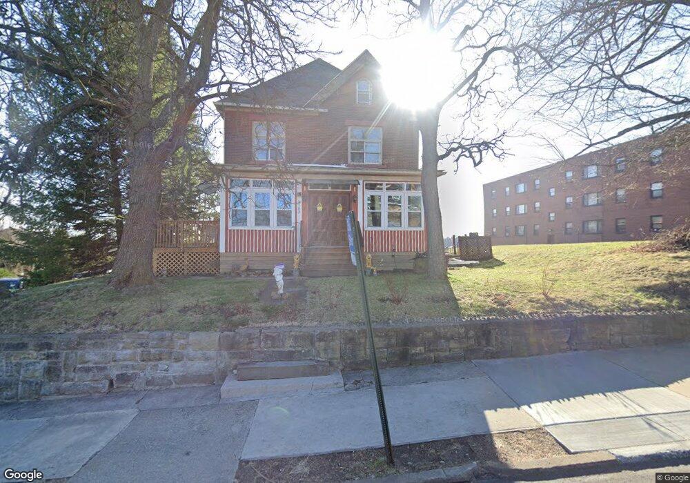
2103 Brownsville Rd Pittsburgh, PA 15210
Carrick NeighborhoodEstimated Value: $55,000 - $221,000
4
Beds
2
Baths
2,296
Sq Ft
$53/Sq Ft
Est. Value
About This Home
This home is located at 2103 Brownsville Rd, Pittsburgh, PA 15210 and is currently estimated at $121,597, approximately $52 per square foot. 2103 Brownsville Rd is a home located in Allegheny County with nearby schools including Pittsburgh Concord K-5, Pittsburgh South Brook, and Pittsburgh Carrick High School.
Ownership History
Date
Name
Owned For
Owner Type
Purchase Details
Closed on
Aug 7, 2009
Sold by
Hughes Stephen M
Bought by
Dragonfly Properties Ltd
Current Estimated Value
Purchase Details
Closed on
May 11, 2009
Sold by
Federal Home Loan Mortgage Corporation
Bought by
Hughes Stephen M
Purchase Details
Closed on
Feb 2, 2009
Sold by
Sbuscio Raymond J
Bought by
Federal Home Loan Mortgage Corporation
Purchase Details
Closed on
Dec 13, 2005
Sold by
Tarvin Charles R
Bought by
Sbuscio Raymond J
Home Financials for this Owner
Home Financials are based on the most recent Mortgage that was taken out on this home.
Original Mortgage
$98,800
Interest Rate
6.17%
Mortgage Type
New Conventional
Create a Home Valuation Report for This Property
The Home Valuation Report is an in-depth analysis detailing your home's value as well as a comparison with similar homes in the area
Home Values in the Area
Average Home Value in this Area
Purchase History
| Date | Buyer | Sale Price | Title Company |
|---|---|---|---|
| Dragonfly Properties Ltd | $20,000 | -- | |
| Hughes Stephen M | $19,500 | -- | |
| Federal Home Loan Mortgage Corporation | $1,710 | -- | |
| Sbuscio Raymond J | $104,000 | -- |
Source: Public Records
Mortgage History
| Date | Status | Borrower | Loan Amount |
|---|---|---|---|
| Previous Owner | Sbuscio Raymond J | $98,800 |
Source: Public Records
Tax History Compared to Growth
Tax History
| Year | Tax Paid | Tax Assessment Tax Assessment Total Assessment is a certain percentage of the fair market value that is determined by local assessors to be the total taxable value of land and additions on the property. | Land | Improvement |
|---|---|---|---|---|
| 2025 | $836 | $36,300 | $14,300 | $22,000 |
| 2024 | $836 | $36,300 | $14,300 | $22,000 |
| 2023 | $836 | $36,300 | $14,300 | $22,000 |
| 2022 | $825 | $36,300 | $14,300 | $22,000 |
| 2021 | $825 | $36,300 | $14,300 | $22,000 |
| 2020 | $821 | $36,300 | $14,300 | $22,000 |
| 2019 | $821 | $36,300 | $14,300 | $22,000 |
| 2018 | $659 | $36,300 | $14,300 | $22,000 |
| 2017 | $821 | $36,300 | $14,300 | $22,000 |
| 2016 | $172 | $36,300 | $14,300 | $22,000 |
| 2015 | $172 | $36,300 | $14,300 | $22,000 |
| 2014 | $803 | $36,300 | $14,300 | $22,000 |
Source: Public Records
Map
Nearby Homes
- 2020 Brownsville Rd
- 2000 Brownsville Rd
- 145 E Woodford Ave
- 309 Parkfield St
- 331 Redwood St
- 2404 Diehl Ave
- 26 Carrick Ave
- 2211 Lucina Ave
- 400 Ariston Ave
- 404 Ariston Ave
- 2082 Walton Ave
- 1641 Mount Joseph St
- 0 Brownsville Rd Unit 1689715
- 206 Alries St
- 373 Copperfield Ave
- 12 E Meyers St
- 2382 Edgar St
- 228 Alries St
- 2445 Brownsville Rd
- 1611 Westmont Ave
- 10 E Woodford Ave
- 2055 Brownsville Rd
- 12 E Woodford Ave
- 2053 Brownsville Rd
- 2048 Brownsville Rd
- 14 E Woodford Ave
- 2046 Brownsville Rd
- 2045 Brownsville Rd
- 2104 Brownsville Rd
- 20 E Woodford Ave
- 20 E Woodford Ave
- 11 E Woodford Ave
- 2044 Brownsville Rd
- 2098 Hazeldell St
- 2043 Brownsville Rd
- 23 E Woodford Ave
- 10 W Woodford Ave
- 2100 Hazeldell St
- 2040 Brownsville Rd Unit 2042
- 25 E Woodford Ave