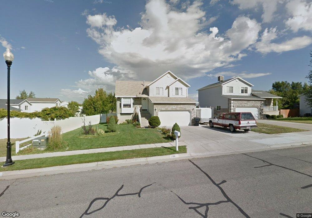
2106 W 1630 N Clearfield, UT 84015
Estimated Value: $440,014 - $464,000
3
Beds
2
Baths
1,410
Sq Ft
$319/Sq Ft
Est. Value
About This Home
This home is located at 2106 W 1630 N, Clearfield, UT 84015 and is currently estimated at $449,254, approximately $318 per square foot. 2106 W 1630 N is a home located in Davis County with nearby schools including Parkside Elementary School, West Point Junior High School, and Clearfield High School.
Ownership History
Date
Name
Owned For
Owner Type
Purchase Details
Closed on
Jul 5, 2002
Sold by
Teasdale Todd D and Teasdale Doris M
Bought by
Teasdale Todd D and Teasdale Doris
Current Estimated Value
Home Financials for this Owner
Home Financials are based on the most recent Mortgage that was taken out on this home.
Original Mortgage
$124,000
Outstanding Balance
$52,059
Interest Rate
6.71%
Estimated Equity
$397,195
Purchase Details
Closed on
Oct 30, 1997
Sold by
Far West Construction & Development Inc
Bought by
Teasdale Todd D and Teasdale Doris M
Home Financials for this Owner
Home Financials are based on the most recent Mortgage that was taken out on this home.
Original Mortgage
$101,023
Interest Rate
7.36%
Mortgage Type
FHA
Purchase Details
Closed on
May 12, 1997
Sold by
Rkt Holding Company Inc
Bought by
Far West Construction & Development Inc
Create a Home Valuation Report for This Property
The Home Valuation Report is an in-depth analysis detailing your home's value as well as a comparison with similar homes in the area
Home Values in the Area
Average Home Value in this Area
Purchase History
| Date | Buyer | Sale Price | Title Company |
|---|---|---|---|
| Teasdale Todd D | -- | Us Title | |
| Teasdale Todd D | -- | Associated Title Company | |
| Teasdale Todd D | -- | Associated Title Company | |
| Far West Construction & Development Inc | -- | Equity Title Agency |
Source: Public Records
Mortgage History
| Date | Status | Borrower | Loan Amount |
|---|---|---|---|
| Open | Teasdale Todd D | $124,000 | |
| Closed | Teasdale Todd D | $101,023 |
Source: Public Records
Tax History Compared to Growth
Tax History
| Year | Tax Paid | Tax Assessment Tax Assessment Total Assessment is a certain percentage of the fair market value that is determined by local assessors to be the total taxable value of land and additions on the property. | Land | Improvement |
|---|---|---|---|---|
| 2025 | $2,322 | $223,300 | $109,474 | $113,826 |
| 2024 | $2,242 | $216,700 | $118,191 | $98,509 |
| 2023 | $2,041 | $365,000 | $138,247 | $226,753 |
| 2022 | $2,190 | $216,700 | $80,011 | $136,689 |
| 2021 | $2,024 | $297,000 | $107,943 | $189,057 |
| 2020 | $1,756 | $255,000 | $96,097 | $158,903 |
| 2019 | $1,691 | $240,000 | $104,293 | $135,707 |
| 2018 | $1,564 | $218,000 | $87,090 | $130,910 |
| 2016 | $1,369 | $98,560 | $34,786 | $63,774 |
| 2015 | $1,406 | $96,250 | $34,786 | $61,464 |
| 2014 | $1,410 | $98,038 | $34,786 | $63,252 |
| 2013 | -- | $92,191 | $29,219 | $62,972 |
Source: Public Records
Map
Nearby Homes
- 2148 W 1570 N
- 1694 N 2225 W
- 1665 N 1960 W
- 2259 W 1800 N
- 1923 W 1340 N
- 1458 N 2400 W
- 1331 N 1850 W
- 1509 N 2475 W
- 1449 N 2475 W
- 2616 N 2125 W Unit 147
- 2371 W 1300 N
- 1251 N 2525 W
- 2642 W 1500 N
- 1657 N 1500 W
- 2162 N 2290 W
- 2184 N 2000 W
- 2083 W 2220 N
- 1467 W 1750 N
- Harvard Plan at Summerfield - Enclave
- 2208 W 2615 N
- 2094 W 1630 N
- 2094 W 1630 N Unit 43
- 1634 N 2140 W
- 2119 W 1630 N
- 2122 W 1630 N Unit 41
- 2122 W 1630 N
- 2101 W 1630 N
- 2078 W 1630 N
- 1656 N 2140 W
- 2087 W 1630 N
- 2127 W 1630 N
- 1662 N 2140 W
- 2072 W 1630 N
- 2073 W 1630 N
- 2139 W 1630 N
- 2108 W 1570 N
- 2056 W 1630 N
- 2096 W 1570 N
- 2122 W 1570 N
- 2122 W 1570 N Unit 34