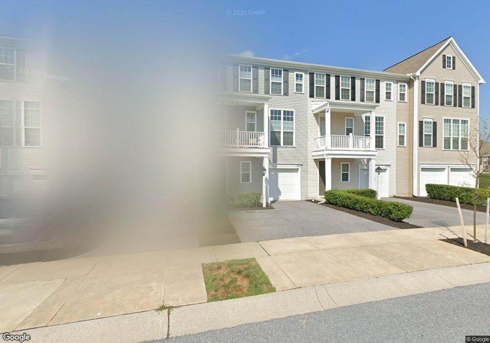
2107 Red Fox Dr Hummelstown, PA 17036
Estimated Value: $386,000 - $442,000
3
Beds
3
Baths
2,447
Sq Ft
$169/Sq Ft
Est. Value
About This Home
This home is located at 2107 Red Fox Dr, Hummelstown, PA 17036 and is currently estimated at $412,644, approximately $168 per square foot. 2107 Red Fox Dr is a home located in Dauphin County with nearby schools including Hershey Elementary School, Hershey Primary Elementary School, and Hershey Middle School.
Ownership History
Date
Name
Owned For
Owner Type
Purchase Details
Closed on
Dec 20, 2017
Sold by
Charter Homes At The Point Inc
Bought by
Corona Christopher J
Current Estimated Value
Home Financials for this Owner
Home Financials are based on the most recent Mortgage that was taken out on this home.
Original Mortgage
$227,991
Outstanding Balance
$191,750
Interest Rate
3.9%
Mortgage Type
New Conventional
Estimated Equity
$220,894
Purchase Details
Closed on
Feb 27, 2017
Sold by
Dsg Development Corp
Bought by
Charter Homes At The Point Inc
Home Financials for this Owner
Home Financials are based on the most recent Mortgage that was taken out on this home.
Original Mortgage
$8,000,000
Interest Rate
4.19%
Mortgage Type
Credit Line Revolving
Create a Home Valuation Report for This Property
The Home Valuation Report is an in-depth analysis detailing your home's value as well as a comparison with similar homes in the area
Home Values in the Area
Average Home Value in this Area
Purchase History
| Date | Buyer | Sale Price | Title Company |
|---|---|---|---|
| Corona Christopher J | $239,990 | Nationwide Title Clearing | |
| Charter Homes At The Point Inc | $390,000 | None Available |
Source: Public Records
Mortgage History
| Date | Status | Borrower | Loan Amount |
|---|---|---|---|
| Open | Corona Christopher J | $227,991 | |
| Previous Owner | Charter Homes At The Point Inc | $8,000,000 |
Source: Public Records
Tax History Compared to Growth
Tax History
| Year | Tax Paid | Tax Assessment Tax Assessment Total Assessment is a certain percentage of the fair market value that is determined by local assessors to be the total taxable value of land and additions on the property. | Land | Improvement |
|---|---|---|---|---|
| 2025 | $6,013 | $192,400 | $27,300 | $165,100 |
| 2024 | $5,651 | $192,400 | $27,300 | $165,100 |
| 2023 | $5,551 | $192,400 | $27,300 | $165,100 |
| 2022 | $5,428 | $192,400 | $27,300 | $165,100 |
| 2021 | $5,428 | $192,400 | $27,300 | $165,100 |
| 2020 | $5,428 | $192,400 | $27,300 | $165,100 |
Source: Public Records
Map
Nearby Homes
- 1959 Deer Run Dr
- 1919 Limestone Dr
- 2039H Raleigh Rd
- 2017B Raleigh Rd
- 497 Middletown Rd
- 2042 Locust Ln
- 285 Dogwood Dr
- 177 Middletown Rd
- 265 Redwood St
- 1168 Cord Dr
- 112 Park Ave
- 30 N Walnut St
- 228 W Main St
- 994 Clifton Heights Rd
- 235 W 2nd St
- 258 W 2nd St
- 589 Lovell Ct
- 610 Carrington Ct
- 791 Gregs Dr
- 227 Pleasant View Rd
- 2109 Red Fox Dr
- 2105 Red Fox Dr
- 2105 Red Fox Dr
- 2111 Red Fox Dr
- 2111 Red Fox Dr
- 2103 Red Fox Dr
- 2113 Red Fox Dr
- 2121 Red Fox Dr
- 2123 Red Fox Dr
- 2110 Red Fox Dr
- 2110 Red Fox Dr Unit 264
- 2112 Red Fox Dr
- 2112 Red Fox Dr Unit 265
- 2108 Red Fox Dr
- 2108 Red Fox Dr Unit 263
- 845 Whitetail Dr
- 2106 Red Fox Dr
- 2106 Red Fox Dr Unit 262
- 2114 Red Fox Dr
- 2114 Red Fox Dr Unit 266