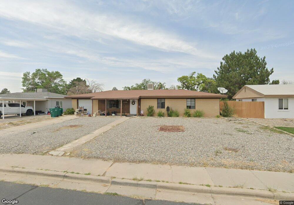
2109 Lynwood Dr Farmington, NM 87401
Estimated Value: $231,766 - $271,000
--
Bed
--
Bath
1,378
Sq Ft
$183/Sq Ft
Est. Value
About This Home
This home is located at 2109 Lynwood Dr, Farmington, NM 87401 and is currently estimated at $252,442, approximately $183 per square foot. 2109 Lynwood Dr is a home located in San Juan County with nearby schools including McKinley Elementary School, Tibbetts Middle School, and Farmington High School.
Ownership History
Date
Name
Owned For
Owner Type
Purchase Details
Closed on
Dec 19, 2012
Sold by
Williams Jesse and Williams Massy
Bought by
Mccarville Michael T and Mccarville Jodie M
Current Estimated Value
Home Financials for this Owner
Home Financials are based on the most recent Mortgage that was taken out on this home.
Original Mortgage
$60,000
Outstanding Balance
$41,570
Interest Rate
3.37%
Mortgage Type
New Conventional
Estimated Equity
$210,872
Purchase Details
Closed on
Oct 4, 2012
Sold by
Mncarville Jodie
Bought by
Williams Jesse and Mcarville Jodie
Create a Home Valuation Report for This Property
The Home Valuation Report is an in-depth analysis detailing your home's value as well as a comparison with similar homes in the area
Home Values in the Area
Average Home Value in this Area
Purchase History
| Date | Buyer | Sale Price | Title Company |
|---|---|---|---|
| Mccarville Michael T | -- | None Available | |
| Williams Jesse | -- | None Available |
Source: Public Records
Mortgage History
| Date | Status | Borrower | Loan Amount |
|---|---|---|---|
| Open | Mccarville Michael T | $60,000 |
Source: Public Records
Tax History Compared to Growth
Tax History
| Year | Tax Paid | Tax Assessment Tax Assessment Total Assessment is a certain percentage of the fair market value that is determined by local assessors to be the total taxable value of land and additions on the property. | Land | Improvement |
|---|---|---|---|---|
| 2024 | $1,299 | $54,626 | $0 | $0 |
| 2023 | $1,299 | $53,035 | $0 | $0 |
| 2022 | $1,238 | $51,490 | $0 | $0 |
| 2021 | $1,194 | $50,074 | $0 | $0 |
| 2020 | $1,161 | $48,827 | $0 | $0 |
| 2019 | $1,122 | $47,405 | $0 | $0 |
| 2018 | $1,102 | $47,405 | $0 | $0 |
| 2017 | $1,087 | $47,405 | $0 | $0 |
| 2016 | $1,082 | $47,405 | $0 | $0 |
| 2015 | $1,064 | $47,405 | $0 | $0 |
| 2014 | $1,119 | $50,828 | $0 | $0 |
Source: Public Records
Map
Nearby Homes
- 212 W Sunset Place
- 200 W 24th St
- 195 McDonald Rd
- 212 W 25th St
- XX Brookside Dr
- 1805 Brenwood Dr
- LOT 4 XX W 24th St
- 636 Ridge Lea Ct
- 2900 Northwood Dr
- 2413 N Municipal Dr
- 2906 Northwood Dr
- 3003 Northwood Cir
- 3104 N Western Ave
- 3105 N Sunset Ave
- 3108 N Mesa Dr
- 3110 N Sunset Ave
- 2412 Pheasant Place
- 1108 N Dustin Ave
- 607 E 16th St
- 1013 N Orchard Dr
- 2105 Lynwood Dr
- 2113 Lynwood Dr
- 2116 Summit Dr
- 2112 Summit Dr
- 2117 Lynwood Dr
- 2103 Lynwood Dr
- 2120 Summit Dr
- 2108 Summit Dr
- 2108 Lynwood Dr
- 2112 Lynwood Dr
- 2104 Lynwood Dr
- 2116 Lynwood Dr
- 212 Lynwood Dr
- 2124 Summit Dr
- 2104 Summit Dr
- 2101 Lynwood Dr
- 2100 Lynwood Dr
- 209 Lynwood Dr
- 2117 Summit Dr
- 2113 Summit Dr