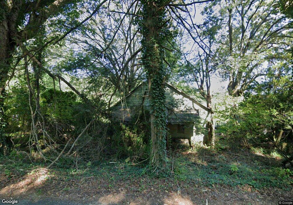
211 Lewis Brown Rd Dahlonega, GA 30533
Estimated Value: $183,463 - $271,000
--
Bed
2
Baths
980
Sq Ft
$224/Sq Ft
Est. Value
About This Home
This home is located at 211 Lewis Brown Rd, Dahlonega, GA 30533 and is currently estimated at $219,821, approximately $224 per square foot. 211 Lewis Brown Rd is a home located in Lumpkin County with nearby schools including Clay County Middle School and Lumpkin County High School.
Ownership History
Date
Name
Owned For
Owner Type
Purchase Details
Closed on
May 23, 2019
Sold by
Brock Dorothy L
Bought by
Ledbetter Chester Carlton H and Ledbetter Chester Beth
Current Estimated Value
Purchase Details
Closed on
Sep 16, 2002
Bought by
Brock Dorothy L
Purchase Details
Closed on
Jun 24, 1999
Sold by
Brock Dorothy L
Bought by
Bell Birdie
Purchase Details
Closed on
Jun 10, 1991
Sold by
Bell Birdie
Bought by
Brock Dorothy L
Purchase Details
Closed on
Sep 1, 1978
Bought by
Bell Birdie
Create a Home Valuation Report for This Property
The Home Valuation Report is an in-depth analysis detailing your home's value as well as a comparison with similar homes in the area
Home Values in the Area
Average Home Value in this Area
Purchase History
| Date | Buyer | Sale Price | Title Company |
|---|---|---|---|
| Ledbetter Chester Carlton H | $140,000 | -- | |
| Brock Dorothy L | $110,000 | -- | |
| Bell Birdie | $26,000 | -- | |
| Brock Dorothy L | $24,800 | -- | |
| Bell Birdie | -- | -- |
Source: Public Records
Tax History Compared to Growth
Tax History
| Year | Tax Paid | Tax Assessment Tax Assessment Total Assessment is a certain percentage of the fair market value that is determined by local assessors to be the total taxable value of land and additions on the property. | Land | Improvement |
|---|---|---|---|---|
| 2024 | $1,421 | $58,590 | $53,928 | $4,662 |
| 2023 | $1,160 | $49,318 | $44,656 | $4,662 |
| 2022 | $1,037 | $41,876 | $37,214 | $4,662 |
| 2021 | $1,072 | $41,876 | $37,214 | $4,662 |
| 2020 | $1,064 | $40,320 | $35,658 | $4,662 |
| 2019 | $293 | $40,320 | $35,658 | $4,662 |
| 2018 | $312 | $40,320 | $35,658 | $4,662 |
| 2017 | $319 | $40,320 | $35,658 | $4,662 |
| 2016 | $329 | $40,320 | $35,658 | $4,662 |
| 2015 | $289 | $40,320 | $35,658 | $4,662 |
| 2014 | $289 | $40,320 | $35,658 | $4,662 |
| 2013 | -- | $40,320 | $35,658 | $4,661 |
Source: Public Records
Map
Nearby Homes
- 87 Tolleffs Trail
- 128 Young Deer Dr
- 296 Norman Bell Rd
- 202 Indian Trail
- 0 Arborwood Dr Unit 10645890
- 0 Bearden Rd Unit 10598024
- 0 Bearden Rd Unit 7642996
- 380 Copper Mill Rd
- 6480 Highway 52 W
- 83 Austin Ct
- 1228 Winters Mountain Rd
- 94 King Arthur Ct
- 300 Mountain Ridge Dr
- 962 Winters Mountain Rd
- 0 Winters Mountain Rd Unit 7681054
- 0 Winters Mountain Rd Unit 10643431
- 238 Sunrise Trail
- 100 Rocky Branch Dr
- 600 Chapman Ridge Ln
- 211 Lewis Brown Rd
- 0 Lewis Brown Rd Unit 3168474
- 167 Lewis Brown Dr
- 250 Lewis Brown Dr
- 284 Lewis Brown Dr
- 325 Lewis Brown Rd
- 135 Boyd W Barrett Rd
- 0 Boyd W Barrett Rd
- 131 Lewis Brown Rd
- 288 Lewis Brown Rd
- 209 Boyd W Barrett Rd
- 4941 Highway 52 E
- 4931 Highway 52 E
- 131 Boyd W Barrett Rd
- 355 Boyd W Barrett Rd
- 5007 Highway 52 E
- 410 Lewis Brown Rd
- 0 Tolleffs Trail Unit 3171219
- 0 Tolleffs Trail Unit 3170892
- 0 Tolleffs Trail Unit 7054126