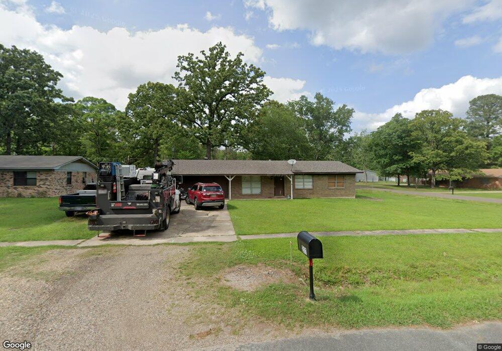
211 Redwood Dr Texarkana, TX 75501
Estimated Value: $194,712 - $249,000
--
Bed
--
Bath
2,112
Sq Ft
$102/Sq Ft
Est. Value
About This Home
This home is located at 211 Redwood Dr, Texarkana, TX 75501 and is currently estimated at $216,178, approximately $102 per square foot. 211 Redwood Dr is a home located in Bowie County with nearby schools including Liberty-Eylau Early Childhood Center, Liberty-Eylau Primary School, and Liberty-Eylau C.K. Bender Elementary Campus.
Ownership History
Date
Name
Owned For
Owner Type
Purchase Details
Closed on
Apr 2, 2012
Sold by
Domino Fcu
Bought by
Butler Harvey A and Butler Cheryl L
Current Estimated Value
Home Financials for this Owner
Home Financials are based on the most recent Mortgage that was taken out on this home.
Original Mortgage
$82,650
Outstanding Balance
$57,045
Interest Rate
3.97%
Mortgage Type
New Conventional
Estimated Equity
$159,133
Purchase Details
Closed on
Apr 15, 2005
Sold by
Sufridge Charles A
Bought by
Wiedrich Dearlyn R and Wiedrich Sheri L
Home Financials for this Owner
Home Financials are based on the most recent Mortgage that was taken out on this home.
Original Mortgage
$14,534
Interest Rate
5.93%
Mortgage Type
Stand Alone Second
Purchase Details
Closed on
Jan 26, 2005
Sold by
Suffridge Shirley M
Bought by
Suffridge Charles A
Home Financials for this Owner
Home Financials are based on the most recent Mortgage that was taken out on this home.
Original Mortgage
$36,263
Interest Rate
5.71%
Mortgage Type
Future Advance Clause Open End Mortgage
Create a Home Valuation Report for This Property
The Home Valuation Report is an in-depth analysis detailing your home's value as well as a comparison with similar homes in the area
Home Values in the Area
Average Home Value in this Area
Purchase History
| Date | Buyer | Sale Price | Title Company |
|---|---|---|---|
| Butler Harvey A | -- | Stewart Title Of Texarkana | |
| Wiedrich Dearlyn R | -- | None Available | |
| Suffridge Charles A | -- | None Available |
Source: Public Records
Mortgage History
| Date | Status | Borrower | Loan Amount |
|---|---|---|---|
| Open | Butler Harvey A | $82,650 | |
| Previous Owner | Wiedrich Dearlyn R | $14,534 | |
| Previous Owner | Suffridge Charles A | $36,263 |
Source: Public Records
Tax History Compared to Growth
Tax History
| Year | Tax Paid | Tax Assessment Tax Assessment Total Assessment is a certain percentage of the fair market value that is determined by local assessors to be the total taxable value of land and additions on the property. | Land | Improvement |
|---|---|---|---|---|
| 2025 | $1,235 | $171,106 | $16,000 | $155,106 |
| 2024 | $1,235 | $156,258 | $16,000 | $148,643 |
| 2023 | $2,123 | $142,053 | $0 | $0 |
| 2022 | $2,225 | $140,462 | $16,000 | $124,462 |
| 2021 | $2,151 | $117,399 | $14,500 | $102,899 |
| 2020 | $2,082 | $112,782 | $14,500 | $98,282 |
| 2019 | $2,105 | $108,391 | $14,500 | $93,891 |
| 2018 | $2,040 | $105,022 | $14,500 | $90,522 |
| 2017 | $2,020 | $104,376 | $14,500 | $89,876 |
| 2016 | $2,020 | $104,376 | $14,500 | $89,876 |
| 2015 | $1,586 | $103,549 | $14,500 | $89,049 |
| 2014 | $1,586 | $100,357 | $14,500 | $85,857 |
Source: Public Records
Map
Nearby Homes
- 403 Brookfield St
- 6514 Buchanan Loop Rd
- 101 Redwood Dr
- 2043 Randall Rd
- 0 Randall Rd
- 194 W Starlite Dr
- 280 Patriot Way
- 6 Southridge St
- 6815 Buchanan Loop Rd
- lot15 B2 Quail Brook
- lot15 B1 Quail Brook
- lot14 B2 Quail Brook
- Lot 1 B2 Quail Brook
- 39 Quail Brook Dr
- 6606 Us-59
- 6606 Us Highway 59 S
- 144 Joe Tyl Rd
- 7689 Us-59
- 7685 State Highway 59
- 5789 U S 59
- 209 Redwood Dr
- 101 Brookfield
- 212 Cummings Ln
- 105 Brookfield St
- 107 Brookfield St
- 207 Redwood Dr
- 210 Cummings Ln
- 109 Brookfield St
- 210 Redwood Dr
- 208 Cummings Ln
- 205 Redwood Dr
- 208 Redwood Dr
- 111 Brookfield St
- 206 Cummings Ln
- 315 Maryland Dr
- 313 Maryland Dr
- 206 Redwood Dr
- 203 Redwood Dr
- 317 Maryland Dr
- 211 Maryland Dr