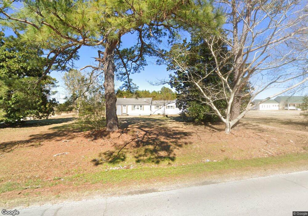
211 Sam Garner Rd Newport, NC 28570
Estimated Value: $311,000 - $409,000
4
Beds
3
Baths
1,944
Sq Ft
$182/Sq Ft
Est. Value
About This Home
This home is located at 211 Sam Garner Rd, Newport, NC 28570 and is currently estimated at $353,592, approximately $181 per square foot. 211 Sam Garner Rd is a home located in Carteret County with nearby schools including Newport Elementary School, Newport Middle School, and West Carteret High School.
Ownership History
Date
Name
Owned For
Owner Type
Purchase Details
Closed on
Nov 6, 2019
Sold by
Bell Margaret Mudoch and Bell Dickie Sarah
Bought by
Rice Charlotte Ashleigh and Russell Justin Blaire
Current Estimated Value
Purchase Details
Closed on
Aug 13, 2019
Sold by
Mehlich Mary Bell
Bought by
Bell Deckie Sarah
Purchase Details
Closed on
Jul 11, 2018
Sold by
Mehlich Mary Bell
Bought by
Dickie Sarah Bell
Create a Home Valuation Report for This Property
The Home Valuation Report is an in-depth analysis detailing your home's value as well as a comparison with similar homes in the area
Home Values in the Area
Average Home Value in this Area
Purchase History
| Date | Buyer | Sale Price | Title Company |
|---|---|---|---|
| Rice Charlotte Ashleigh | $11,500 | None Available | |
| Bell Deckie Sarah | -- | None Available | |
| Dickie Sarah Bell | -- | None Available |
Source: Public Records
Tax History Compared to Growth
Tax History
| Year | Tax Paid | Tax Assessment Tax Assessment Total Assessment is a certain percentage of the fair market value that is determined by local assessors to be the total taxable value of land and additions on the property. | Land | Improvement |
|---|---|---|---|---|
| 2025 | $1,033 | $283,436 | $84,623 | $198,813 |
| 2024 | $320 | $46,262 | $26,017 | $20,245 |
| 2023 | $385 | $46,262 | $26,017 | $20,245 |
| 2022 | $380 | $46,262 | $26,017 | $20,245 |
| 2021 | $0 | $46,262 | $26,017 | $20,245 |
| 2020 | $379 | $46,262 | $26,017 | $20,245 |
| 2019 | $426 | $61,421 | $34,668 | $26,753 |
| 2017 | $721 | $142,389 | $34,668 | $107,721 |
| 2016 | $721 | $142,389 | $34,668 | $107,721 |
| 2015 | $707 | $142,389 | $34,668 | $107,721 |
| 2014 | $697 | $139,773 | $45,037 | $94,736 |
Source: Public Records
Map
Nearby Homes
- 126 Hatcher Dr
- 415 Hillcrest Dr
- 404 Hillcrest Dr
- 414 W Branch Dr
- 806 Lord Granville Dr
- 904 Lord Granville Dr
- 357 Mccabe Rd
- 311 Lord Granville Dr
- 304 Lord Granville Dr
- 341 Mccabe Rd
- 6650 Highway 70 W
- 302 Lord Granville Dr
- 212 Lord Granville Dr
- 105 Fairway Dr W
- 215 Oak Dr
- 113 Fairway Dr W
- 5320 Highway 70 W
- 812 E Chatham St
- 206 Lazy Ln
- 200 Tree Fern Dr
- 197 Sam Garner Rd
- 231 Sam Garner Rd
- 198 Sam Garner Rd
- 226 Sam Garner Rd
- 173 Sam Garner Rd
- 242 Sam Garner Rd
- 158 Sam Garner Rd
- 5674 Highway 70
- 5674 Highway 70
- 118 Sheppard Cruse Dr
- 00000 Wood
- 101 & 107 Wood Ln
- 101 Wood Ln
- 126 Sheppard Cruse Dr
- 5596 Highway 70
- 5568 Highway 70
- 5568 Highway 70
- 166 Sheppard Cruse Dr
- 401 Sam Garner Rd
- 374 Wildwood Rd