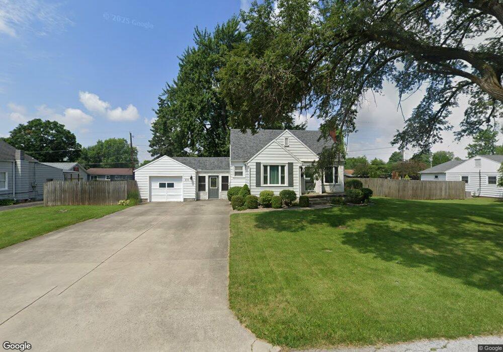
211 Watson Ave Fostoria, OH 44830
Estimated Value: $125,000 - $138,045
2
Beds
1
Bath
850
Sq Ft
$154/Sq Ft
Est. Value
About This Home
This home is located at 211 Watson Ave, Fostoria, OH 44830 and is currently estimated at $131,011, approximately $154 per square foot. 211 Watson Ave is a home located in Hancock County with nearby schools including Fostoria Intermediate Elementary School and Fostoria Junior/Senior High School.
Ownership History
Date
Name
Owned For
Owner Type
Purchase Details
Closed on
Aug 9, 2007
Sold by
Ellis Nicole A and Ellis Robert David
Bought by
Busack Stacey L
Current Estimated Value
Home Financials for this Owner
Home Financials are based on the most recent Mortgage that was taken out on this home.
Original Mortgage
$71,250
Outstanding Balance
$45,227
Interest Rate
6.71%
Mortgage Type
Purchase Money Mortgage
Estimated Equity
$85,784
Purchase Details
Closed on
Aug 14, 2003
Sold by
Ariza Flossie J
Bought by
Floriana Nicole A
Home Financials for this Owner
Home Financials are based on the most recent Mortgage that was taken out on this home.
Original Mortgage
$61,100
Interest Rate
5.47%
Mortgage Type
Purchase Money Mortgage
Create a Home Valuation Report for This Property
The Home Valuation Report is an in-depth analysis detailing your home's value as well as a comparison with similar homes in the area
Home Values in the Area
Average Home Value in this Area
Purchase History
| Date | Buyer | Sale Price | Title Company |
|---|---|---|---|
| Busack Stacey L | $75,000 | Whitman Title | |
| Floriana Nicole A | $63,000 | Wolph Title |
Source: Public Records
Mortgage History
| Date | Status | Borrower | Loan Amount |
|---|---|---|---|
| Open | Busack Stacey L | $71,250 | |
| Previous Owner | Floriana Nicole A | $61,100 |
Source: Public Records
Tax History Compared to Growth
Tax History
| Year | Tax Paid | Tax Assessment Tax Assessment Total Assessment is a certain percentage of the fair market value that is determined by local assessors to be the total taxable value of land and additions on the property. | Land | Improvement |
|---|---|---|---|---|
| 2024 | $1,725 | $34,660 | $8,360 | $26,300 |
| 2023 | $1,721 | $34,660 | $8,360 | $26,300 |
| 2022 | $1,875 | $34,660 | $8,360 | $26,300 |
| 2021 | $1,650 | $29,350 | $8,830 | $20,520 |
| 2020 | $1,658 | $29,350 | $8,830 | $20,520 |
| 2019 | $1,650 | $29,350 | $8,830 | $20,520 |
| 2018 | $1,472 | $25,520 | $7,680 | $17,840 |
| 2017 | $735 | $25,520 | $7,680 | $17,840 |
| 2016 | $1,293 | $25,520 | $7,680 | $17,840 |
| 2015 | $1,116 | $22,130 | $7,680 | $14,450 |
| 2014 | $1,116 | $22,130 | $7,680 | $14,450 |
| 2012 | $1,311 | $25,880 | $9,360 | $16,520 |
Source: Public Records
Map
Nearby Homes
- 411 Monticello Dr
- 418 W Ridge Dr
- 425 W Ridge Dr
- 509 College Ave
- 1401 Van Buren St
- 348 W South St
- 603 N Vine St
- 603 Alma Dr
- 461 W Lytle St
- 461 W Lytle St Unit 106
- 461 W Lytle St Unit 145
- 203 N Union St
- 22979 State Route 12
- 711 Hart Ave Unit 713
- 0 W South Route 12
- 520 N Union St
- 723 N Union St
- 211 Summit St
- 435 Park Ave
- 892 N Countyline St
- 207 Watson Ave
- 215 Watson Ave
- 204 Jeanette Dr
- 202 Jeanette Dr
- 222 Watson Ave
- 226 Watson Ave
- 200 Jeanette Dr
- 206 Jeanette Dr
- 223 Watson Ave
- 216 Watson Ave
- 230 Watson Ave
- 208 Jeanette Dr
- 227 Watson Ave
- 232 Watson Ave
- 232 Watson Ave
- 215 Elwood Ave
- 207 Elwood Ave
- 223 Elwood Ave
- 231 Watson Ave
- 227 Elwood Ave