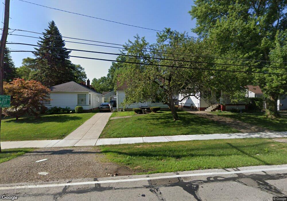
21129 Westwood Rd Cleveland, OH 44126
Estimated Value: $235,174 - $289,000
4
Beds
2
Baths
1,344
Sq Ft
$196/Sq Ft
Est. Value
About This Home
This home is located at 21129 Westwood Rd, Cleveland, OH 44126 and is currently estimated at $262,794, approximately $195 per square foot. 21129 Westwood Rd is a home located in Cuyahoga County with nearby schools including Gilles-Sweet Elementary School, Lewis F Mayer Middle School, and Fairview High School.
Ownership History
Date
Name
Owned For
Owner Type
Purchase Details
Closed on
Aug 19, 2003
Sold by
Reep Michael and Reep Michael L
Bought by
Ramos Mauricio C and Romero Ana M
Current Estimated Value
Home Financials for this Owner
Home Financials are based on the most recent Mortgage that was taken out on this home.
Original Mortgage
$120,000
Outstanding Balance
$52,843
Interest Rate
5.62%
Mortgage Type
Purchase Money Mortgage
Estimated Equity
$209,951
Purchase Details
Closed on
Sep 4, 1998
Sold by
Breznock Veronica H
Bought by
Reep Michael and Reep Michael L
Home Financials for this Owner
Home Financials are based on the most recent Mortgage that was taken out on this home.
Original Mortgage
$104,806
Interest Rate
7.02%
Mortgage Type
FHA
Purchase Details
Closed on
Jan 1, 1975
Bought by
Breznock Veronica H
Create a Home Valuation Report for This Property
The Home Valuation Report is an in-depth analysis detailing your home's value as well as a comparison with similar homes in the area
Home Values in the Area
Average Home Value in this Area
Purchase History
| Date | Buyer | Sale Price | Title Company |
|---|---|---|---|
| Ramos Mauricio C | $130,000 | -- | |
| Reep Michael | $105,000 | -- | |
| Breznock Veronica H | -- | -- |
Source: Public Records
Mortgage History
| Date | Status | Borrower | Loan Amount |
|---|---|---|---|
| Open | Ramos Mauricio C | $120,000 | |
| Closed | Reep Michael | $104,806 |
Source: Public Records
Tax History Compared to Growth
Tax History
| Year | Tax Paid | Tax Assessment Tax Assessment Total Assessment is a certain percentage of the fair market value that is determined by local assessors to be the total taxable value of land and additions on the property. | Land | Improvement |
|---|---|---|---|---|
| 2024 | $4,360 | $62,720 | $11,165 | $51,555 |
| 2023 | $4,219 | $52,010 | $9,520 | $42,490 |
| 2022 | $4,115 | $52,010 | $9,520 | $42,490 |
| 2021 | $4,194 | $52,010 | $9,520 | $42,490 |
| 2020 | $3,860 | $41,930 | $7,670 | $34,270 |
| 2019 | $3,435 | $119,800 | $21,900 | $97,900 |
| 2018 | $3,245 | $41,930 | $7,670 | $34,270 |
| 2017 | $3,202 | $36,060 | $6,830 | $29,230 |
| 2016 | $3,181 | $36,060 | $6,830 | $29,230 |
| 2015 | $3,003 | $36,060 | $6,830 | $29,230 |
| 2014 | $3,003 | $34,340 | $6,510 | $27,830 |
Source: Public Records
Map
Nearby Homes
- 21143 Westwood Rd
- 4243 W 212th St
- 21237 Westwood Rd
- 21236 Northwood Ave
- 20778 Woodstock Ave
- 4291 W 215th St
- 4298 W 215th St
- 4036 W 219th St
- 20688 Belvidere Ave
- 3826 W 210th St
- 3712 Addington Ct
- 3733 River Ln
- 4140 W 220th St
- 3740 W 214th St
- 20187 Grannis Rd
- 21872 Addington Blvd Unit 15
- 4235 W 222nd St
- 21503 Hillsdale Ave
- 22377 Rivergate Dr
- 3420 W 210th St
- 21133 Westwood Rd
- 21123 Westwood Rd
- 4218 W 211th St
- 4226 W 211th St
- 21147 Westwood Rd
- 21183 Westwood Rd
- 21130 Westwood Rd
- 4181 W 212th St
- 21140 Westwood Rd
- 21122 Westwood Rd
- 4167 W 211th St
- 4187 W 211th St
- 4189 W 212th St
- 21148 Westwood Rd
- 4221 W 210th St
- 21114 Westwood Rd
- 4240 W 211th St
- 21189 Westwood Rd
- 21180 Westwood Rd
- 21080 Westwood Rd