Estimated Value: $220,000 - $281,000
1
Bed
1
Bath
--
Sq Ft
7,841
Sq Ft Lot
About This Home
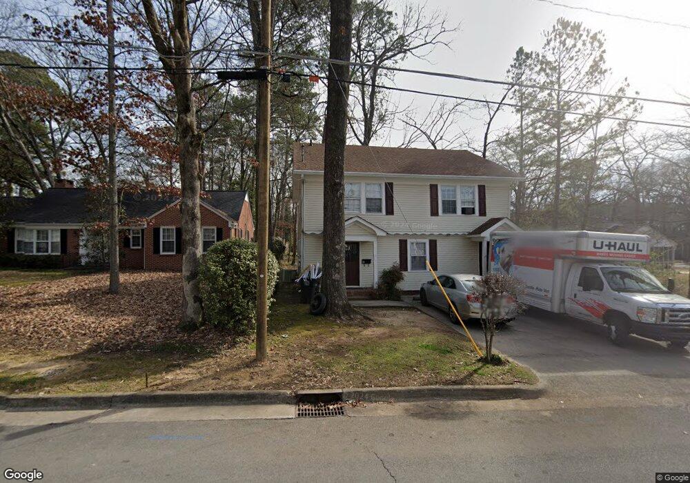
This home is located at 212 & 212 1 2 Leland Ave, Rome, GA 30165 and is currently estimated at $243,467. 212 & 212 1 2 Leland Ave is a home located in Floyd County with nearby schools including Rome High School and Unity Christian School.
Ownership History
Date
Name
Owned For
Owner Type
Purchase Details
Closed on
Dec 4, 2020
Sold by
Yates Clinton Harrod
Bought by
Mnia Llc
Current Estimated Value
Purchase Details
Closed on
Apr 30, 1997
Bought by
P and R
Purchase Details
Closed on
Nov 15, 1996
Bought by
P and R
Purchase Details
Closed on
Jan 9, 1996
Bought by
P and R
Purchase Details
Closed on
May 2, 1991
Sold by
Bell Donald J
Bought by
Yates Clint
Purchase Details
Closed on
Jul 1, 1974
Sold by
Doss Malcolm M and Bell Donald J
Bought by
Bell Donald J and Mrs Herschel W
Purchase Details
Closed on
Aug 28, 1972
Sold by
White J M
Bought by
Doss Malcolm M and Bell Donald J
Purchase Details
Closed on
Jan 1, 1901
Bought by
White J M
Create a Home Valuation Report for This Property
The Home Valuation Report is an in-depth analysis detailing your home's value as well as a comparison with similar homes in the area
Home Values in the Area
Average Home Value in this Area
Purchase History
| Date | Buyer | Sale Price | Title Company |
|---|---|---|---|
| Mnia Llc | $140,000 | -- | |
| Yates Clinton Harrod | -- | -- | |
| Yates Clinton Harrod | -- | -- | |
| P | -- | -- | |
| P | -- | -- | |
| P | -- | -- | |
| Yates Clint | $40,000 | -- | |
| Bell Donald J | $12,000 | -- | |
| Bell Donald J | -- | -- | |
| Doss Malcolm M | $17,500 | -- | |
| White J M | -- | -- |
Source: Public Records
Tax History Compared to Growth
Tax History
| Year | Tax Paid | Tax Assessment Tax Assessment Total Assessment is a certain percentage of the fair market value that is determined by local assessors to be the total taxable value of land and additions on the property. | Land | Improvement |
|---|---|---|---|---|
| 2024 | $3,357 | $101,328 | $10,138 | $91,190 |
| 2023 | $3,588 | $82,481 | $9,216 | $73,265 |
| 2022 | $2,451 | $67,162 | $7,603 | $59,559 |
| 2021 | $2,070 | $55,792 | $7,603 | $48,189 |
| 2020 | $1,906 | $50,928 | $5,760 | $45,168 |
| 2019 | $1,423 | $45,228 | $5,760 | $39,468 |
| 2018 | $1,649 | $44,556 | $5,760 | $38,796 |
| 2017 | $1,585 | $42,805 | $5,760 | $37,045 |
| 2016 | $1,543 | $41,562 | $5,760 | $35,802 |
| 2015 | $1,457 | $41,562 | $5,760 | $35,802 |
| 2014 | $1,457 | $41,562 | $5,760 | $35,802 |
Source: Public Records
Map
Nearby Homes
- 105 Robin St NW
- 208 Dodd St NW
- 7 Raymond Ave NW
- 204 Oakwood St NW
- 4 Colonial Dr NW
- 614 Briarwood Cir NW
- 0 Unbridled Rd Unit 22 23074684
- 808 Charlton St NW
- 527 W 11th St NE
- 1005 N 2nd Ave NW Unit 39
- PEARSON Plan at Shorter Village
- 9 Shorter Cir SW
- 601 W 10th St NE
- 1006 Avenue A NE
- 209 Sherwood Rd SW
- 124 Sheridan Dr NW
- 6 Horseleg Creek Rd SW
- 715 Avenue A NE
- 23 Sweetspire Dr NW
- 212 Leland Ave NW
- 210 Leland Ave NW
- 300 Leland Ave NW
- 300 Leland Ave NW Unit 26
- 208 Leland Ave NW
- 101 Dodd St NW
- 206 Leland Ave NW Unit 63C
- 206 Leland Ave NW
- 100 Dodd St NW
- 0 Leland Ave Unit 8633320
- 0 Leland Ave Unit 8792546
- 0 Leland Ave Unit 8909957
- 0 Leland Ave Unit 3143018
- 0 Leland Ave Unit 3188638
- 0 Leland Ave Unit 3267665
- 0 Leland Ave Unit 7412381
- 0 Leland Ave
- 102 Dodd St NW
- 105 Dodd St NW
- 203 Leland Ave NW