Estimated Value: $397,000 - $445,000
4
Beds
4
Baths
3,000
Sq Ft
$140/Sq Ft
Est. Value
About This Home
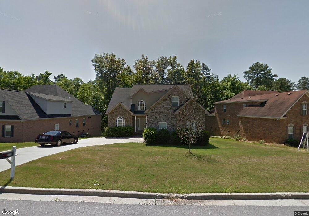
This home is located at 212 Mineral Ct, Evans, GA 30809 and is currently estimated at $420,376, approximately $140 per square foot. 212 Mineral Ct is a home located in Columbia County with nearby schools including Evans Elementary School, John F. Kennedy Middle School, and Evans Middle School.
Ownership History
Date
Name
Owned For
Owner Type
Purchase Details
Closed on
May 31, 2023
Sold by
Baker Rosiah M
Bought by
Baker Byran J
Current Estimated Value
Purchase Details
Closed on
Sep 17, 2004
Sold by
Bonair Builders
Bought by
Baker Jerry and Potter Cynthia
Home Financials for this Owner
Home Financials are based on the most recent Mortgage that was taken out on this home.
Original Mortgage
$196,000
Interest Rate
5.62%
Mortgage Type
Purchase Money Mortgage
Create a Home Valuation Report for This Property
The Home Valuation Report is an in-depth analysis detailing your home's value as well as a comparison with similar homes in the area
Home Values in the Area
Average Home Value in this Area
Purchase History
| Date | Buyer | Sale Price | Title Company |
|---|---|---|---|
| Baker Byran J | -- | -- | |
| Baker Bryan J | -- | -- | |
| Baker Jerry | $245,000 | -- |
Source: Public Records
Mortgage History
| Date | Status | Borrower | Loan Amount |
|---|---|---|---|
| Previous Owner | Baker Jerry | $196,000 | |
| Closed | Baker Jerry | $49,000 |
Source: Public Records
Tax History Compared to Growth
Tax History
| Year | Tax Paid | Tax Assessment Tax Assessment Total Assessment is a certain percentage of the fair market value that is determined by local assessors to be the total taxable value of land and additions on the property. | Land | Improvement |
|---|---|---|---|---|
| 2025 | $4,235 | $175,170 | $29,804 | $145,366 |
| 2024 | $4,117 | $162,456 | $26,604 | $135,852 |
| 2023 | $4,117 | $175,306 | $24,804 | $150,502 |
| 2022 | $3,779 | $143,205 | $26,204 | $117,001 |
| 2021 | $3,387 | $122,444 | $20,404 | $102,040 |
| 2020 | $3,186 | $112,672 | $19,304 | $93,368 |
| 2019 | $3,178 | $112,361 | $19,504 | $92,857 |
| 2018 | $2,924 | $102,889 | $20,204 | $82,685 |
| 2017 | $2,899 | $101,638 | $17,204 | $84,434 |
| 2016 | $2,787 | $101,246 | $17,680 | $83,566 |
| 2015 | $2,769 | $100,373 | $16,980 | $83,393 |
| 2014 | $2,631 | $94,076 | $16,980 | $77,096 |
Source: Public Records
Map
Nearby Homes
- 510 Farmington Cir
- 1764 Davenport Dr
- 952 Lillian Park Dr Unit Lp127
- 944 Lillian Park Dr Unit Lp124
- 942 Lillian Park Dr Unit Lp123
- 940 Lillian Park Dr Unit Lp122
- 938 Lillian Park Dr Unit LP121
- 329 Holly Oak Way Unit SC79
- 322 Farmington Dr
- 327 Holly Oak Way Unit SC80
- 930 Lillian Park Dr Unit Lp119
- 647 Bunchgrass St
- 2140 Sinclair Dr Unit Sc85
- 4876 Rolling Hill Rd
- 2170 Sinclair Dr Unit Sc97
- 902 Lillian Park Dr Unit Lp111
- 2172 Sinclair Dr Unit Sc98
- 2111 Sinclair Dr
- 4854 Hereford Farm Rd
- 2142 Sinclair Dr Unit SC86
- 214 Mineral Ct
- 210 Mineral Ct
- 216 Mineral Ct
- 211 Mineral Ct
- 206 Mineral Ct
- 209 Mineral Ct
- 213 Mineral Ct
- 218 Mineral Ct
- 529 Farmington Cir
- 531 Farmington Cir
- 207 Mineral Ct
- 533 Farmington Cir
- 204 Mineral Ct
- 205 Mineral Ct
- 527 Farmington Cir
- 203 Mineral Ct
- 535 Farmington Cir
- 525 Farmington Cir
- 220 Mineral Ct
- 217 Mineral Ct