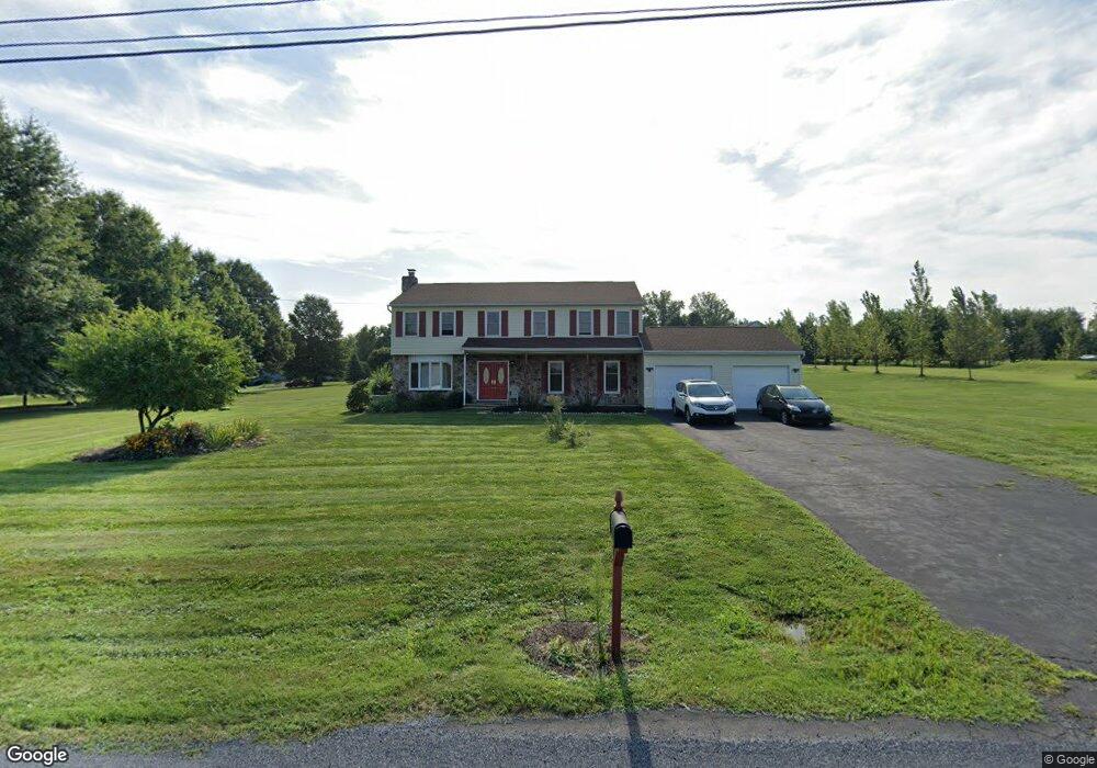
212 Reitnour Rd Spring City, PA 19475
East Vincent Township NeighborhoodEstimated Value: $555,000 - $635,000
4
Beds
3
Baths
2,480
Sq Ft
$240/Sq Ft
Est. Value
About This Home
This home is located at 212 Reitnour Rd, Spring City, PA 19475 and is currently estimated at $594,262, approximately $239 per square foot. 212 Reitnour Rd is a home located in Chester County with nearby schools including East Coventry Elementary School, Owen J Roberts Middle School, and Owen J Roberts High School.
Ownership History
Date
Name
Owned For
Owner Type
Purchase Details
Closed on
Nov 15, 2013
Sold by
Holding Michele and Holding Johnson Michelle Yvette
Bought by
Holding Michele
Current Estimated Value
Home Financials for this Owner
Home Financials are based on the most recent Mortgage that was taken out on this home.
Original Mortgage
$251,000
Interest Rate
3.36%
Mortgage Type
New Conventional
Create a Home Valuation Report for This Property
The Home Valuation Report is an in-depth analysis detailing your home's value as well as a comparison with similar homes in the area
Home Values in the Area
Average Home Value in this Area
Purchase History
| Date | Buyer | Sale Price | Title Company |
|---|---|---|---|
| Holding Michele | -- | None Available |
Source: Public Records
Mortgage History
| Date | Status | Borrower | Loan Amount |
|---|---|---|---|
| Closed | Holding Michele | $251,000 |
Source: Public Records
Tax History Compared to Growth
Tax History
| Year | Tax Paid | Tax Assessment Tax Assessment Total Assessment is a certain percentage of the fair market value that is determined by local assessors to be the total taxable value of land and additions on the property. | Land | Improvement |
|---|---|---|---|---|
| 2025 | $8,542 | $207,960 | $65,250 | $142,710 |
| 2024 | $8,542 | $207,960 | $65,250 | $142,710 |
| 2023 | $8,418 | $207,960 | $65,250 | $142,710 |
| 2022 | $8,281 | $207,960 | $65,250 | $142,710 |
| 2021 | $8,139 | $207,960 | $65,250 | $142,710 |
| 2020 | $7,928 | $207,960 | $65,250 | $142,710 |
| 2019 | $7,779 | $207,960 | $65,250 | $142,710 |
| 2018 | $7,689 | $207,960 | $65,250 | $142,710 |
| 2017 | $7,413 | $205,340 | $65,250 | $140,090 |
| 2016 | $6,163 | $205,340 | $65,250 | $140,090 |
| 2015 | $6,163 | $205,340 | $65,250 | $140,090 |
| 2014 | $6,163 | $205,340 | $65,250 | $140,090 |
Source: Public Records
Map
Nearby Homes
- 891 Brown Dr
- 120 Alackness Rd
- 26 Kolb Rd
- 1112 W Bridge St
- 5 Madison Dr
- 33 Mulberry Green
- 25 Hastings Ln
- 723 Saylors Mill Rd
- 801 Heckel Ave
- 440 King St
- 10 Ashwood Dr
- Welsh Plan at Riverstone Crossing
- 205 Polaris Dr
- 865 Cypress Ave
- 857 Buttonwood Ave
- 885 Buttonwood Ave
- 841 Cypress Ave
- 885 Cypress Ave
- 431 Broad St
- 621 Hoffman Blvd