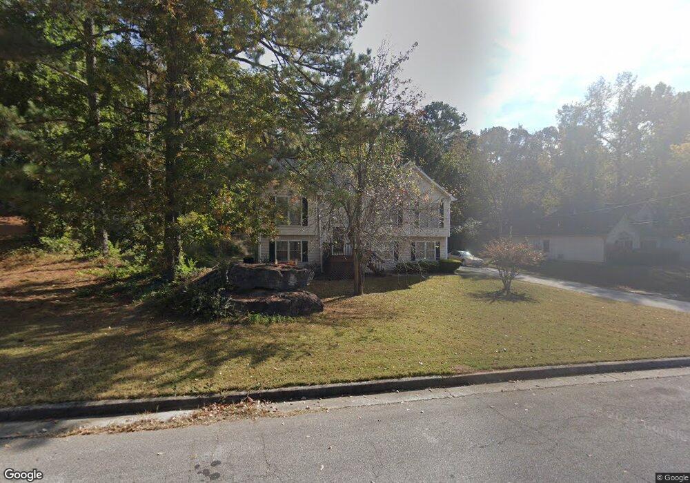
2120 Amherst Trail SE Conyers, GA 30094
Estimated Value: $273,000 - $342,887
3
Beds
3
Baths
1,535
Sq Ft
$209/Sq Ft
Est. Value
About This Home
This home is located at 2120 Amherst Trail SE, Conyers, GA 30094 and is currently estimated at $321,222, approximately $209 per square foot. 2120 Amherst Trail SE is a home located in Rockdale County with nearby schools including Sims Elementary School, Edwards Middle School, and Heritage High School.
Ownership History
Date
Name
Owned For
Owner Type
Purchase Details
Closed on
May 28, 1999
Sold by
Roland Helen P
Bought by
Farley Oris
Current Estimated Value
Home Financials for this Owner
Home Financials are based on the most recent Mortgage that was taken out on this home.
Original Mortgage
$125,836
Interest Rate
7.43%
Mortgage Type
FHA
Create a Home Valuation Report for This Property
The Home Valuation Report is an in-depth analysis detailing your home's value as well as a comparison with similar homes in the area
Home Values in the Area
Average Home Value in this Area
Purchase History
| Date | Buyer | Sale Price | Title Company |
|---|---|---|---|
| Farley Oris | $125,900 | -- |
Source: Public Records
Mortgage History
| Date | Status | Borrower | Loan Amount |
|---|---|---|---|
| Previous Owner | Farley Oris | $125,836 |
Source: Public Records
Tax History Compared to Growth
Tax History
| Year | Tax Paid | Tax Assessment Tax Assessment Total Assessment is a certain percentage of the fair market value that is determined by local assessors to be the total taxable value of land and additions on the property. | Land | Improvement |
|---|---|---|---|---|
| 2024 | $2,736 | $113,000 | $25,960 | $87,040 |
| 2023 | $2,714 | $115,600 | $26,000 | $89,600 |
| 2022 | $2,139 | $93,200 | $20,240 | $72,960 |
| 2021 | $1,907 | $79,480 | $14,960 | $64,520 |
| 2020 | $1,473 | $63,520 | $13,320 | $50,200 |
| 2019 | $1,297 | $56,600 | $10,200 | $46,400 |
| 2018 | $1,253 | $54,920 | $10,200 | $44,720 |
| 2017 | $1,271 | $54,960 | $10,200 | $44,760 |
| 2016 | $790 | $41,680 | $5,880 | $35,800 |
| 2015 | $792 | $41,680 | $5,880 | $35,800 |
| 2014 | $712 | $41,680 | $5,880 | $35,800 |
| 2013 | -- | $47,960 | $11,200 | $36,760 |
Source: Public Records
Map
Nearby Homes
- 660 Kirkus Dr SE
- 340 Windsor Walk SE
- Boston Plan at Millers Pointe
- Atlanta Plan at Millers Pointe
- Columbus Plan at Millers Pointe
- 309 Windsor Walk SE Unit 1
- 2370 Ebenezer Rd SE
- Astrid Plan at Alder Park
- Harrison Plan at Alder Park
- Baker Plan at Alder Park
- Oliver Plan at Alder Park
- 2631 Rolling Hills Way SE
- 2464 Lennox Rd SE
- 2197 Boxwood Cir
- 1598 Cherry Hill Ln SW Unit 5
- 1675 Mccollum Rd SW
- 1593 Cherry Hill Ln SW
- 1415 Almand Creek Dr SW
- 1423 Almand Creek Dr SW
- 1624 Sugarmaple Ln SW
- 2122 Amherst Trail SE
- 2118 Amherst Trail SE
- 2124 Amherst Trail SE
- 2111 Amherst Trail SE
- 2109 Amherst Trail SE
- 2113 Amherst Trail SE Unit 29
- 2113 Amherst Trail SE
- 2126 Amherst Trail SE
- 2116 Amherst Trail SE
- 2115 Amherst Trail SE
- 2114 Amherst Trail SE
- 525 Christa Ln SE
- 2128 Amherst Trail SE
- 2112 Amherst Trail SE
- 2117 Amherst Trail SE Unit 31
- 2117 Amherst Trail SE
- 2107 Amherst Trail SE
- 2107 Amherst Trail SE
- 2110 Amherst Trail SE
- 2130 Amherst Trail SE