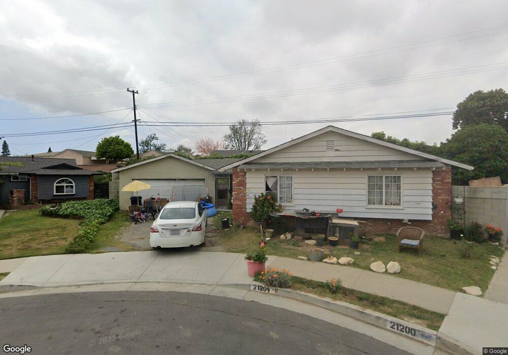
21201 Broadwell Ave Torrance, CA 90502
West Carson NeighborhoodEstimated Value: $775,000 - $863,000
3
Beds
2
Baths
1,148
Sq Ft
$712/Sq Ft
Est. Value
About This Home
This home is located at 21201 Broadwell Ave, Torrance, CA 90502 and is currently estimated at $817,617, approximately $712 per square foot. 21201 Broadwell Ave is a home located in Los Angeles County with nearby schools including Van Deene Avenue Elementary School, Stephen M. White Middle School, and Nathaniel Narbonne Senior High School.
Ownership History
Date
Name
Owned For
Owner Type
Purchase Details
Closed on
Apr 20, 2025
Sold by
Johnson Jill Ann
Bought by
Johnson Family Trust and Johnson
Current Estimated Value
Purchase Details
Closed on
Mar 9, 2024
Sold by
Fagan 2008 Revocable Living Trust and Turman Kathryn Mary
Bought by
Turman Kathryn Mary and Johnson Jill Ann
Purchase Details
Closed on
Aug 20, 2008
Sold by
Fagan Edward J and Fagan Muriel Lee
Bought by
Fagan Edward J
Create a Home Valuation Report for This Property
The Home Valuation Report is an in-depth analysis detailing your home's value as well as a comparison with similar homes in the area
Home Values in the Area
Average Home Value in this Area
Purchase History
| Date | Buyer | Sale Price | Title Company |
|---|---|---|---|
| Johnson Family Trust | -- | None Listed On Document | |
| Fagan Family Trust | -- | None Listed On Document | |
| Turman Kathryn Mary | -- | None Listed On Document | |
| Fagan Edward J | -- | None Available | |
| Fagan Edward J | -- | None Available |
Source: Public Records
Tax History Compared to Growth
Tax History
| Year | Tax Paid | Tax Assessment Tax Assessment Total Assessment is a certain percentage of the fair market value that is determined by local assessors to be the total taxable value of land and additions on the property. | Land | Improvement |
|---|---|---|---|---|
| 2025 | $1,364 | $71,871 | $42,878 | $28,993 |
| 2024 | $1,364 | $70,463 | $42,038 | $28,425 |
| 2023 | $1,342 | $69,082 | $41,214 | $27,868 |
| 2022 | $1,290 | $67,728 | $40,406 | $27,322 |
| 2021 | $1,275 | $66,401 | $39,614 | $26,787 |
| 2019 | $1,238 | $64,434 | $38,440 | $25,994 |
| 2018 | $1,137 | $63,172 | $37,687 | $25,485 |
| 2016 | $1,069 | $60,722 | $36,225 | $24,497 |
| 2015 | $1,046 | $59,811 | $35,681 | $24,130 |
| 2014 | $1,044 | $58,641 | $34,983 | $23,658 |
Source: Public Records
Map
Nearby Homes
- 21141 Berendo Ave
- 22325 Sage Ct
- 22302 Sage Ct
- 22303 Sage Ct
- 1107 W 210th St
- 941 W Carson St Unit 106
- 21125 Normandie Ave
- 20710 Raymond Ave
- 20553 S Vermont Ave Unit 1
- 20553 S Vermont Ave Unit 6
- 20545 S Vermont Ave Unit 2
- 20616 Budlong Ave
- 715 W 220th St Unit 32
- 715 W 220th St Unit 47
- 21602 Figueroa St Unit 10
- 20612 Kenwood Ave
- 1291 Bonnet Way
- 20813 Normandie Ave
- 20518 Raymond Ave
- 1145 Milton St
- 1006 W 212th St
- 21205 Broadwell Ave
- 21200 Broadwell Ave
- 1000 W 212th St
- 1010 W 212th St
- 21204 Broadwell Ave
- 21211 Broadwell Ave
- 21210 Broadwell Ave
- 1016 W 212th St
- 21215 Broadwell Ave
- 21148 Broadwell Ave
- 21222 Broadwell Ave
- 21213 New Hampshire Ave
- 21217 New Hampshire Ave
- 1009 Clarion Dr
- 21207 New Hampshire Ave
- 21219 Broadwell Ave
- 1020 W 212th St
- 21223 New Hampshire Ave
- 21144 Broadwell Ave