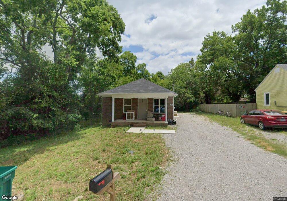
213 Dorris Ave Lewisburg, TN 37091
Estimated Value: $201,669 - $240,000
--
Bed
1
Bath
1,008
Sq Ft
$218/Sq Ft
Est. Value
About This Home
This home is located at 213 Dorris Ave, Lewisburg, TN 37091 and is currently estimated at $219,417, approximately $217 per square foot. 213 Dorris Ave is a home located in Marshall County with nearby schools including Marshall Elementary School, Oak Grove Elementary School, and Westhills Elementary School.
Ownership History
Date
Name
Owned For
Owner Type
Purchase Details
Closed on
Mar 5, 2020
Sold by
Wilson James and Corbin John
Bought by
Tankersley Edward B and Tankersley Lynn W
Current Estimated Value
Purchase Details
Closed on
Nov 14, 2018
Sold by
Angell Johnnie George
Bought by
Wilson James and Corbin John
Purchase Details
Closed on
Jan 12, 2000
Sold by
Wells Ray N
Bought by
Johnnie Angell
Create a Home Valuation Report for This Property
The Home Valuation Report is an in-depth analysis detailing your home's value as well as a comparison with similar homes in the area
Home Values in the Area
Average Home Value in this Area
Purchase History
| Date | Buyer | Sale Price | Title Company |
|---|---|---|---|
| Tankersley Edward B | $12,500 | None Available | |
| Wilson James | $19,501 | -- | |
| Johnnie Angell | $38,900 | -- |
Source: Public Records
Tax History Compared to Growth
Tax History
| Year | Tax Paid | Tax Assessment Tax Assessment Total Assessment is a certain percentage of the fair market value that is determined by local assessors to be the total taxable value of land and additions on the property. | Land | Improvement |
|---|---|---|---|---|
| 2024 | -- | $37,475 | $2,500 | $34,975 |
| 2023 | $1,164 | $37,475 | $2,500 | $34,975 |
| 2022 | $1,164 | $37,475 | $2,500 | $34,975 |
| 2021 | $655 | $14,100 | $1,500 | $12,600 |
| 2020 | $419 | $9,000 | $1,500 | $7,500 |
| 2019 | $405 | $9,000 | $1,500 | $7,500 |
| 2018 | $401 | $9,000 | $1,500 | $7,500 |
| 2017 | $401 | $9,000 | $1,500 | $7,500 |
| 2016 | $398 | $7,775 | $1,750 | $6,025 |
| 2015 | $363 | $7,775 | $1,750 | $6,025 |
| 2014 | $363 | $7,775 | $1,750 | $6,025 |
Source: Public Records
Map
Nearby Homes
- 610 Forrest St
- 525 Maple St
- 518 Maple St
- 215 5th Ave N
- 632 Colburn Dr
- 640 6th Ave S
- 726 Thomas Ave
- 0 New Lake Rd Unit RTC3030964
- 316 Haynes St
- 966 Berry St
- 117 W End Ave N
- 251 Joyce Ave
- 1221 W Commerce St
- 108 W End Ave N
- 240 Joyce Ave
- 1111 W End Ave N
- 0 Joyce Ave
- 416 1st Ave N
- 347 Oakwood Dr
- 718 Midway St