Estimated Value: $188,000 - $193,040
2
Beds
1
Bath
934
Sq Ft
$204/Sq Ft
Est. Value
About This Home
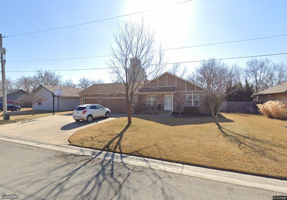
This home is located at 213 N Queen St, Maize, KS 67101 and is currently estimated at $190,520, approximately $203 per square foot. 213 N Queen St is a home located in Sedgwick County with nearby schools including Vermillion Elementary School, Pray-Woodman Elementary, and Maize Elementary School.
Ownership History
Date
Name
Owned For
Owner Type
Purchase Details
Closed on
Jan 16, 2023
Sold by
Gast Michael S and Gast Dana L
Bought by
Michael S Gast And Dana L Gast Living Trust and Gast
Current Estimated Value
Purchase Details
Closed on
Oct 8, 2010
Sold by
Gast Michael S and Gast Dana L
Bought by
Gast Michael S and Gast Dana L
Home Financials for this Owner
Home Financials are based on the most recent Mortgage that was taken out on this home.
Original Mortgage
$80,965
Interest Rate
4.39%
Mortgage Type
New Conventional
Purchase Details
Closed on
Jul 13, 2009
Sold by
Gast Michael S and Gast Dana L
Bought by
Gast Michael S
Create a Home Valuation Report for This Property
The Home Valuation Report is an in-depth analysis detailing your home's value as well as a comparison with similar homes in the area
Home Values in the Area
Average Home Value in this Area
Purchase History
| Date | Buyer | Sale Price | Title Company |
|---|---|---|---|
| Michael S Gast And Dana L Gast Living Trust | -- | None Listed On Document | |
| Gast Michael S | -- | Security 1St Title | |
| Gast Michael S | -- | None Available |
Source: Public Records
Mortgage History
| Date | Status | Borrower | Loan Amount |
|---|---|---|---|
| Previous Owner | Gast Michael S | $80,965 |
Source: Public Records
Tax History Compared to Growth
Tax History
| Year | Tax Paid | Tax Assessment Tax Assessment Total Assessment is a certain percentage of the fair market value that is determined by local assessors to be the total taxable value of land and additions on the property. | Land | Improvement |
|---|---|---|---|---|
| 2025 | $2,548 | $19,332 | $5,325 | $14,007 |
| 2024 | $2,548 | $17,733 | $2,438 | $15,295 |
| 2023 | $2,548 | $15,939 | $2,438 | $13,501 |
| 2022 | $2,223 | $14,893 | $2,300 | $12,593 |
| 2021 | $2,147 | $14,180 | $2,300 | $11,880 |
| 2020 | $2,000 | $13,248 | $2,300 | $10,948 |
| 2019 | $1,936 | $12,857 | $2,300 | $10,557 |
| 2018 | $1,831 | $12,133 | $1,691 | $10,442 |
| 2017 | $1,840 | $0 | $0 | $0 |
| 2016 | $1,765 | $0 | $0 | $0 |
| 2015 | $1,685 | $0 | $0 | $0 |
| 2014 | $1,668 | $0 | $0 | $0 |
Source: Public Records
Map
Nearby Homes
- 113 N Queen St
- 10730 W 53rd St N
- 300 W Albert St Unit 29R
- 300 W Albert St Unit 9
- 300 W Albert St Unit 13
- 319 Jonathan St
- 5463 Brisk Bay Ct
- 5465 Brisk Bay Ct
- 5561 Wandering Way
- 5591 Wandering Way
- 5603 Wandering Way
- 5563 Wandering Way
- 5468 N Briskbay Ct
- 5558 Wandering Way
- 5479 Brisk Bay St
- 5416 N Briskbay Ct
- 5414 N Briskbay Ct
- 403 S Sweetwater Rd
- 5410 N Briskbay Ct
- 5408 N Briskbay Ct
- 209 N Queen St
- 212 N Queen St
- 208 N Queen St
- 221 N Queen St
- 204 N Queen St
- 216 N Queen St
- 309 Harvest Ln
- 225 N Queen St
- 313 Harvest Ln
- 205 N Heather Ln
- 305 N Heather Ln
- 209 N Heather Ln
- 109 N Queen St
- 113 N King St
- 309 N Heather Ln
- 229 N Queen St
- 317 N Heather Ln
- 308 Harvest Ln
- 304 Harvest Ln
- 315 N Heather Ln