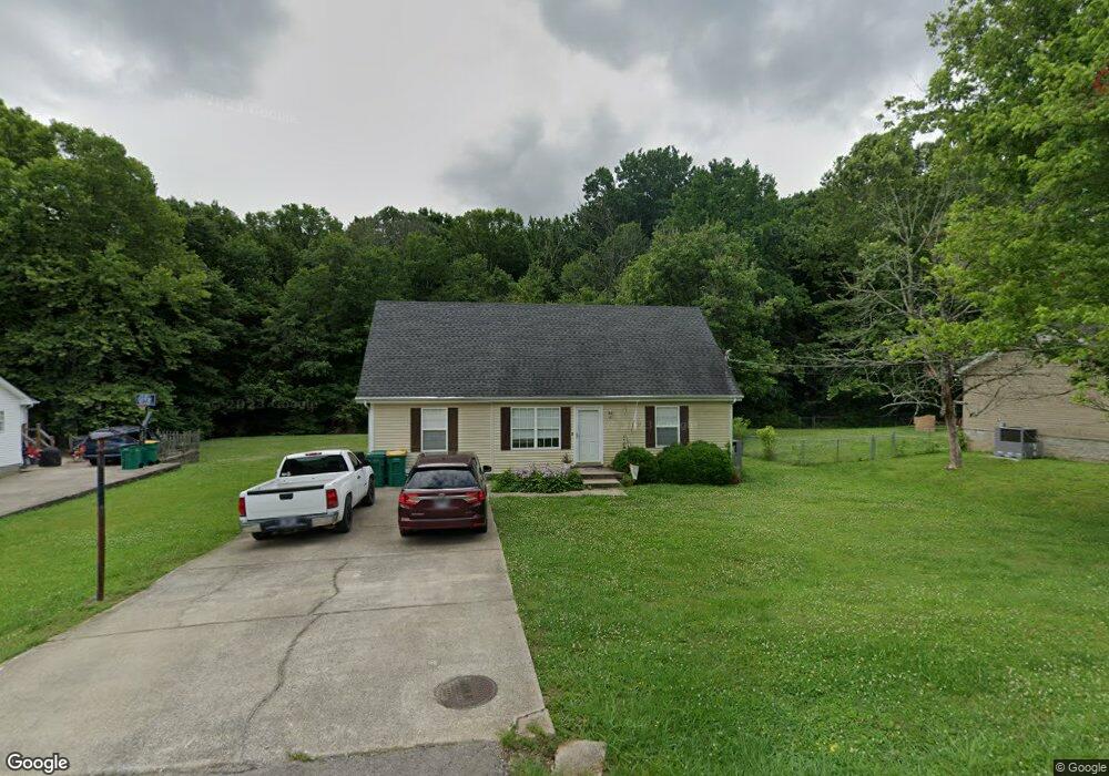
2131 Phillips St Lewisburg, TN 37091
Estimated Value: $231,000 - $278,000
--
Bed
3
Baths
1,462
Sq Ft
$178/Sq Ft
Est. Value
About This Home
This home is located at 2131 Phillips St, Lewisburg, TN 37091 and is currently estimated at $259,752, approximately $177 per square foot. 2131 Phillips St is a home located in Marshall County with nearby schools including Marshall Elementary School, Oak Grove Elementary School, and Westhills Elementary School.
Ownership History
Date
Name
Owned For
Owner Type
Purchase Details
Closed on
Oct 2, 2019
Sold by
Adams David L
Bought by
Adams J Ryan L and Adams Amanda J
Current Estimated Value
Purchase Details
Closed on
Jun 10, 2011
Sold by
Huey Bob
Bought by
Adams David L
Home Financials for this Owner
Home Financials are based on the most recent Mortgage that was taken out on this home.
Original Mortgage
$41,152
Interest Rate
4.65%
Mortgage Type
Commercial
Purchase Details
Closed on
May 24, 2011
Bought by
Jent Huey Rob Jason
Home Financials for this Owner
Home Financials are based on the most recent Mortgage that was taken out on this home.
Original Mortgage
$41,152
Interest Rate
4.65%
Mortgage Type
Commercial
Purchase Details
Closed on
May 13, 2011
Sold by
Federal National Mortgage Association
Bought by
Huey Bob and Jent Jason
Home Financials for this Owner
Home Financials are based on the most recent Mortgage that was taken out on this home.
Original Mortgage
$41,152
Interest Rate
4.65%
Mortgage Type
Commercial
Purchase Details
Closed on
Aug 10, 2010
Sold by
Cummings Jennifer
Bought by
Federal National Mortgage Association
Purchase Details
Closed on
Oct 25, 2007
Sold by
Timothy Richardson and Timothy Krist
Bought by
Bobby Cummings and Bobby Jennifer
Home Financials for this Owner
Home Financials are based on the most recent Mortgage that was taken out on this home.
Original Mortgage
$85,278
Interest Rate
6.37%
Purchase Details
Closed on
Apr 16, 2007
Sold by
U S Dept Of Housing & Urba
Bought by
Timothy Richardson and Timothy Kristi
Purchase Details
Closed on
Aug 26, 2005
Sold by
Bryan William D
Bought by
Hud
Purchase Details
Closed on
Apr 2, 2002
Sold by
Harmon Thomas R and Harmon Patricia
Bought by
Bryant William D and Bryant Melissa
Purchase Details
Closed on
Mar 28, 2002
Bought by
Bryand William D
Purchase Details
Closed on
May 31, 1990
Bought by
Harmon Thomas R and Harmon Patricia A
Purchase Details
Closed on
Jan 31, 1990
Bought by
First Tennessee Mortgage
Purchase Details
Closed on
Sep 5, 1989
Bought by
Raynor Linda C
Create a Home Valuation Report for This Property
The Home Valuation Report is an in-depth analysis detailing your home's value as well as a comparison with similar homes in the area
Home Values in the Area
Average Home Value in this Area
Purchase History
| Date | Buyer | Sale Price | Title Company |
|---|---|---|---|
| Adams J Ryan L | -- | -- | |
| Adams David L | $49,725 | -- | |
| Jent Huey Rob Jason | $45,200 | -- | |
| Huey Bob | $45,150 | -- | |
| Federal National Mortgage Association | $73,369 | -- | |
| Bobby Cummings | $85,278 | -- | |
| Timothy Richardson | $55,000 | -- | |
| Hud | -- | -- | |
| Bryant William D | $83,000 | -- | |
| Bryand William D | $83,000 | -- | |
| Harmon Thomas R | $49,000 | -- | |
| First Tennessee Mortgage | $51,000 | -- | |
| Raynor Linda C | $47,000 | -- |
Source: Public Records
Mortgage History
| Date | Status | Borrower | Loan Amount |
|---|---|---|---|
| Previous Owner | Adams David L | $41,152 | |
| Previous Owner | Raynor Linda C | $85,278 |
Source: Public Records
Tax History Compared to Growth
Tax History
| Year | Tax Paid | Tax Assessment Tax Assessment Total Assessment is a certain percentage of the fair market value that is determined by local assessors to be the total taxable value of land and additions on the property. | Land | Improvement |
|---|---|---|---|---|
| 2024 | -- | $39,675 | $8,750 | $30,925 |
| 2023 | $1,232 | $39,675 | $8,750 | $30,925 |
| 2022 | $1,232 | $39,675 | $8,750 | $30,925 |
| 2021 | $1,027 | $22,075 | $5,000 | $17,075 |
| 2020 | $1,027 | $22,075 | $5,000 | $17,075 |
| 2019 | $994 | $22,075 | $5,000 | $17,075 |
| 2018 | $983 | $22,075 | $5,000 | $17,075 |
| 2017 | $983 | $22,075 | $5,000 | $17,075 |
| 2016 | $930 | $18,175 | $3,000 | $15,175 |
| 2015 | $849 | $18,175 | $3,000 | $15,175 |
| 2014 | $849 | $18,175 | $3,000 | $15,175 |
Source: Public Records
Map
Nearby Homes
- 2095 Phillips St
- 2090 Wild Cherry Dr
- 2085 Wild Cherry Dr
- 2080 Wild Cherry Dr
- 127 Crestview Dr
- 0 Crestview Dr
- 475 Skyline Dr
- 161 Crestview Dr
- 0 W Ellington Pkwy
- 141 Crestview Dr
- 486 David Ave
- 541 Skyline Dr S
- 530 David Ave
- 425 Centennial Ave
- 2330 Old Mooresville Pike
- 750 Lakehill Cir
- 575 Joyce Cir
- 238 Hopkins Ave
- 1371 W Commerce St
- 347 Oakwood Dr
- 2135 Phillips St
- 2121 Phillips St
- 2111 Phillips St
- 2136 Phillips St
- 2130 Phillips St
- 2120 Phillips St
- 2101 Phillips St
- 2110 Phillips St
- 2100 Phillips St
- 2085 Phillips St
- 2080 Sugar Tree Dr
- 2079 Phillips St
- 2082 Phillips St
- 2076 Sugar Tree Dr
- 2073 Phillips St
- 2074 Phillips St
- 2062 Sugar Tree Dr
- 2067 Sugar Tree Dr
- 2067 Phillips St
- 2068 Phillips St