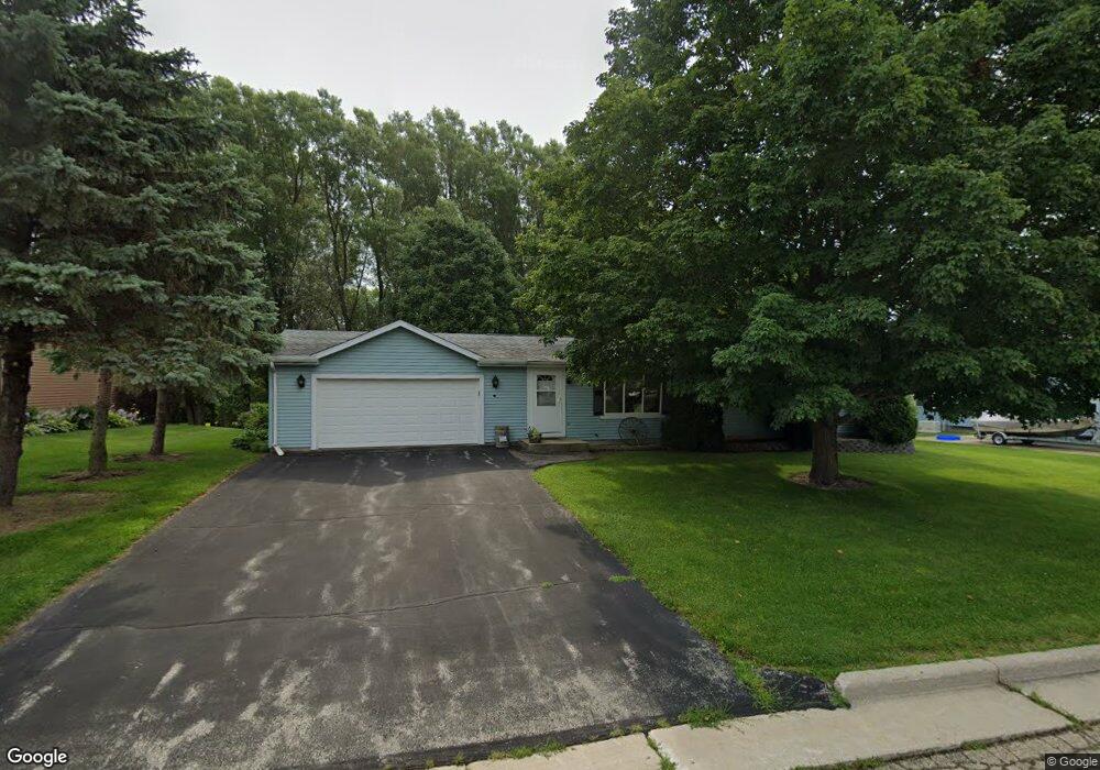
214 Michael Dr Iron Ridge, WI 53035
Estimated Value: $252,000 - $318,000
3
Beds
2
Baths
1,104
Sq Ft
$263/Sq Ft
Est. Value
About This Home
This home is located at 214 Michael Dr, Iron Ridge, WI 53035 and is currently estimated at $290,232, approximately $262 per square foot. 214 Michael Dr is a home located in Dodge County with nearby schools including Horicon Elementary School, Horicon High School, and St. Matthew Lutheran School.
Ownership History
Date
Name
Owned For
Owner Type
Purchase Details
Closed on
Sep 22, 2010
Sold by
Schoening Donald R and Schoening Shirley M
Bought by
Zimmerman Suzanne L
Current Estimated Value
Home Financials for this Owner
Home Financials are based on the most recent Mortgage that was taken out on this home.
Original Mortgage
$85,000
Outstanding Balance
$55,900
Interest Rate
4.36%
Mortgage Type
New Conventional
Estimated Equity
$234,332
Create a Home Valuation Report for This Property
The Home Valuation Report is an in-depth analysis detailing your home's value as well as a comparison with similar homes in the area
Home Values in the Area
Average Home Value in this Area
Purchase History
| Date | Buyer | Sale Price | Title Company |
|---|---|---|---|
| Zimmerman Suzanne L | $125,000 | -- |
Source: Public Records
Mortgage History
| Date | Status | Borrower | Loan Amount |
|---|---|---|---|
| Open | Zimmerman Suzanne L | $85,000 |
Source: Public Records
Tax History Compared to Growth
Tax History
| Year | Tax Paid | Tax Assessment Tax Assessment Total Assessment is a certain percentage of the fair market value that is determined by local assessors to be the total taxable value of land and additions on the property. | Land | Improvement |
|---|---|---|---|---|
| 2024 | $2,695 | $145,500 | $34,000 | $111,500 |
| 2023 | $2,631 | $145,500 | $34,000 | $111,500 |
| 2022 | $2,602 | $145,500 | $34,000 | $111,500 |
| 2021 | $2,513 | $145,500 | $34,000 | $111,500 |
| 2020 | $2,746 | $145,500 | $34,000 | $111,500 |
| 2019 | $2,580 | $145,500 | $34,000 | $111,500 |
| 2018 | $2,614 | $145,500 | $34,000 | $111,500 |
| 2017 | $2,484 | $145,500 | $34,000 | $111,500 |
| 2016 | $2,442 | $145,500 | $34,000 | $111,500 |
| 2015 | $2,428 | $145,500 | $34,000 | $111,500 |
| 2014 | $2,754 | $145,500 | $34,000 | $111,500 |
Source: Public Records
Map
Nearby Homes
- 0 Burkwald Ave
- 202 East Ave
- 234 Watertower Cir
- Lt0 E Neda Rd
- N5413 County Rd S
- N6436 County Road Tw
- N4973 Lake Dr
- N4690 Lake Dr
- N4569 Hazelwood Rd
- N4510 Anthony Island -
- N4510 & N4504 Anthony Island
- Lt38 Sinissippi Point Rd
- .68 Acre Parcel Anthony Island
- W4069 Raasch Hill Rd
- 244 S Ridge St
- 727 E Lakeview Rd Unit 8
- W4436 E Lakeview Rd
- 827 E Lakeview Rd
- Lt1 W Horseshoe Rd
- 252 S Hustis St
- 216 Michael Dr
- 212 Michael Dr
- 207 Michael Dr
- 209 Michael Dr
- 210 Michael Dr
- 205 Michael Dr
- 218 Michael Dr
- 211 Michael Dr
- 112 Westgate Dr
- 202 Michael Dr
- 114 Westgate Dr
- 110 Westgate Dr
- 220 Michael Dr
- 116 Westgate Dr
- 200 Michael Dr
- 222 Michael Dr
- 206 Michael Dr Unit B
- 206 Michael Dr Unit A
- 118 Westgate Dr
- 115 Westgate Dr