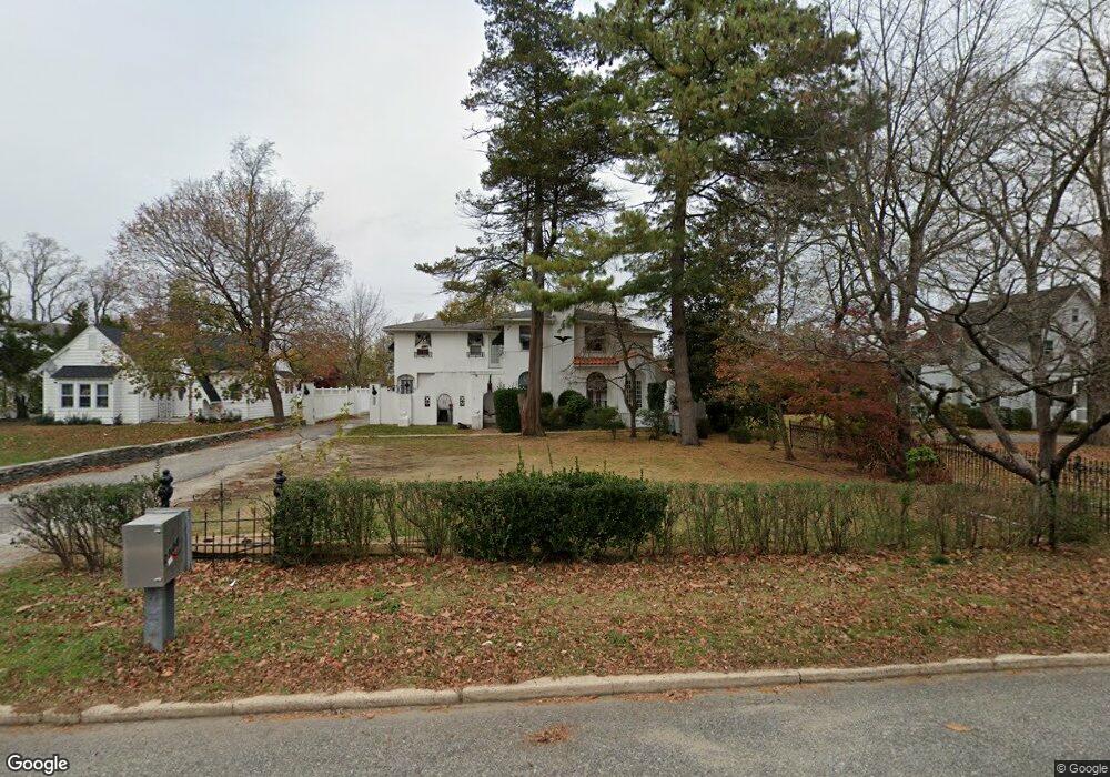
2144 E Landis Ave Vineland, NJ 08361
Estimated Value: $332,251 - $387,000
--
Bed
--
Bath
2,847
Sq Ft
$129/Sq Ft
Est. Value
About This Home
This home is located at 2144 E Landis Ave, Vineland, NJ 08361 and is currently estimated at $368,063, approximately $129 per square foot. 2144 E Landis Ave is a home located in Cumberland County with nearby schools including Pauline J. Petway Elementary School, Johnstone School, and Veterans Memorial Intermediate School.
Ownership History
Date
Name
Owned For
Owner Type
Purchase Details
Closed on
Aug 3, 2005
Sold by
Reyes Wilfredo
Bought by
Larriu Robert
Current Estimated Value
Purchase Details
Closed on
Oct 15, 2001
Sold by
Beneficial Mtg Co
Bought by
Reyes Wilfredo
Home Financials for this Owner
Home Financials are based on the most recent Mortgage that was taken out on this home.
Original Mortgage
$73,500
Interest Rate
6.92%
Create a Home Valuation Report for This Property
The Home Valuation Report is an in-depth analysis detailing your home's value as well as a comparison with similar homes in the area
Home Values in the Area
Average Home Value in this Area
Purchase History
| Date | Buyer | Sale Price | Title Company |
|---|---|---|---|
| Larriu Robert | -- | -- | |
| Reyes Wilfredo | $83,500 | -- |
Source: Public Records
Mortgage History
| Date | Status | Borrower | Loan Amount |
|---|---|---|---|
| Previous Owner | Reyes Wilfredo | $73,500 |
Source: Public Records
Tax History Compared to Growth
Tax History
| Year | Tax Paid | Tax Assessment Tax Assessment Total Assessment is a certain percentage of the fair market value that is determined by local assessors to be the total taxable value of land and additions on the property. | Land | Improvement |
|---|---|---|---|---|
| 2025 | $5,843 | $183,500 | $26,400 | $157,100 |
| 2024 | $5,843 | $183,500 | $26,400 | $157,100 |
| 2023 | $5,804 | $183,500 | $26,400 | $157,100 |
| 2022 | $5,632 | $183,500 | $26,400 | $157,100 |
| 2021 | $5,529 | $183,500 | $26,400 | $157,100 |
| 2020 | $5,371 | $183,500 | $26,400 | $157,100 |
| 2019 | $5,298 | $183,500 | $26,400 | $157,100 |
| 2018 | $5,158 | $183,500 | $26,400 | $157,100 |
| 2017 | $4,899 | $183,500 | $26,400 | $157,100 |
| 2016 | $4,727 | $183,500 | $26,400 | $157,100 |
| 2015 | $4,553 | $183,500 | $26,400 | $157,100 |
| 2014 | $4,305 | $183,500 | $26,400 | $157,100 |
Source: Public Records
Map
Nearby Homes
- 101 Oaklawn Terrace
- 211 Oaklawn Terrace
- 208 Oaklawn Terrace
- 2227 E Landis Ave
- 307 N Spring Rd
- 135 S Spring Rd
- 2201 Ida Ln
- 29 N Brewster Rd
- 208 S Brewster Rd
- 667 Alps Place
- 191 Redcrest St
- 2139 E Chestnut Ave Unit 27
- 1173 New Pear St
- 254 Lawrence St
- 866 Chapel Dr
- 664 Brentwood Dr
- 733 Sharon Ct
- 1825 Washington Ave
- 746 Sharon Ct
- 763 Sharon Ct
- 2130 E Landis Ave
- 2164 E Landis Ave
- 49 Oaklawn Terrace
- 44 Jay Terrace
- 2114 E Landis Ave
- 2114 E Landis Ave Unit 10
- 2114 E Landis Ave Unit 9
- 2114 E Landis Ave Unit 8
- 2114 E Landis Ave Unit 11
- 2114 E Landis Ave Unit 6
- 2114 E Landis Ave Unit 3
- 2114 E Landis Ave Unit 4B
- 63 Oaklawn Terrace
- 60 Jay Terrace Unit . D
- 60 Jay Terrace
- 50 Oaklawn Terrace
- 2135 E Landis Ave
- 2198 E Landis Ave Unit LOWER UNIT
- 2198 E Landis Ave Unit UPPER LEVEL
- 76 Jay Terrace