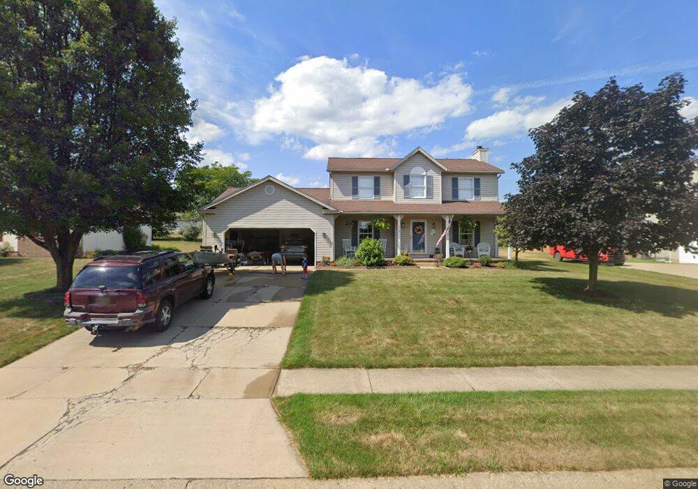
215 Buffalo Ridge St Louisville, OH 44641
Estimated Value: $285,000 - $302,000
3
Beds
3
Baths
1,792
Sq Ft
$162/Sq Ft
Est. Value
About This Home
This home is located at 215 Buffalo Ridge St, Louisville, OH 44641 and is currently estimated at $290,042, approximately $161 per square foot. 215 Buffalo Ridge St is a home located in Stark County with nearby schools including Louisville High School and St. Thomas Aquinas High School & Middle School.
Ownership History
Date
Name
Owned For
Owner Type
Purchase Details
Closed on
Jul 29, 1998
Sold by
Carney Jeffrey P and Carney Jill A
Bought by
Aquino Christopher and Aquino Andrea L
Current Estimated Value
Home Financials for this Owner
Home Financials are based on the most recent Mortgage that was taken out on this home.
Original Mortgage
$110,800
Outstanding Balance
$23,035
Interest Rate
6.88%
Mortgage Type
Purchase Money Mortgage
Estimated Equity
$267,007
Purchase Details
Closed on
Jun 14, 1995
Sold by
Colonial Homes Inc
Bought by
Carney Jeffrey P and Carney Jill
Home Financials for this Owner
Home Financials are based on the most recent Mortgage that was taken out on this home.
Original Mortgage
$93,900
Interest Rate
8%
Mortgage Type
New Conventional
Purchase Details
Closed on
Aug 26, 1994
Sold by
Buffalo Ridge Allotment
Bought by
Colonial Homes Inc
Create a Home Valuation Report for This Property
The Home Valuation Report is an in-depth analysis detailing your home's value as well as a comparison with similar homes in the area
Home Values in the Area
Average Home Value in this Area
Purchase History
| Date | Buyer | Sale Price | Title Company |
|---|---|---|---|
| Aquino Christopher | $138,600 | -- | |
| Carney Jeffrey P | $123,900 | -- | |
| Colonial Homes Inc | $55,500 | -- |
Source: Public Records
Mortgage History
| Date | Status | Borrower | Loan Amount |
|---|---|---|---|
| Open | Aquino Christopher | $110,800 | |
| Closed | Carney Jeffrey P | $93,900 |
Source: Public Records
Tax History Compared to Growth
Tax History
| Year | Tax Paid | Tax Assessment Tax Assessment Total Assessment is a certain percentage of the fair market value that is determined by local assessors to be the total taxable value of land and additions on the property. | Land | Improvement |
|---|---|---|---|---|
| 2025 | -- | $87,540 | $17,360 | $70,180 |
| 2024 | -- | $87,540 | $17,360 | $70,180 |
| 2023 | $2,553 | $59,400 | $17,220 | $42,180 |
| 2022 | $2,558 | $59,400 | $17,220 | $42,180 |
| 2021 | $2,566 | $59,400 | $17,220 | $42,180 |
| 2020 | $2,134 | $53,660 | $15,510 | $38,150 |
| 2019 | $2,143 | $51,600 | $15,510 | $36,090 |
| 2018 | $2,053 | $51,600 | $15,510 | $36,090 |
| 2017 | $1,936 | $46,940 | $12,670 | $34,270 |
| 2016 | $1,975 | $46,940 | $12,670 | $34,270 |
| 2015 | $1,981 | $46,940 | $12,670 | $34,270 |
| 2014 | $1,839 | $40,500 | $10,920 | $29,580 |
| 2013 | $923 | $40,500 | $10,920 | $29,580 |
Source: Public Records
Map
Nearby Homes
- 1702 View Pointe Ave
- 1639 Horizon Dr
- 908 Sand Lot Cir
- 8225 Georgetown St
- 510 S Bauman Ct
- 6969 Georgetown St NE
- 204 E Broad St
- 728 E Broad St
- 520 S Silver St
- 107 E Broad St
- 641 S Nickelplate St
- 2425 Miday Ave NE
- 308 Superior St
- 1715 High St
- 2110 Edmar St
- 3390 Meese Rd NE
- 1812 E Broad St
- 325 Lincoln Ave
- 201 Indiana Ave
- 4060 Hambleton Ave NE
- 205 Buffalo Ridge St
- 305 Buffalo Ridge St
- 214 Shawnee Cir
- 115 Buffalo Ridge St
- 204 Shawnee Cir
- 304 Shawnee Cir
- 315 Buffalo Ridge St
- 214 Buffalo Ridge St
- 204 Buffalo Ridge St
- 304 Buffalo Ridge St
- 114 Shawnee Cir
- 314 Shawnee Cir
- 405 Buffalo Ridge St
- 105 Buffalo Ridge St
- 114 Buffalo Ridge St
- 314 Buffalo Ridge St
- 404 Shawnee Cir
- 104 Shawnee Cir
- 104 Buffalo Ridge St
- 404 Buffalo Ridge St