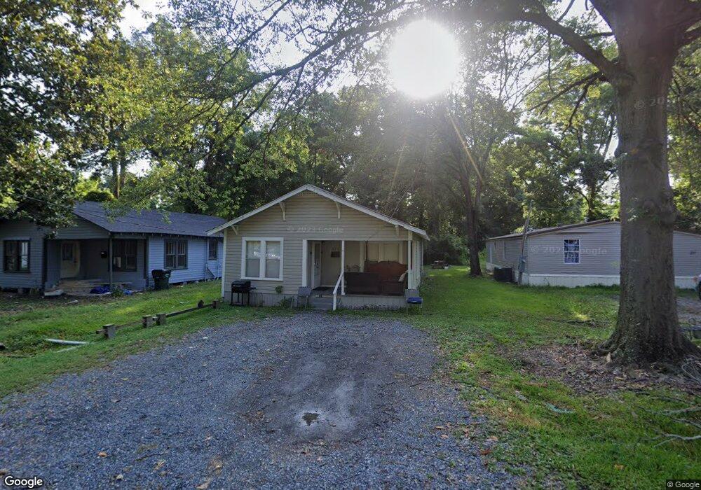
215 Hoover St West Monroe, LA 71292
Estimated Value: $57,014 - $287,000
--
Bed
--
Bath
--
Sq Ft
6,708
Sq Ft Lot
About This Home
This home is located at 215 Hoover St, West Monroe, LA 71292 and is currently estimated at $121,254. 215 Hoover St is a home located in Ouachita Parish with nearby schools including Riverbend Elementary School, Riser Middle School, and West Monroe High School.
Ownership History
Date
Name
Owned For
Owner Type
Purchase Details
Closed on
May 12, 2022
Sold by
Wesley Gibson John and Wesley Jessica
Bought by
Jordan Cindy L
Current Estimated Value
Purchase Details
Closed on
Oct 18, 2014
Sold by
Self Jimmy and Self Margaret Marie
Bought by
Bernelle Dale Emile
Purchase Details
Closed on
Aug 21, 2006
Sold by
Rispoli Conrad J
Bought by
Self Jimmy and Self Margaret Marie
Home Financials for this Owner
Home Financials are based on the most recent Mortgage that was taken out on this home.
Original Mortgage
$33,450
Interest Rate
6.79%
Mortgage Type
Unknown
Create a Home Valuation Report for This Property
The Home Valuation Report is an in-depth analysis detailing your home's value as well as a comparison with similar homes in the area
Home Values in the Area
Average Home Value in this Area
Purchase History
| Date | Buyer | Sale Price | Title Company |
|---|---|---|---|
| Jordan Cindy L | $17,000 | None Listed On Document | |
| Bernelle Dale Emile | $30,000 | None Available | |
| Self Jimmy | $29,000 | None Available |
Source: Public Records
Mortgage History
| Date | Status | Borrower | Loan Amount |
|---|---|---|---|
| Previous Owner | Self Jimmy | $33,450 |
Source: Public Records
Tax History Compared to Growth
Tax History
| Year | Tax Paid | Tax Assessment Tax Assessment Total Assessment is a certain percentage of the fair market value that is determined by local assessors to be the total taxable value of land and additions on the property. | Land | Improvement |
|---|---|---|---|---|
| 2024 | $247 | $2,900 | $464 | $2,436 |
| 2023 | $247 | $2,900 | $464 | $2,436 |
| 2022 | $237 | $2,900 | $464 | $2,436 |
| 2021 | $237 | $2,900 | $464 | $2,436 |
| 2020 | $237 | $2,900 | $464 | $2,436 |
| 2019 | $233 | $2,900 | $464 | $2,436 |
| 2018 | $233 | $2,900 | $464 | $2,436 |
| 2017 | $233 | $2,900 | $464 | $2,436 |
| 2016 | $232 | $2,900 | $464 | $2,436 |
| 2015 | $231 | $2,900 | $464 | $2,436 |
| 2014 | $25 | $2,900 | $464 | $2,436 |
| 2013 | $25 | $2,900 | $464 | $2,436 |
Source: Public Records
Map
Nearby Homes
- 217 Hoover St
- 201 Wheelis St
- 204 Heard St
- 205 N 8th St
- 00 Cherry St
- 127 and 134 Nora St
- 809 Pine St
- 114 Horne St
- 525 Thomas Rd
- 0 and 706 N 4th St Unit Stella Street
- 403 Drew Ave Unit 405,407,409,411
- 705 Rowan St
- 0 Basic Dr
- 0 Basic Dr
- 1206 N 4th St
- 1206 N 4th St Unit Cherry Street
- 121 Hemlock Cir
- 321 Smith St
- 304 Medorah Dr
- 610 S 3rd St
- 213 Hoover St
- 211 Hoover St
- 209 Hoover St
- 924 Montgomery Ave
- 922 Montgomery Ave
- 218 Hoover St
- 212 Hoover St
- 918 Montgomery Ave
- 920 Montgomery Ave
- 1000 Montgomery Ave
- 215 Jonesboro Rd
- 914 Montgomery Ave
- 221 Crawford St
- 916 Montgomery Ave
- 925 Montgomery Ave
- 921 Montgomery Ave
- 923 Montgomery Ave
- 217 Crawford St
- 105 Boyd St
- 203 Jonesboro Rd