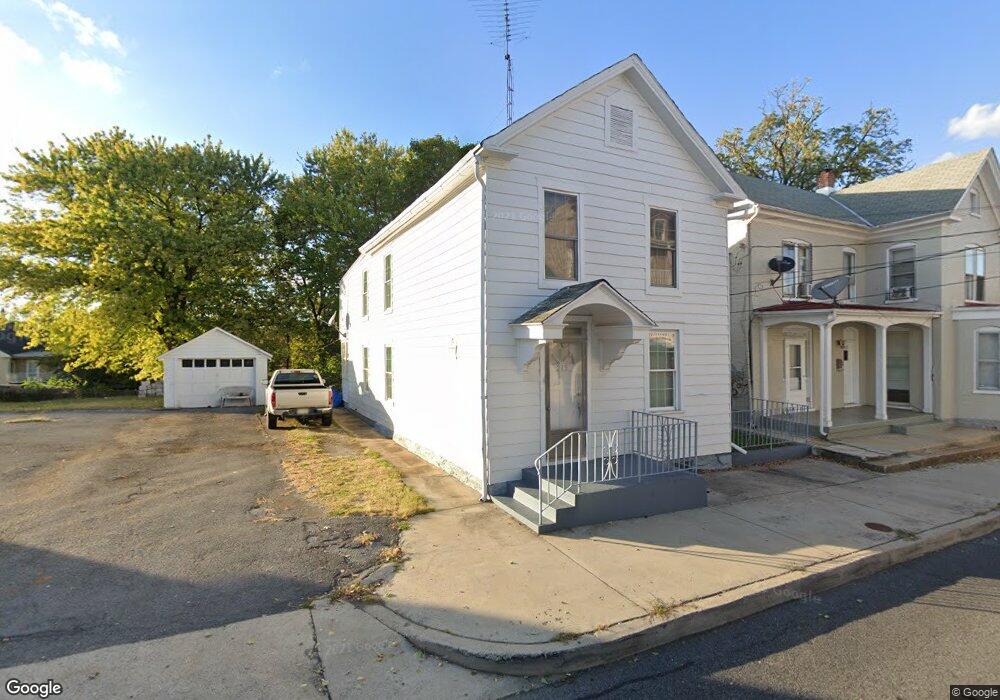
215 N Cannon Ave Hagerstown, MD 21740
Central NeighborhoodEstimated Value: $151,763 - $234,000
--
Bed
1
Bath
1,484
Sq Ft
$123/Sq Ft
Est. Value
About This Home
This home is located at 215 N Cannon Ave, Hagerstown, MD 21740 and is currently estimated at $182,441, approximately $122 per square foot. 215 N Cannon Ave is a home located in Washington County with nearby schools including Pangborn Elementary School, Otsego West Campus High School, and Northern Middle School.
Ownership History
Date
Name
Owned For
Owner Type
Purchase Details
Closed on
May 24, 2023
Sold by
Plotner Ricki
Bought by
Plotner Ricki
Current Estimated Value
Purchase Details
Closed on
Sep 22, 1995
Sold by
Fouke M B
Bought by
Plotner Ii Robert E
Home Financials for this Owner
Home Financials are based on the most recent Mortgage that was taken out on this home.
Original Mortgage
$63,650
Interest Rate
7.81%
Create a Home Valuation Report for This Property
The Home Valuation Report is an in-depth analysis detailing your home's value as well as a comparison with similar homes in the area
Home Values in the Area
Average Home Value in this Area
Purchase History
| Date | Buyer | Sale Price | Title Company |
|---|---|---|---|
| Plotner Ricki | -- | None Listed On Document | |
| Plotner Ricki | -- | None Listed On Document | |
| Plotner Ii Robert E | $65,000 | -- |
Source: Public Records
Mortgage History
| Date | Status | Borrower | Loan Amount |
|---|---|---|---|
| Previous Owner | Plotner Ii Robert E | $63,650 |
Source: Public Records
Tax History Compared to Growth
Tax History
| Year | Tax Paid | Tax Assessment Tax Assessment Total Assessment is a certain percentage of the fair market value that is determined by local assessors to be the total taxable value of land and additions on the property. | Land | Improvement |
|---|---|---|---|---|
| 2025 | $1,073 | $133,600 | $20,000 | $113,600 |
| 2024 | $1,073 | $117,833 | $0 | $0 |
| 2023 | $930 | $102,067 | $0 | $0 |
| 2022 | $786 | $86,300 | $20,000 | $66,300 |
| 2021 | $739 | $82,833 | $0 | $0 |
| 2020 | $739 | $79,367 | $0 | $0 |
| 2019 | $710 | $75,900 | $20,000 | $55,900 |
| 2018 | $710 | $75,900 | $20,000 | $55,900 |
| 2017 | $710 | $75,900 | $0 | $0 |
| 2016 | -- | $81,400 | $0 | $0 |
| 2015 | -- | $81,400 | $0 | $0 |
| 2014 | $2,031 | $81,400 | $0 | $0 |
Source: Public Records
Map
Nearby Homes
- 136 N Cannon Ave
- 207 N Mulberry St
- 338 Liberty St
- 142 East Ave
- 312 E Franklin St
- 351 Liberty St
- 200 E Franklin St
- 133 Randolph Ave
- 115 East Ave
- 51 N Cannon Ave
- 414 E Franklin St
- 227 N Locust St
- 308 N Locust St
- 228 E Washington St
- 243 N Locust St
- 440 Liberty St
- 409 N Mulberry St
- 409 411 N Mulberry St
- 35 N Cleveland Ave
- 54 Randolph Ave
- 205 N Cannon Ave
- 207 N Cannon Ave
- 230 East Ave
- 228 East Ave
- 217 N Cannon Ave
- 202 Cannon 202 Ave N
- 224 East Ave
- 214 N Cannon Ave
- 202 N Cannon Ave
- 235 East Ave
- 220 E 218-220 Ave
- 147 N Cannon Ave
- 233 East Ave
- 206 N Cannon Ave
- 204 N Cannon Ave
- 231 East Ave
- 227 Jefferson St
- 208 N Cannon Ave
- 212 N Cannon Ave Unit 212214
- 225 Jefferson St