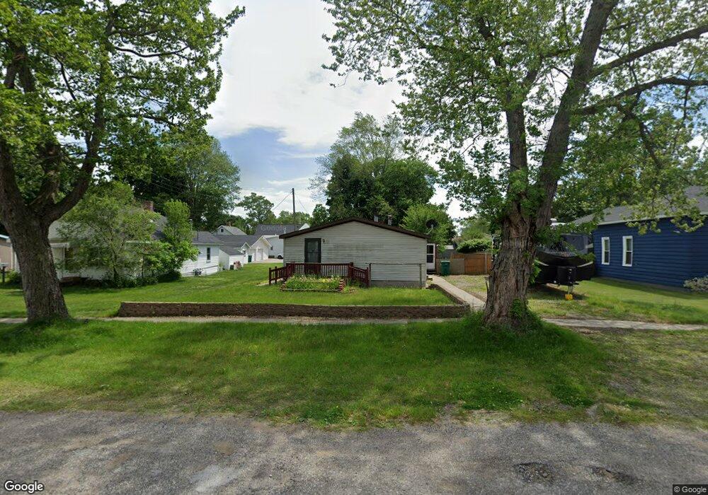
215 W Michigan Ave Oscoda, MI 48750
Estimated Value: $138,000 - $204,681
3
Beds
2
Baths
1,539
Sq Ft
$105/Sq Ft
Est. Value
About This Home
This home is located at 215 W Michigan Ave, Oscoda, MI 48750 and is currently estimated at $161,920, approximately $105 per square foot. 215 W Michigan Ave is a home located in Iosco County with nearby schools including Richardson Elementary School and Oscoda Area High School.
Ownership History
Date
Name
Owned For
Owner Type
Purchase Details
Closed on
Jun 22, 2020
Sold by
Burns Julie A
Bought by
Howell Thomas D and Howell Jamie M
Current Estimated Value
Home Financials for this Owner
Home Financials are based on the most recent Mortgage that was taken out on this home.
Original Mortgage
$50,400
Outstanding Balance
$35,431
Interest Rate
3.2%
Mortgage Type
New Conventional
Estimated Equity
$126,489
Purchase Details
Closed on
Feb 13, 2014
Sold by
Larry Dale and Burns Julie Anne
Bought by
Burns Julie Anne
Purchase Details
Closed on
Apr 29, 2010
Sold by
Bailey Scott Paul and Bailey Paul S
Bought by
Burns Larry Dale and Burns Julie Anne
Home Financials for this Owner
Home Financials are based on the most recent Mortgage that was taken out on this home.
Original Mortgage
$31,200
Interest Rate
5.16%
Create a Home Valuation Report for This Property
The Home Valuation Report is an in-depth analysis detailing your home's value as well as a comparison with similar homes in the area
Home Values in the Area
Average Home Value in this Area
Purchase History
| Date | Buyer | Sale Price | Title Company |
|---|---|---|---|
| Howell Thomas D | $63,000 | None Available | |
| Burns Julie Anne | -- | -- | |
| Burns Larry Dale | $39,000 | -- |
Source: Public Records
Mortgage History
| Date | Status | Borrower | Loan Amount |
|---|---|---|---|
| Open | Howell Thomas D | $50,400 | |
| Previous Owner | Burns Larry Dale | $31,200 |
Source: Public Records
Tax History Compared to Growth
Tax History
| Year | Tax Paid | Tax Assessment Tax Assessment Total Assessment is a certain percentage of the fair market value that is determined by local assessors to be the total taxable value of land and additions on the property. | Land | Improvement |
|---|---|---|---|---|
| 2025 | $1,978 | $70,100 | $70,100 | $0 |
| 2024 | $1,812 | $62,800 | $0 | $0 |
| 2023 | $1,266 | $50,500 | $50,500 | $0 |
| 2022 | $1,695 | $39,100 | $39,100 | $0 |
| 2021 | $1,641 | $37,900 | $37,900 | $0 |
| 2020 | $1,433 | $36,500 | $36,500 | $0 |
| 2019 | $1,414 | $36,100 | $36,100 | $0 |
| 2018 | $1,417 | $36,000 | $36,000 | $0 |
| 2017 | $1,278 | $39,600 | $39,600 | $0 |
| 2016 | $1,246 | $39,600 | $0 | $0 |
| 2015 | -- | $37,400 | $0 | $0 |
| 2014 | -- | $30,600 | $0 | $0 |
| 2013 | -- | $32,500 | $0 | $0 |
Source: Public Records
Map
Nearby Homes
- 205 E Water Ave Unit 16
- 411 Ottawa Dr
- 112 1st St N
- 430 S State St
- #26 Appletree Trail
- #49 Appletree Trail
- #21 Meadow Ln
- #46 Vaughan Trail
- #48 Vaughan Trail
- #3 Vaughan Trail
- #20 Vaughan Trail
- VL Vaughan Trail
- #18 Vaughan Trail
- #1 Vaughan Trail
- #16 Vaughan Trail
- #17 Vaughan Trail
- #47 Vaughan Trail
- #25 Appletree Trail
- 879 S State St
- 891 S State St
- 112 Superior St N
- 213 W Michigan Ave
- 211 W Michigan Ave
- 216 W River Rd
- 100 Superior St N
- 207 W Michigan Ave
- 220 W Michigan Ave
- 210 W River Rd
- 216 W Michigan Ave
- 205 W Michigan Ave
- 212 W Michigan Ave
- 101 Superior St N
- 300 W Michigan Ave
- 105 Pearl St N
- 111 Superior St N
- 113 Pearl St N
- 210 W Michigan Ave
- 307 W Michigan Ave
- 304 W River Rd
- 109 Pearl St N