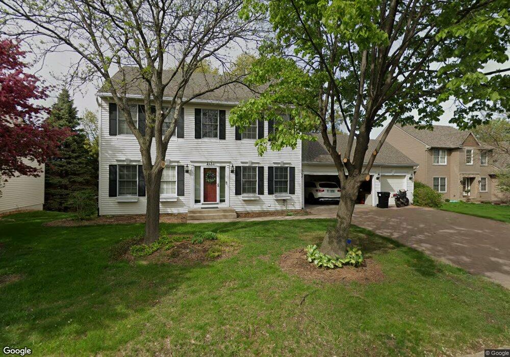
2151 Warrick Ct Saint Paul, MN 55122
Estimated Value: $544,148 - $597,000
5
Beds
3
Baths
3,190
Sq Ft
$180/Sq Ft
Est. Value
About This Home
This home is located at 2151 Warrick Ct, Saint Paul, MN 55122 and is currently estimated at $574,787, approximately $180 per square foot. 2151 Warrick Ct is a home located in Dakota County with nearby schools including Oak Ridge Elementary School, Black Hawk Middle School, and Eastview Senior High School.
Ownership History
Date
Name
Owned For
Owner Type
Purchase Details
Closed on
Aug 6, 2021
Sold by
Koep Sharif and Koep Annette
Bought by
Tschida Jacob J and Bliven Jessica C
Current Estimated Value
Home Financials for this Owner
Home Financials are based on the most recent Mortgage that was taken out on this home.
Original Mortgage
$400,000
Outstanding Balance
$363,176
Interest Rate
2.8%
Mortgage Type
New Conventional
Estimated Equity
$211,611
Purchase Details
Closed on
Jun 27, 2017
Sold by
Budd Steven E and Budd Deborah Ann
Bought by
Koep Sharif and Koep Annette
Home Financials for this Owner
Home Financials are based on the most recent Mortgage that was taken out on this home.
Original Mortgage
$382,850
Interest Rate
4.02%
Mortgage Type
New Conventional
Purchase Details
Closed on
Sep 26, 1997
Sold by
Hoffman Jon and Hoffman Laura
Bought by
Budd Steven E and Budd Deborah Ann
Create a Home Valuation Report for This Property
The Home Valuation Report is an in-depth analysis detailing your home's value as well as a comparison with similar homes in the area
Home Values in the Area
Average Home Value in this Area
Purchase History
| Date | Buyer | Sale Price | Title Company |
|---|---|---|---|
| Tschida Jacob J | $510,000 | Legacy Title | |
| Koep Sharif | $403,000 | Liberty Title Inc | |
| Budd Steven E | $226,500 | -- | |
| Tschida Jacob Jacob | $510,000 | -- |
Source: Public Records
Mortgage History
| Date | Status | Borrower | Loan Amount |
|---|---|---|---|
| Open | Tschida Jacob J | $400,000 | |
| Previous Owner | Koep Sharif | $382,850 | |
| Closed | Tschida Jacob Jacob | $400,000 |
Source: Public Records
Tax History Compared to Growth
Tax History
| Year | Tax Paid | Tax Assessment Tax Assessment Total Assessment is a certain percentage of the fair market value that is determined by local assessors to be the total taxable value of land and additions on the property. | Land | Improvement |
|---|---|---|---|---|
| 2024 | $5,668 | $514,000 | $131,800 | $382,200 |
| 2023 | $5,668 | $518,500 | $132,200 | $386,300 |
| 2022 | $4,734 | $486,700 | $131,800 | $354,900 |
| 2021 | $4,572 | $421,100 | $114,600 | $306,500 |
| 2020 | $4,600 | $397,800 | $109,200 | $288,600 |
| 2019 | $4,110 | $390,000 | $104,000 | $286,000 |
| 2018 | $4,038 | $368,600 | $99,000 | $269,600 |
| 2017 | $4,110 | $351,600 | $94,400 | $257,200 |
| 2016 | $4,001 | $341,800 | $89,800 | $252,000 |
| 2015 | $3,918 | $323,332 | $87,773 | $235,559 |
| 2014 | -- | $322,024 | $85,391 | $236,633 |
| 2013 | -- | $299,570 | $76,880 | $222,690 |
Source: Public Records
Map
Nearby Homes
- 4774 Slater Rd
- 4632 Westwood Ln
- 2100 Viburnum Trail
- 2107 Kings Rd
- 2065 Kings Rd
- 3309 Red Oak Cir N
- 247 River Woods Ln
- 319 River Woods Ln
- 221 River Woods Ln
- 2123 Cliffhill Ln
- 4463 Cinnamon Ridge Cir
- 188 River Woods Ln
- 11902 River Hills Cir
- 145 River Woods Ln
- 146 River Woods Ln
- 4427 Cinnamon Ridge Cir
- 2115 Cliffview Dr
- 4425 Cinnamon Ridge Cir
- 11921 Baypoint Dr
- 3017 Mcleod St
- 2155 Warrick Ct
- 2147 Warrick Ct
- 4770 Highcroft Ct
- 2159 Warrick Ct
- 4771 Highcroft Ct
- 2141 Warrick Ct
- 4774 Highcroft Ct
- 4686 Slater Rd
- 2163 Warrick Ct
- 4775 Highcroft Ct
- 2144 Warrick Ct
- 4680 Slater Rd
- 4682 Slater Rd
- 4770 Slater Rd
- 4678 Slater Rd
- 4778 Highcroft Ct
- 4779 Highcroft Ct
- 2140 Warrick Ct
- 2136 Warrick Ct
- 4782 Highcroft Ct