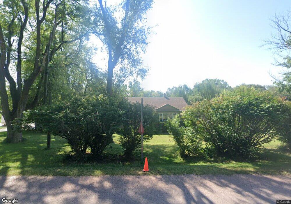
21651 Chestnut Rd Council Bluffs, IA 51503
Estimated Value: $379,000 - $480,190
3
Beds
2
Baths
2,240
Sq Ft
$185/Sq Ft
Est. Value
About This Home
This home is located at 21651 Chestnut Rd, Council Bluffs, IA 51503 and is currently estimated at $415,048, approximately $185 per square foot. 21651 Chestnut Rd is a home located in Pottawattamie County with nearby schools including E.A. Kreft Primary School, Titan Hill Intermediate School, and Lewis Central Middle School.
Ownership History
Date
Name
Owned For
Owner Type
Purchase Details
Closed on
Feb 28, 2018
Sold by
Orsi Linda M
Bought by
Beckby John F
Current Estimated Value
Purchase Details
Closed on
Apr 14, 2008
Sold by
Mathews David H and Mathews Cheryl L
Bought by
Beckby John F and Orsi Linda M
Home Financials for this Owner
Home Financials are based on the most recent Mortgage that was taken out on this home.
Original Mortgage
$164,000
Interest Rate
6.09%
Mortgage Type
Unknown
Create a Home Valuation Report for This Property
The Home Valuation Report is an in-depth analysis detailing your home's value as well as a comparison with similar homes in the area
Home Values in the Area
Average Home Value in this Area
Purchase History
| Date | Buyer | Sale Price | Title Company |
|---|---|---|---|
| Beckby John F | -- | None Available | |
| Beckby John F | $205,000 | None Available |
Source: Public Records
Mortgage History
| Date | Status | Borrower | Loan Amount |
|---|---|---|---|
| Previous Owner | Beckby John F | $164,000 |
Source: Public Records
Tax History Compared to Growth
Tax History
| Year | Tax Paid | Tax Assessment Tax Assessment Total Assessment is a certain percentage of the fair market value that is determined by local assessors to be the total taxable value of land and additions on the property. | Land | Improvement |
|---|---|---|---|---|
| 2025 | $3,756 | $394,200 | $86,400 | $307,800 |
| 2024 | $3,756 | $341,800 | $75,200 | $266,600 |
| 2023 | $2,910 | $279,000 | $75,200 | $203,800 |
| 2022 | $2,654 | $217,700 | $67,100 | $150,600 |
| 2021 | $4,078 | $217,700 | $67,100 | $150,600 |
| 2020 | $2,580 | $217,700 | $67,100 | $150,600 |
| 2019 | $2,694 | $190,000 | $48,473 | $141,527 |
| 2018 | $2,632 | $190,000 | $48,473 | $141,527 |
| 2017 | $2,706 | $190,000 | $48,473 | $141,527 |
| 2015 | $2,680 | $190,000 | $48,473 | $141,527 |
| 2014 | $2,700 | $190,000 | $48,473 | $141,527 |
Source: Public Records
Map
Nearby Homes
- 21823 Chestnut Rd
- 22231 Stoneybrook Dr
- LOT 1 -2 Overland Trail
- 21337 Greenview Rd
- 100 Highland Acres Loop
- 184 Dayan Dr
- 22080 Greenview Rd
- 109 Dorset Ave
- 23267 Highway 92
- 108 Essex Ave
- 20.57 AC. M L State Orchard Rd
- 5021 Providence Rd
- 4820 Oneida Cir
- 20425 Greenview Rd
- 15365 Crestview Dr
- 218 Brent Ln
- LOT 10 Fannin Cir
- 14851 Highland Park Rd
- 4792 Cedarbrook Dr
- 411 Redwood Dr
- 23000 Chestnut Rd
- 24500 Chestnut Rd
- 0 Chestnut Rd
- 29.75 AC Chestnut Rd
- 29.75 ACRE Chestnut Rd
- 21705 Chestnut Rd
- 21696 Chestnut Rd
- 21735 Chestnut Rd
- 21636 Pioneer Trail
- 21698 Pioneer Trail
- 21720 Green Valley Ave
- 21774 Green Valley Ave
- 21770 Chestnut Rd
- 21777 Green Valley Ave
- 21730 Pioneer Trail
- 21788 Green Valley Ave
- 21711 Pioneer Trail
- 21797 Green Valley Ave
- 13601 Bluebird Ln
- 21760 Pioneer Trail