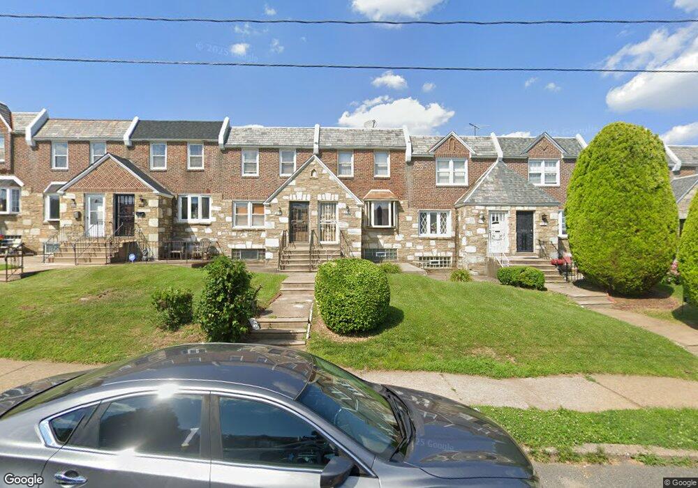
217 E Fariston Dr Philadelphia, PA 19120
Melrose Park Gardens NeighborhoodEstimated Value: $217,000 - $255,000
3
Beds
2
Baths
1,152
Sq Ft
$209/Sq Ft
Est. Value
About This Home
This home is located at 217 E Fariston Dr, Philadelphia, PA 19120 and is currently estimated at $240,290, approximately $208 per square foot. 217 E Fariston Dr is a home located in Philadelphia County with nearby schools including Thomas K. Finletter School, Samuel Fels High School, and Eugenio Maria de Hostos Charter School.
Ownership History
Date
Name
Owned For
Owner Type
Purchase Details
Closed on
Apr 10, 2003
Sold by
Tisdale Juanita
Bought by
Lewis Michael A and Lewis Lynn C
Current Estimated Value
Home Financials for this Owner
Home Financials are based on the most recent Mortgage that was taken out on this home.
Original Mortgage
$89,200
Outstanding Balance
$38,010
Interest Rate
5.64%
Estimated Equity
$202,280
Create a Home Valuation Report for This Property
The Home Valuation Report is an in-depth analysis detailing your home's value as well as a comparison with similar homes in the area
Home Values in the Area
Average Home Value in this Area
Purchase History
| Date | Buyer | Sale Price | Title Company |
|---|---|---|---|
| Lewis Michael A | $92,000 | -- |
Source: Public Records
Mortgage History
| Date | Status | Borrower | Loan Amount |
|---|---|---|---|
| Open | Lewis Michael A | $89,200 |
Source: Public Records
Tax History Compared to Growth
Tax History
| Year | Tax Paid | Tax Assessment Tax Assessment Total Assessment is a certain percentage of the fair market value that is determined by local assessors to be the total taxable value of land and additions on the property. | Land | Improvement |
|---|---|---|---|---|
| 2025 | $2,577 | $234,800 | $46,960 | $187,840 |
| 2024 | $2,577 | $234,800 | $46,960 | $187,840 |
| 2023 | $2,577 | $184,100 | $36,820 | $147,280 |
| 2022 | $1,513 | $139,100 | $36,820 | $102,280 |
| 2021 | $2,143 | $0 | $0 | $0 |
| 2020 | $2,143 | $0 | $0 | $0 |
| 2019 | $1,992 | $0 | $0 | $0 |
| 2018 | $1,949 | $0 | $0 | $0 |
| 2017 | $1,949 | $0 | $0 | $0 |
| 2016 | $1,529 | $0 | $0 | $0 |
| 2015 | $1,463 | $0 | $0 | $0 |
| 2014 | -- | $139,200 | $12,800 | $126,400 |
| 2012 | -- | $19,136 | $2,205 | $16,931 |
Source: Public Records
Map
Nearby Homes
- 230 E Fariston Dr
- 138 E Fariston Dr
- 152 E Walnut Park Dr
- 5815 Newtown Ave
- 103 W Godfrey Ave
- 307 E Cheltenham Ave
- 133 W Godfrey Ave
- 100 Boncouer Rd
- 6588 W Walnut Park Dr
- 330-32 Sanger St
- 7620 Front St
- 126 Rosemar St
- 139 Rosemar St
- 344 Van Kirk St
- 153 Rosemar St
- 127 Fern St
- 209 Stearly St
- 407 E Sanger St Unit 9
- 252 Benner St
- 183 Rosemar St
- 219 E Fariston Dr
- 215 E Fariston Dr
- 221 E Fariston Dr
- 213 E Fariston Dr
- 223 E Fariston Dr
- 211 E Fariston Dr
- 209 E Fariston Dr
- 225 E Fariston Dr
- 207 E Fariston Dr
- 244 E Cheltenham Ave
- 246 E Cheltenham Ave
- 205 E Fariston Dr
- 248 E Cheltenham Ave
- 240 E Cheltenham Ave
- 242 E Cheltenham Ave
- 252 E Cheltenham Ave
- 250 E Cheltenham Ave
- 203 E Fariston Dr
- 227 E Fariston Dr
- 238 E Cheltenham Ave