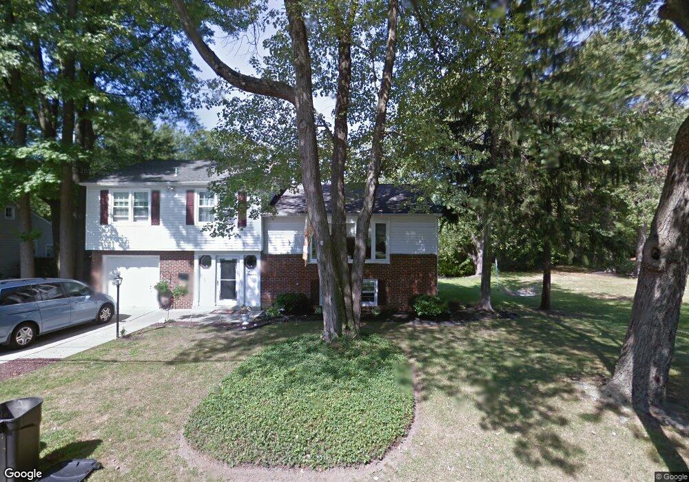
217 Hazel Ave Haddon Township, NJ 08108
Haddon Township NeighborhoodEstimated Value: $461,000 - $581,000
3
Beds
2
Baths
1,608
Sq Ft
$342/Sq Ft
Est. Value
About This Home
This home is located at 217 Hazel Ave, Haddon Township, NJ 08108 and is currently estimated at $549,534, approximately $341 per square foot. 217 Hazel Ave is a home located in Camden County with nearby schools including William G. Rohrer Middle School, Haddon Township High School, and Haddonfield Friends School.
Ownership History
Date
Name
Owned For
Owner Type
Purchase Details
Closed on
Jun 29, 2007
Sold by
Ponti Margaret
Bought by
Dunn Peter
Current Estimated Value
Home Financials for this Owner
Home Financials are based on the most recent Mortgage that was taken out on this home.
Original Mortgage
$226,000
Outstanding Balance
$141,110
Interest Rate
6.48%
Mortgage Type
New Conventional
Estimated Equity
$408,424
Create a Home Valuation Report for This Property
The Home Valuation Report is an in-depth analysis detailing your home's value as well as a comparison with similar homes in the area
Home Values in the Area
Average Home Value in this Area
Purchase History
| Date | Buyer | Sale Price | Title Company |
|---|---|---|---|
| Dunn Peter | $302,000 | -- |
Source: Public Records
Mortgage History
| Date | Status | Borrower | Loan Amount |
|---|---|---|---|
| Open | Dunn Peter | $226,000 |
Source: Public Records
Tax History Compared to Growth
Tax History
| Year | Tax Paid | Tax Assessment Tax Assessment Total Assessment is a certain percentage of the fair market value that is determined by local assessors to be the total taxable value of land and additions on the property. | Land | Improvement |
|---|---|---|---|---|
| 2025 | $11,320 | $517,700 | $176,200 | $341,500 |
| 2024 | $10,983 | $271,800 | $101,900 | $169,900 |
| 2023 | $10,983 | $271,800 | $101,900 | $169,900 |
| 2022 | $10,782 | $271,800 | $101,900 | $169,900 |
| 2021 | $10,864 | $271,800 | $101,900 | $169,900 |
| 2020 | $10,742 | $271,800 | $101,900 | $169,900 |
| 2019 | $10,353 | $271,800 | $101,900 | $169,900 |
| 2018 | $10,288 | $271,800 | $101,900 | $169,900 |
| 2017 | $10,111 | $271,800 | $101,900 | $169,900 |
| 2016 | $9,921 | $271,800 | $101,900 | $169,900 |
| 2015 | $9,597 | $271,800 | $101,900 | $169,900 |
| 2014 | $9,431 | $271,800 | $101,900 | $169,900 |
Source: Public Records
Map
Nearby Homes
- 209 Westmont Ave
- 110 Westmont Ave
- 215 Haddonfield Commons
- 209 Haddonfield Commons
- 144 Marne Ave
- 310 Briarwood Ave
- 501 Rhoads Ave
- 315 Peyton Ave
- 510 Rhoads Ave
- 155 Rhoads Ave
- 740 S Atlantic Ave
- 608 S Atlantic Ave
- 63 Truman Ave
- 23 Center St
- 268 Buckner Ave
- 117 Haddon Ave
- 252 Rhoads Ave
- 634 W Redman Ave
- 33 Estaugh Ave
- 19 E Albertson Ave
- 219 Hazel Ave
- 215 Hazel Ave
- 210 Hazel Ave
- 216 Carlton Ave
- 224 Hazel Terrace
- 221 Hazel Terrace
- 222 Hazel Terrace
- 205 Hazel Ave
- 214 Carlton Ave
- 212 Carlton Ave
- 201 Hazel Ave
- 225 Hazel Terrace
- 223 Hazel Terrace
- 210 Carlton Ave
- 206 Hazel Ave
- 211 Norwood Ave
- 208 Carlton Ave
- 215 Norwood Ave
- 213 Norwood Ave
- 209 Norwood Ave