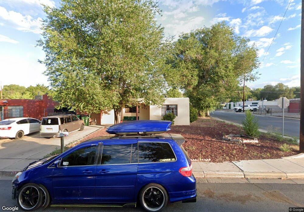
217 La Plata Dr Farmington, NM 87401
Estimated Value: $193,000 - $254,000
--
Bed
--
Bath
1,542
Sq Ft
$139/Sq Ft
Est. Value
About This Home
This home is located at 217 La Plata Dr, Farmington, NM 87401 and is currently estimated at $214,292, approximately $138 per square foot. 217 La Plata Dr is a home located in San Juan County with nearby schools including Apache Elementary School, Tibbetts Middle School, and Farmington High School.
Ownership History
Date
Name
Owned For
Owner Type
Purchase Details
Closed on
Oct 12, 2011
Sold by
Perry Mark B and Perry Cassie L
Bought by
Farmington Laplata Llc
Current Estimated Value
Purchase Details
Closed on
Aug 3, 2011
Sold by
Secretary Of Veterans Affairs
Bought by
Perry Mark B and Perry Cassie L
Home Financials for this Owner
Home Financials are based on the most recent Mortgage that was taken out on this home.
Original Mortgage
$112,005
Interest Rate
4.34%
Mortgage Type
VA
Purchase Details
Closed on
Feb 17, 2011
Sold by
Gomez Albert L
Bought by
Wells Fargo Bank Na
Purchase Details
Closed on
Feb 8, 2011
Sold by
Wells Fargo Bank Na
Bought by
The Secretary Of Veterans Affairs
Purchase Details
Closed on
Mar 4, 2008
Sold by
Reynolds Vance H and Reynolds Lynne C
Bought by
Gomez Albert L and Gomez Allison K
Home Financials for this Owner
Home Financials are based on the most recent Mortgage that was taken out on this home.
Original Mortgage
$158,600
Interest Rate
5.47%
Mortgage Type
VA
Create a Home Valuation Report for This Property
The Home Valuation Report is an in-depth analysis detailing your home's value as well as a comparison with similar homes in the area
Home Values in the Area
Average Home Value in this Area
Purchase History
| Date | Buyer | Sale Price | Title Company |
|---|---|---|---|
| Farmington Laplata Llc | -- | None Available | |
| Perry Mark B | -- | None Available | |
| Wells Fargo Bank Na | -- | None Available | |
| The Secretary Of Veterans Affairs | -- | None Available | |
| Gomez Albert L | -- | None Available |
Source: Public Records
Mortgage History
| Date | Status | Borrower | Loan Amount |
|---|---|---|---|
| Previous Owner | Perry Mark B | $112,005 | |
| Previous Owner | Gomez Albert L | $158,600 |
Source: Public Records
Tax History Compared to Growth
Tax History
| Year | Tax Paid | Tax Assessment Tax Assessment Total Assessment is a certain percentage of the fair market value that is determined by local assessors to be the total taxable value of land and additions on the property. | Land | Improvement |
|---|---|---|---|---|
| 2024 | $973 | $40,940 | $0 | $0 |
| 2023 | $973 | $39,748 | $0 | $0 |
| 2022 | $928 | $38,590 | $0 | $0 |
| 2021 | $905 | $37,939 | $0 | $0 |
| 2020 | $899 | $37,783 | $0 | $0 |
| 2019 | $903 | $38,141 | $0 | $0 |
| 2018 | $909 | $39,110 | $0 | $0 |
| 2017 | $897 | $39,110 | $0 | $0 |
| 2016 | $893 | $39,110 | $0 | $0 |
| 2015 | $878 | $39,110 | $0 | $0 |
| 2014 | $923 | $41,170 | $0 | $0 |
Source: Public Records
Map
Nearby Homes
- 707 W Apache St
- 621 W Apache St
- XX W Apache St
- 600 W Arrington St
- 414 W Comanche St
- 502 W Animas St
- 511 N Behrend Ave
- NYA W Murray Dr
- XXX S Lake St
- 1011 N Auburn Ave
- 602 N Orchard Ave Unit A - F
- 308 E Main St
- 1013 N Orchard Dr
- 800 S Auburn Ave
- 335 E Main St
- 308 N Court Ave
- 702 N Dustin Ave
- 712 N Dustin Ave
- 313 N Buena Vista Ave
- 636 Ridge Lea Ct
- 215 La Plata Dr
- 220 El Paso Dr
- 726 La Plata Dr
- 218 El Paso Dr
- 213 La Plata Dr
- 216 La Plata Dr
- 212 La Plata Dr
- 216 El Paso Dr
- 731 El Paso Dr
- 724 La Plata Dr
- 727 La Plata Dr
- 211 La Plata Dr
- 208 La Plata Dr
- 729 El Paso Dr
- 214 El Paso Dr
- 723 La Plata Dr
- 722 La Plata Dr
- 209 La Plata Dr
- 209 Padilla Dr
- 225 El Paso Dr