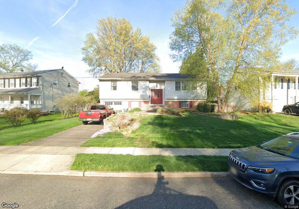
217 Mimosa Dr Cherry Hill, NJ 08003
Estimated Value: $476,932 - $526,000
--
Bed
--
Bath
2,325
Sq Ft
$216/Sq Ft
Est. Value
About This Home
This home is located at 217 Mimosa Dr, Cherry Hill, NJ 08003 and is currently estimated at $502,733, approximately $216 per square foot. 217 Mimosa Dr is a home located in Camden County with nearby schools including James F. Cooper Elementary School, Henry C. Beck Middle School, and Cherry Hill High-East High School.
Ownership History
Date
Name
Owned For
Owner Type
Purchase Details
Closed on
Sep 20, 2023
Sold by
Raffa Michael G and Raffa Judith G
Bought by
Raffa Michael George
Current Estimated Value
Purchase Details
Closed on
Oct 7, 2002
Sold by
Macolino Mark
Bought by
Raffa Michael G and Raffa Judith G
Home Financials for this Owner
Home Financials are based on the most recent Mortgage that was taken out on this home.
Original Mortgage
$157,400
Interest Rate
6.03%
Purchase Details
Closed on
Aug 27, 1999
Sold by
Dalrymple Randy
Bought by
Macolino Mark and Macolino Patricia
Home Financials for this Owner
Home Financials are based on the most recent Mortgage that was taken out on this home.
Original Mortgage
$134,900
Interest Rate
7.83%
Mortgage Type
FHA
Create a Home Valuation Report for This Property
The Home Valuation Report is an in-depth analysis detailing your home's value as well as a comparison with similar homes in the area
Home Values in the Area
Average Home Value in this Area
Purchase History
| Date | Buyer | Sale Price | Title Company |
|---|---|---|---|
| Raffa Michael George | -- | None Listed On Document | |
| Raffa Michael George | -- | None Listed On Document | |
| Raffa Michael G | $209,900 | -- | |
| Macolino Mark | $135,000 | -- |
Source: Public Records
Mortgage History
| Date | Status | Borrower | Loan Amount |
|---|---|---|---|
| Previous Owner | Raffa Michael G | $157,400 | |
| Previous Owner | Macolino Mark | $134,900 |
Source: Public Records
Tax History Compared to Growth
Tax History
| Year | Tax Paid | Tax Assessment Tax Assessment Total Assessment is a certain percentage of the fair market value that is determined by local assessors to be the total taxable value of land and additions on the property. | Land | Improvement |
|---|---|---|---|---|
| 2025 | $9,217 | $206,700 | $69,500 | $137,200 |
| 2024 | $8,686 | $206,700 | $69,500 | $137,200 |
| 2023 | $8,686 | $206,700 | $69,500 | $137,200 |
| 2022 | $8,446 | $206,700 | $69,500 | $137,200 |
| 2021 | $8,473 | $206,700 | $69,500 | $137,200 |
| 2020 | $8,369 | $206,700 | $69,500 | $137,200 |
| 2019 | $8,365 | $206,700 | $69,500 | $137,200 |
| 2018 | $8,342 | $206,700 | $69,500 | $137,200 |
| 2017 | $8,229 | $206,700 | $69,500 | $137,200 |
| 2016 | $8,119 | $206,700 | $69,500 | $137,200 |
| 2015 | $7,991 | $206,700 | $69,500 | $137,200 |
| 2014 | $7,902 | $206,700 | $69,500 | $137,200 |
Source: Public Records
Map
Nearby Homes
- 103 Aspen Ct
- 100 E Eagle Ln
- 220 Deerpark Ct
- 26 Regent Rd
- 16 Gatehouse Ln
- 360 Juniper St
- 8 Elbow Ln
- 309 Highgate Ln
- 219 Conestoga Dr
- 100 Old Colony Ln
- 22 Hawk Ln
- 63 Banner Ct Unit 63
- 800 Marlowe Rd
- 213 Balfield Terrace
- 145 Kilburn Dr
- 209 Henfield Ave
- 1406 Jonathan Ln
- 12 Princess Ave
- 23 King Ave
- 29 Apple Way