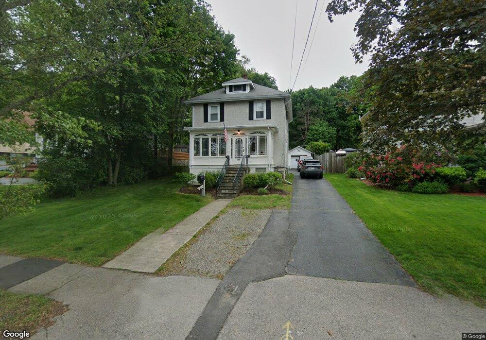
217 Washington St Norwood, MA 02062
North Norwood NeighborhoodEstimated Value: $624,000 - $726,000
4
Beds
1
Bath
1,456
Sq Ft
$466/Sq Ft
Est. Value
About This Home
This home is located at 217 Washington St, Norwood, MA 02062 and is currently estimated at $678,767, approximately $466 per square foot. 217 Washington St is a home located in Norfolk County with nearby schools including Norwood High School, St Catherine Of Siena School, and Xaverian Brothers High School.
Ownership History
Date
Name
Owned For
Owner Type
Purchase Details
Closed on
Jan 8, 1982
Bought by
Cavolowsky Paul J and Cavolowsky Patricia
Current Estimated Value
Create a Home Valuation Report for This Property
The Home Valuation Report is an in-depth analysis detailing your home's value as well as a comparison with similar homes in the area
Home Values in the Area
Average Home Value in this Area
Purchase History
| Date | Buyer | Sale Price | Title Company |
|---|---|---|---|
| Cavolowsky Paul J | $20,000 | -- |
Source: Public Records
Mortgage History
| Date | Status | Borrower | Loan Amount |
|---|---|---|---|
| Open | Cavolowsky Paul J | $138,300 | |
| Closed | Cavolowsky Paul J | $80,000 | |
| Closed | Cavolowsky Paul J | $20,000 | |
| Closed | Cavolowsky Paul J | $23,000 |
Source: Public Records
Tax History Compared to Growth
Tax History
| Year | Tax Paid | Tax Assessment Tax Assessment Total Assessment is a certain percentage of the fair market value that is determined by local assessors to be the total taxable value of land and additions on the property. | Land | Improvement |
|---|---|---|---|---|
| 2025 | $59 | $561,100 | $277,300 | $283,800 |
| 2024 | $5,731 | $547,400 | $277,300 | $270,100 |
| 2023 | $5,186 | $502,500 | $241,200 | $261,300 |
| 2022 | $4,842 | $450,400 | $219,300 | $231,100 |
| 2021 | $4,723 | $416,500 | $211,300 | $205,200 |
| 2020 | $4,713 | $422,700 | $211,300 | $211,400 |
| 2019 | $4,319 | $396,600 | $201,300 | $195,300 |
| 2018 | $4,378 | $394,800 | $191,700 | $203,100 |
| 2017 | $4,080 | $365,900 | $191,700 | $174,200 |
| 2016 | $3,806 | $342,300 | $191,700 | $150,600 |
| 2015 | $3,754 | $327,300 | $183,000 | $144,300 |
| 2014 | $3,607 | $311,500 | $166,000 | $145,500 |
Source: Public Records
Map
Nearby Homes
- 25 Bird Rd
- 365 Washington St Unit 4
- 42 Myrtle St
- 85 Casey St
- 68-70 Adams St
- 301 Neponset St Unit 25
- 301 Neponset St Unit 17
- 66 Crestwood Cir
- 470 Nahatan St
- 17 Royal Ct
- 227 Prospect St
- 131 Bay Colony Dr
- 253 Nahatan St Unit 11
- 618 Nahatan St
- 1 Lenox St Unit 115
- 1 Lenox St Unit 312
- 39 Westbrook Ln
- 49 Railroad Ave
- 232-234 Nahatan St
- 135 Cottage St Unit 2
- 221 Washington St
- 215 Washington St
- 215 Washington St Unit 1
- 225 Washington St
- 229 Washington St
- 207 Washington St
- 231 Washington St
- 203 Washington St
- 203 Washington St Unit 1
- 202 Washington St
- 212 Washington St
- 196 Washington St
- 224 Washington St
- 235 Washington St
- 79 Bird Rd
- 85 Bird Rd
- 194 Washington St
- 239 Washington St
- 192 Washington St
- 27 Fales Ave